Wednesday, April 29, 2009

476. Highways, One Hundred Days, Derby Days

Whenever I have nothing in particular to write about, and today is one of those days, I can usually rely on using the entry number as it relates to one of Kentucky's highway numbers.

Today, for entry number 476, I could mention KY476, a run of a highway of which part used to be part of KY80, Kentucky's state-crossing southern corridor, which probably more than any other state highway, has been rerouted here, rebuiilt there, and renumbered all over more than any other road.

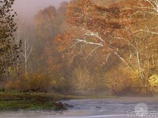
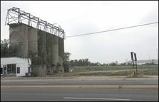
KY476 gets its start in Perry and later ends Breathitt County, Kentucky. North Main Street in Hazard, headed north, leads KY476 out of Hazard, following along the side of the North Fork of the Kentucky River toward the intersection known as Darfork, shown in the picture at right which is copied from H. B. Elkins' website, www.millenniumhwy.net which is one of my favorites websites. All I can tell you about Darfork, is that I've driven across the bridge in the picture, and turned right onto 476, which would be south on North Main Street. But, turning the other way, 476 follows the creekbed and the railroad, as is the case in most eastern Kentucky towns, from one village to the next, the next one being at the Mouth of Lotts Creek. The next town in Bulan and a few miles later 476 comes to where the Engel Fork Road breaks off at Dwarf.

Past Dwarf the road meanders along side the river passing through severla small places in the road - Ary, Stacy, Hardshale, Clayhole, and Flintville, ending in the Breathitt County commnuity of Lost Creek, which is home to the Breathitt County Third District Magistate Jeff Noble, of no relation to my knowledge, although I did meet his mother on my way back from Hillbilly Days in 2007.

That's the long and short of KY476.

Another waymarker for today is the One Hundred Days mark of the administration of America's 44th President, Barack Hussein Obama, Jr. Every media outlet (including those in the blogosphere) seems to marking it with their own grade. As a supporter and admirer of the president, I give him very high marks. I needn't go into why - I'll just say that I have been very pleased with the outcome of my vote and that is not the usual situation. I'm still in awe that he was elected and I think things will improve once we get past the Republican-created economic quagmire which won't be easy but will be done.

Finally, here along the Left Bank of the Ohio River near Milepost 606, it is Kentucky Derby Week, marking the 135th running of America's oldest continuously ran sporting event, the Kentucky Derby, at Churchill Downs in South Louisville. As a note, the Kentucky Oaks could also hold that title. Not much gets accomplished this week, and that will likely include any more entries from me until Sunday.


This picture shows Churchill Downs, at center-right on the picture, on January 27, 1937, during the Great Flood of '37.

Happy Great Steamboat Race Day.
Happy Pegasus Parade Day.
Happy Kentucky Oaks Day.
Happy Kentucky Derby Day.

Monday, April 27, 2009

475. Utica? Where is Utica?

At 6:58 am today, someone logged on here along the Left Bank of the Ohio near Milepost 606. The information listed tells me they did so from the tiny village of Utica, Kentucky.

And that reminds me of a story, the butt of which is me.

Back in the fall of 1978, I was a freshman at the University of Kentucky. I lived in Kirwan II, one of the low-rise dorms on South Campus in the Blanding-Kirwan Commons. Kirwan II was assigned to freshmen men only. During those first few days or weeks, much time was spent meeting new friends. This often occurred at the supper table over at the South Commons Cafeteria, the place I regularly ate. There I met Steve Davis and Mark Whitaker, both of Colerain, Ohio which is a suburb northwest of Cincinnati, as well as my two neighbors in my dorm, in the room to my room's left, Steve Marelli and Gary Loyd, both of Daviess County. Rounding out the group was my roommate, Peter Matthews Wright, of Pittsburgh, Pennsylvania.

Our conversations often centered on our hometowns. In the UK Freshman Register I was listed as being from Okolona, Kentucky, which I explained was a suburb of Louisville. Peter would talk about Pittsburgh, Steve Davis and Mark would talk about Cincinnati, I'd chime in for Louisville, and Steve Marelli trumped up Owensboro, his hometown. Finally, Gary Loyd would go on about the virtues of Utica, Kentucky. Utica this and Utica that, on and on. It was somewhat maddening and we derided him more than once over his Utica-centered pronouncements.

A month or two into the fall semester, one would think that every thing which could be said about Utica, Kentucky had been said. Not so with Gary, who could always find one more way for Utica to one-up Owensboro, Louisville, Cincinnati, or Pittsburgh - or New York, Paris, or London for that matter. I was among the deriders about what good could come out of Utica.

Sometime in October, Marelli and I decided we needed a break from class and declared ourselves a holiday - that is to say we cut class. And we decided to go visit some of my relatives over in Frankfort, who during this time of year, would be cutting and bundling tobacco. We caught a ride over to Frankfort from my late Uncle Noble Hedger, who lived in Lexington and was an employee at the Health Department on East Main. Once in Frankfort we somehow made it out to my aunt's house and garden on Pea Ridge Road. Aunt Frances Moore raised a huge garden on the back of Taylor Collins' farm, land which is now part of the Capital City Airport, next to what used to be the Whippoorwill Springs Golf Course. (Aunt Frances is still with us, now 89 and no longer raising a garden).

From there we borrowed somebody's car and went to visit my great-grandfather, Robert Lewis, Sr., who lived along the Old Louisville Road between the communities of Bridgeport in Franklin County and Graefensburg in Shelby County. I had just about this time begun an interest in genealogy, but I knew very little about Papaw Lewis's family other than he was originally from Owenton. I knew he had two brothers, Revel and Roy, and I thought I knew about a sister, Theresa. In October, 1978, my great-grandfather would have been 85 years old. He died three months after this visit.

So it was that Marelli and I were sitting in his kitchen while he had lunch, which consisted of the exact same thing he had had for breakfast and would have later for supper - a hamburger, some milk-toast, peas, and half-and-half to drink. We asked all kinds of questions and he responded with answers and a few questions of his own. One was directed to Marelli about his family and his hometown. When Marelli responded that he was from Owensboro, my great-grandfather took an interest. He explained that he too was from Owensboro, but not really. I interjected that I thought he was from Owenton. Rather than being from Owenton or Owensboro, he told us he was in fact from a little village about 12 miles south of Owensboro and named for his family, and still called Lewis. When Marelli asked where that was, he described it as just west of Utica and that, in fact, while Lewis did not have post office, Utica did. So, for all intents and purposes, he was from Utica. The villages of Lewis and Utica are, to this day, less than a mile apart in southern Daviess County, just west of US431 on KY140.

Upon learning that I was descended from a Utica resident Marelli looked at me and let out a big laugh. He couldn't wait to get back to Lexington that night and spread the news. Not only was Utica everything that Gary said it was, it was also Jeff Noble's ancestral hometown.

Thursday, April 23, 2009

474. Trivial Answers


Here are the answers to the Trivial Driving Quiz from last week. I really appreciate everyone who submitted an answer or comment.

1. East Manslick Road - PRESTON HIGHWAY - South Park Road.

2. Robbs Lane - SHEPHERDSVILLE ROAD (formerly known as OLD SHEPHERDSVILLE ROAD) - Applegate Lane.

3. Seventh Street Road - BERRY BOULEVARD or SEVENTH STREET ROAD - Manslick Road. (Two possible answers). This is not the original configuration of the intersection, although it has been this way since the late 1930s. Originally, before Berry Boulevard was built, the road forked at this point, with 7th Street Road hugging the railroad R-O-W to the point of crossing. The city limits line between Shively and Louisville follows this old line, behind the Thorobred Dance Club building.

4. New Cut Road - SOUTHERN PARKWAY - Taylor Boulevard.

5. Baxter Avenue - SHADY LANE (ENTRANCE TO CALVARY CEMETERY also accepted - Newburg Road. This is an old Louisville City Limits line from the 1920s. As evidence, you will notice the sidewalks end at this point on Newburg Road.

6. Browns Lane - BOWLING BOULEVARD - Hubbards Lane. This original answer would have been Browns Lane, and was until not long ago. With the construction of Kresge Way in the 1970s and Bowling Boulevard in the 1980s, the road names have changed disconnecting the two sections of Browns Lane in this area.

7. Southside Drive - NEW CUT ROAD - Third Street Road.

8. Algonquin Parkway - WINKLER AVENUE - Rodman Avenue. Again, this is not the original configuration, which originally had Algonquin forking off of Winkler Avenue, with Rodman crossing over both streets. The former path can be reckoned by following the driveway out of the Dairy Queen to Rodman.

9. Breckenridge Lane - FRANKFORT AVENUE (SHELBYVILLE ROAD also accepted reluntantly) - Chenoweth Lane. Of course, up until the 1980s, Breckenridge Lane was spelled Breckinridge Lane.

10. Brownsboro Road - BROWNSBORO ROAD - Ballardsville Road.

11. Manslick Road - PALATKA ROAD - Saint Andrews Church Road.

12. Beulah Church Road - BEULAH CHURCH ROAD - Fegenbush Lane

13. S. Third Street - NO ANSWER, THE STREET CHANGES NAME IN THE MIDDLE OF THE BLOCK. FOR THAT MATTER, THE BLOCK NUMBER SKIPS FROM 3100 TO 3700 AT THE SAME POINT - Southern Parkway. (This is a trick
question). Where 3rd Street originally ended was where Mayor Jacob decided to build his "Grand Avenue" out to Jacob's Park, now called Iroquois Park. The park was also called Jacob's Folly at the time, as it was in the middle of nowhere with no access. All that has changed.

14. Winkler Avenue - WINKLER AVENUE - Taylor Boulevard.

15. Goss Avenue - EASTERN PARKWAY - Poplar Level Road.

16. Fern Valley Road - FEGENBUSH LANE - S. Hurstbourne Parkway. This is a recently finished roadway, rebuilding Fern Valley at Poplar Level and extending S. Hurstbourne over to meet them. Briefly last year, there was a movement to change the name of Fern Valley to W. Hurstbourne, as businesses would rather have a Hurstbourne address than a Fern Valley address.

17. W. Manslick Road - FAIRDALE ROAD - Mount Holly Avenue.

18. Pindell Avenue - HESS LANE - Oriole Drive.

19. Oakdale Avenue - SOUTHERN PARKWAY - S. Third Street.

20. E. Main Street - NO ANSWER, THE STREET CHANGES NAMES IN THE MIDDLE OF THE 1400 BLOCK - Mellwood Avenue. (This is a trick
question).

21. S. 15th Street - W. HILL STREET - S. 16th Street. Before the construction of the old Brown-Williamson plant at this intersection, S. 16th followed it former patter and would not intersected with S. 15th at this point.

22. E. Oak Street - BARRET AVENUE - Winter Avenue.

23. S. Shelby Street - CLARK'S LANE - Preston Highway.

24. Newburg Road - SHEPHERDSVILLE ROAD (formerly known as OLD SHEPHERDSVILLE ROAD) - Buechel Bank Road.

26. Klondike Lane - KLONDIKE LANE -Bradford Avenue.

27. Hikes Lane - NEWBURG ROAD (PETERSBURG or OLD NEWBURG ROAD also accepted) - Produce Road. For years, in the 1960s and 1970s, the intersection of Produce Road, then known as Produce Lane, did not connect with Hikes Lane or anything else. It was built but didn't go anywhere. In the 1970s, the ends of Produce Lane and Hikes Lane were constructed to connect to the previously built intersection.

28. S. 7th Street - ALGONQUIN PARKWAY - Seventh Street Road. (There is
disagreement on this answer. I am looking for the Post Office definition). Others assert the name changes at the old Railroad R-O-W just south of McFerran Elementary. Still others say it is where the City Limits line is on the west side, which is a few blocks south of Algonquin Parkway, just past the Mobile Home Park entrance. Of course the City erroneously marks it as 7th Street in places all the way out to Berry Boulevard.

29. New Cut Road - BROWN AUSTIN ROAD or W. MANSLICK ROAD - W. Manslick Road. This was not the original configuration. In the 1980s, a road was built through between W. Manslick Road at Brown Austin Road and New Cut Road about 3/4 mile to the north. People mostly called it Manslick Road (since that is a pretty common street name in Louisville and Jefferson County) but it really wasn't. It was never officially named and was only known on some maps as KY1865. Finally, in the 1990s, and after a few building permits were taken, it became necessary to name it. Since W. Manslick went off in another direction at one end, it was decided to name it New Cut Road. But then at the other end was the road originally called New Cut. That section was changed to Old New Cut.

30. Saint Andrews Church Road - DIXIE HIGHWAY - Greenwood Road.

31. W. Manslick Road - W. MANSLICK ROAD - Keys Ferry Road.

32. Old New Cut Road - W. MANSLICK ROAD - Penile Road.

Extra Credit:

Where is the street Louisville Metro officially calls Old Shepherdsville Road? Hint: It is not the street most of us mean when we say Old Shepherdsville Road (or "Old Shep") but it used to be. ANSWER: IT IS THE REMNANT OF THE OLDER PART OF SHEOHERDSVILLE ROAD AT SAINT FRANCIS AVENUE IN THE CITY OF WEST BUECHEL.

Also, Louisville has three streets named Indian Trail which aren't connected. Where are they? ANSWER: ONE IS EAST OF PRESTON HIGHWAY, STARTING AT MONTGOMERY CHEVROLET. THE SECOND IS WEST OF PRESTON HIGHWAY, STARTING AT H&S HARDWARE. THE THIRD IS OFF NEW CUT ROAD, NORTH OF THE OUTER LOOP.

Happy Trails!

Sunday, April 19, 2009

473. In Lieu of Thunder

Knowing the streets and alleys would be packed with people in various states of clear-mindedness for Thunder over Louisville, I took to the streets - or really the highways and backroads - yesterday to get away from it all. I had promised a dear friend of mine who is, unfortunately but deservedly, incarcerated in a State Prison in West Liberty that I would visit. I hadn't been to see him for two years - actually two years ago on Thunder Day. Is that an acceptable set of words, Thunder Day, like we say Oaks Day and Derby Day? Along the way I was hoping to see my friend Tony, who lives in Mount Sterling. I thought I might also look up the new Vice Chair of the Kentucky Democratic Party since I had planned my route through her town.

Thus it was I headed out to the east along I-64, crossing over the Floyds Fork of Salt River in Jefferson County and Guist and Benson creeks in Shelby County. Benson Creek was at one time one of the southern borders of Jefferson County, Virginia. Crossing into Franklin County I made the great descent and ascent over the Kentucky River, another original border of Jefferson County, Virginia, separating it from Fayette County, Virginia. (See the map above for the original division of Kentucky County, Virginia into the three original counties of Jefferson, Fayette, and Lincoln. The far west of the state came in 1811 by a purchase from Native Americans of what has come to be known as the Jackson Purcahse, after Andrew Jackson). Next came Woodford, Scott, and Fayette, with their crossings of South Elkhorn Creek and Cane Run. I continued on I-64 into Clark County, exitting onto the By-Pass (KY1958) to get over to the McDonald's on the west side of town on US60 for a refill of coffee.

From this point until my return, I stayed off the Interstate system and on a number of less travelled backroads. I coursed through downtown Winchester, a old western looking town, where US 60 makes a right angle off of Lexington Avenue and onto Main Street and then to the northeast toward Mount Sterling in Montgomery County. My first stop was in Mount Sterling to meet a friend, one I haven't seen since one night in Lexington several years ago. Mount Sterling's big festival is the Court Days which is in October, something everyone should make at least once. I always like to drive once around the Courthouse, which is on an offset square completely done in cobblestones. Little has changed around the Montgomery County Court House.

Truthfully I also tend to get confused in Mount Sterling because of US60 and US460. In Frankfort, US460 heads due east out of town while US60 runs to the south out past the KDP HQ and into Woodford County. The opposite is true in Mount Sterling, where again the two routes intersect, with US460 heading due south along Bank Street while US60, the route I wanted, goes off to the east, generally running alongside the CSX RR, at least the first few miles. This road is called Owingsville Road, after the county seat of the next county, which is Bath. My second stop was in Bath County, but I did not find the person I was seeking. Other than driving through Bath County along I-64, it has been a while since I've been in the county seat, which is a very pretty little town, with the Courthouse set off on the south side of the downtown square. Like Winchester, but on a much smaller scale, US 60 wraps around the town to the north then east before heading out into the countryside. The view just beyond town, especially to the south, is breathtaking. It looks like the Green Hills of Ireland, with babbling brooks here and there and roads gently cutting through dells and ridges. It is the Ore Mines area of the Daniel Boone National Forest.

At Salt Lick, named for the creek which flows through town, I turned off US60 and onto KY211, which zigzags through this once thriving railroad community, complete with a set of old building straight out of a Hollywood set. The pic on the left is the left side of the street. The old buildings, unfortunately, are on the right. The land is very level except for the railroad crossing, and like other places in Bath County, the water seems to rise up out of the ground at a number of different places forming quick-flowing brooks, which just as mysteriously disappear a few hundred yards later. Off to the east side of this road are the foothills of Kentucky's mountains, set atop of which is Cave Run Lake, someplace I've not been fishing since 1983. KY211 winds down past the turnoff road to the Pioneer Weapons Wildlife Management Area, where hunting with modern day firearms is prohibited. Instead, hunters are required to use old flintlock or percussion cap rifles, or cross bows of some configuration. The area extends all the way over to the lake along what is known as the Zilpo Scenic Byway. Like Bernheim Forest, there is a Fire Tower which draws tourists - the Tater Knob Fire Tower which is very nearly in the center of the area. But, I didn't go there.

Instead, I continued south of KY211 following along side Salt Lick Creek to the highway's intersection with KY36 and turned south toward Frenchburg and Menifee County. Frenchburg is a tiny little place set at the fork of Beaver Creek with Blythe's Branch. As I continued south, now on US460, and the town, all four square blocks of it, is off to the west, I missed most of it. Arguably by driving through the intersection, I crossed over 1/4 of the town.

US460 from here carries you into Morgan County, home to a branch of Morehead State University as well as the Eastern Kentucky Correctional Institute. Passing through the communities of Denniston, Wellington, and Ezel, the bottomland widens into a broader plain and the highway responds by getting considerably wider. Still there are hills bwtween Ezel and West Liberty including one named Index on top of which is the collection of pink buildings which comprise the prison.

My friend and I visited for about an hour and a half. He has had only two other visitors during his time there. Visiting prisoners is one of those things Jesus Christ tells us to do from time-to-time although a lot of modern-day Christians tend to avoid this directive. Many of them seem to have their own version of Christianity. I'm reminded of a bumper sticker I saw the other day on a car. It read, "Telephone! It's Jesus calling. He wants His religion back." I like the message of the sticker. But, I digress.

Leaving the prison site I headed into downtown West Liberty, home to a former boss of mine, Evan Perkins, an attorney, as well as Jacob Payne, the writer of the PageOneKentucky blog. Both left years ago. US460 goes north then east to get out of town and eventually follows the course of the Licking River for a few miles. I followed as far south as KY1000, turning right where the Licking River divides to a Left and Right Fork. KY1000 is a meandering and narrow country lane following the Right Fork to its own fork between Caney and Brushy creeks. At KY191, I turned left, meaning south, at the town of Caney. Between Caney and Cannel City, both small villages about 1.5 miles apart, the territory seemed a little rough, although that may just be my urbanity speaking more loudly than necessary. I did check to see if my cell phone had service. Thoughts of the movie Deliverance came to mind. KY191 follows back around various forks of the Red River, arriving at the little town of Helechewa, where there is a makeshift intersection with the Bert T. Combs Mountain Parkway. I jumped on the parkway, headed generally west for a few miles, exitting back down on KY191 to follow that road into Campton, the county seat of Wolfe County.

Campton is another tiny little town, altough not nearly as small as Frenchburg. And Campton has too many roads called KY15 or Old KY15. Kind of like the Manslick Roads in Jefferson County, Campton has three streets which seem to go by KY15, the main road, the old road, and the Hazard Spur. The one they call Old KY15 on the mailboxes is marked by the state as KY15. I'm presume the state has the correct road marked. Between Campton and the next county seat is the turnoff to make the drive through the Red River Gorge, a geological gem, owned by the federal government.

If you've never been to the Red River Gorge, and I hadn't in years, you need to do go. But there aren't any lodges or restaurants, only trails and paths and rivers and views, along with deep gorges, humongous rocks in the river bed, and hundreds of hikers, most of whom appeared to be in the 20s and 30s. I was frankly envious. If you do not know the story of the Red River Gorge, the plan to build a dam therein, and the political powers which kept that from happening, it is an interesting (and surprising progressive) part of Kentucky history. Louisville's own United States Senator, former Jefferson County Judge Marlow Cook, a Republican, was a key leader against the damming of the river and protection of the gorge. Along with help from the Bingham's at the Courier and in opposition to the Lexington Herld-Leader, the dam/gorge controversy in the end was won by the environmentalists and perhaps its cost. When the country was spending millions of dollars on an unwinnable war on the other side of the globe, doing this project was too much. President Richard Nixon eventually helped put an end to the proposal over the objections of many in his Party.

I spoke with two of the hikers, then took a break at the Gladie Center, a sort of headquarters for the park. Following the 15 mile long KY715/KY77 loop through the Gorge, I exitted through the Nada Tunnel, at right, a 900 foot long unlighted one-lane passage through solid rock - somewhat scary but very cool. At the end, I turned right, back on KY15, or maybe Old KY15, or whatever, and ventured into Stanton, the county seat of Powell County.

As I stayed on College Avenue through town, I missed the courthouse altogether, located a few blocks north of College. I followed up to Clay City, a pretty flat burg and several square blocks, along with a dragway of some sort which could be heard for a few miles both before and after leaving the town. Just past Clay City, I turned left on KY82, crossing the Red River out of Powell County and into Estill County.

Several years ago at a political fundraiser held at Nick Wilkerson's house on S. 3rd Street, a neighbor of his told me of property she owned along KY89 just south of the bridge over the Red River in Estill County. I've always wanted to go by and check on that property - don't ask me why as I don't really have a good answer. Unfortunately, from that day until yesterday, none of my travels took me in such a direction. KY82, the road on which I entered Estill County ends at the Hargett community where it intersects KY89, the main road from Winchester to Irvine. I tunred right on KY 89 and made the general incline up a hill leading to the bridge over the river. I spied her property off to the east just as she described. Crossing over the bridge, I was back in Clark County, completing something of a large circle. I followed KY89 into Winchester, and made my way back through town on US60 (although I'm not sure if 60 follows Main or Maple), and then back out to the By-Pass and over to I-64, this time westbound.

Passing successively back through Fayette, Scott, and Woodford, I was back in Frankfort where I departed the interstate to return to US60, this time heading south into the bucolic city of Versailles. Versailles has always been one of my favorite cities in Kentucky, although Woodford County is a little too rich for my blood. I have Collins and McGohon relatives there. I followed into town on Frankfort Street and out of town on KY33 down to the Martha Layne Collins Bluegrass Parkway. My final destination was to see a friend in Vine Grove.

The BG Parkway is a quiet ride of rolling hills and valleys, crossing from Woodford into Anderson, Mercer, Anderson again, Washington, Nelson, and Hardin counties. Along the way, one crosses over the Kentucky, Salt, Chaplin, Beech Fork, and Rolling Fork rivers headed toward Elizabethtown. I followed US62 (Mulberry Street) into E'town and W. Dixie Avenue, known as Dixie Highway later north, out of town. My friend lives off the main road going over to Vine Grove. We visited for about an hour when the time came to head back to Louisville. As it was now early in the hours of this (Sunday) morning, the traffic of both people and cars left over from Thunder would make the return to the house in Butchertown a little easier.

Friday, April 17, 2009

472. Trivial Driving in Louisville


An orgy of festivities begins here along the Left Bank of the Ohio River near Milepost 606 tomorrow with North America's largest fireworks show, known here as Thunder over Louisville, which come about 9:35 tomorrow night will be an understated description of the noise along the riverbank. Given the weather is (presently) forecast to be nice, upwards of 1,000,000 people will shove, push, and work their way as close to the shores of the Ohio, both here in Louisville and over in Clarksville and Jeffersonville, for our pyrotechnic extravanganza. From tomorrow through the First Saturday in May (and extending through the Day after Derby) folks from all over the United States will find their way to the 26th or 43rd (but not 16th or 17th) Biggest Little Country Town in the Republic.

This calls for a lesson on street names. As any native Louisvillian knows, some of our street's names can be confusing. A number of streets change names, some more than once. So, just for fun, I am offering a trivia game. There are, as usual, no prises shoud you win, just the pride you might have for knowing your way around Louisville. Listed below are several fill-in-the-blank phrases. Here is the deal - the first street name listed turns into the second street name listed at the intersection with the blank. Your job is to fill in the blank. No cheating. Do it from memory (unless you are from out-of-town, which gives you license to cheat). Each of these first-named streets turn into the second-named streets without having to make a turn, whether a slight turn or a full turn. Leave your answers in the comments section. Some of the answers are in the question - kind of like Jeopardy.


For Example:
Hikes Lane _______________ Browns Lane. The answer is Taylorsville Road.


1. East Manslick Road ___________________ South Park Road.

2. Robbs Lane ___________________ Applegate Lane.

3. Seventh Street Road ___________________ Manslick Road. (Two possible answers).

4. New Cut Road ___________________ Taylor Boulevard.

5. Baxter Avenue ___________________ Newburg Road.

6. Browns Lane ___________________ Hubbards Lane.

7. Southside Drive ___________________ Third Street Road.

8. Algonquin Parkway ___________________ Rodman Avenue.

9. Breckenridge Lane ___________________ Chenoweth Lane.

10. Brownsboro Road ___________________ Ballardsville Road.

11. Manslick Road ___________________ Saint Andrews Church Road.

12. Beulah Church Road ___________________ Fegenbush Lane

13. S. Third Street ___________________ Southern Parkway. (This is a trick
question).

14. Winkler Avenue ___________________ Taylor Boulevard.

15. Goss Avenue ___________________ Poplar Level Road.

16. Fern Valley Road ___________________ S. Hurstbourne Parkway.

17. W. Manslick Road ___________________ Mount Holly Avenue.

18. Pindell Avenue ___________________ Oriole Drive.

19. Oakdale Avenue ___________________ S. Third Street.

20. E. Main Street ___________________ Mellwood Avenue. (This is a trick
question).

21. S. 15th Street ___________________ S. 16th Street.

22. E. Oak Street ___________________ Winter Avenue.

23. S. Shelby Street ___________________ Preston Highway.

24. Newburg Road ___________________ Buechel Bank Road.

26. Klondike Lane ___________________ Bradford Avenue.

27. Hikes Lane ___________________ Produce Road.

28. S. 7th Street ___________________ Seventh Street Road. (There is
disagreement on this answer. I am looking for the Post Office definition).

29. New Cut Road ___________________ W. Manslick Road.

30. Saint Andrews Church Road ___________________ Greenwood Road.

31. W. Manslick Road ___________________ Keys Ferry Road.

32. Old New Cut Road ___________________ Penile Road.

Extra Credit:

Where is the street Louisville Metro officially calls Old Shepherdsville Road? Hint: It is not the street most of us mean when we say Old Shepherdsville Road (or "Old Shep") but it used to be.

Also, Louisville has three streets named Indian Trail which aren't connected. Where are they?

Happy Trails.

Enjoy the Thunder.

Sunday, April 12, 2009

471. Happy Easter, among other things

Happy Easter.

Along with my dear friend Migael Dickerson, who called me fresh out of bed at 9:55 a.m. to say he would be joining me at 10:30 a.m. for Easter Mass, I attended church at the Episcopal Church of the Advent, at the top of Broadway on Baxter Avenue. (Migael arrived during the Second Reading). After the lighting of the Easter Candle by the deacon, the Reverend Dr. Eva Markham, the homily was delivered by the Reverend Dr. Tim Mitchell, centering on Jesus being the light of the world, a light which despite much of what happens as life goes on and on, and much does happen, the light can not be extinguished. It was a very good sermon.

Afterwards, the congregation celebrated with champagne and chocolates, set upon a table on what the parishioners call "the point" which is the sliver of land north of the church where Cherokee Road and Baxter Avenue come together opposite Broadway on the west and Cave Hill Cemetery on the east. Last week we used the perimeter of "the point" to make our Passion Sunday Procession into the church. I'm big on processionals and recessionals, in and out of the church, although I joined the Roman Catholic Church too late in life to fully understand "the old days" of Mary feasts, Corpus Christi, and others. Still, I like the ritual.

That point where we celebrated with champagne and chocolates was created when Louisville's "first subdivision" was built in the late 19th century, the beginnings of what is now called the Cherokee Triangle. It began by piercing Broadway across Baxter Avenue, and angled to the southeast, a new road which we now call Cherokee Road, but what originally known as New Broadway. The piercing of the street crossed over property which had been a part of Cave Hill Cemetery and the small amount of cemetery land south of this new road and north of Baxter, now detached from the main tract and unsuitable for burials, became home to the Episcopal Churh of the Advent, first in the form of a lease, and later by passage of title.

They also had organge juice available, which helped me with the champagne, something I truly do not like the taste of. But, a little organge juice makes for a mimosa, something I can handle, especially on a beautiful morning as we had today. From church, I visited the grave of my late uncle, among others, who is buried in Calvary Cemetery, a mile and a half south of the church. Calvary is one of Louisville's Catholic Cemeteries, of which there are officially four, the others being Saint Louis, Saint Michael's, and Saint John's (which is also known as Saint Mary's). There are at least two other Catholic Cemeteries, although they are privately controlled. Saint Andrews is a bucolic spot on top of one of the Seven Hills of southwestern Jefferson County, located off Saint Andrews Church Road on Saint Anthony's Church Road - see the picture above. The other is Saint Stephen, which is a small cemetery along the west side of S. Preston Street, a few blocks north of Eastern Parkway. There is some story having to do with the establishment of Saint Stephen's being centered on a rise of the fees associated with the opening and closing of a grave. I'm not clear on the story so I'll leave it at that.

I eventually made it to my mother's where I was fed, as is usally the case. She had chicken and potatoes and three-bean salad - and root beer to drink. There may have been other items available, but that's what I had. Thus ended my Easter celebration.

*****

Yesterday I was in Frankfort for a meeting of the Kentucky Democratic Party State Central Executive Committee. Other than confirming the governor's choice for a Vice Chair, nothing of note happened although it was relatively interesting and exciting meeting, as our meetings go. Our new vice chair is Bath Coumnty Judge Executive Caroyn Belcher, a CPA from Owingsville. Bath County, whose courthouse is pictured at left, is a few counties east of Fayette along I-64. It is one of five counties in Kentucky which is represented in two different congressional districts, the 4th and the 5th; the other four being Lincoln (1st and 6th), Ohio (1st and 2nd), Scott (4th and 6th), and Jefferson, where twelve precincts mostly in Okolona are in the 2nd rather than the 3rd. After the meeting, I had a lenghthy conversation with George Mills who is the SCEC By-Laws Committee Chair. We talked about divided districts, whether they be these congressional divisions, or the 46 legislative districts in more than one county, such as the 39th in Fayette and Jessamine or the 59th in Jefferson and Oldham, or senate districts such as the 7th, which is in several counties in central Kentucky.

In my last term on the SCEC, I had proposed several by-law amendments which addressed shortcomings (in my opinion) of our by-laws, but my efforts were defeated in February 2008, the day the lawyers stuck together and eventually tabled those efforts. I am hopeful the conversation I had with Mr. Mills will afford an opportunity to reopen those discussions, with a friendlier reception.

Leaving the meeting, I made stops at several cemeteries on my way home. First was Sunset Memorial Gardens, where several generations of my Lewis and Collins and Hockensmith relations are buried, including my grandparents who raised me. From there I went through downtown Frankfort, emerging on the west side of the county along Benson Creek and made my way to Beech Ridge Cemetery in Shelby County. Here are even older generations from my Hockensmith, Perkins, and Peters branches. I also found a cemetery on Bob Rogers Road in that same area with some Perkins and Smith burials. I'm confident the Perkinses there are kin, although I'm not sure as to how. I arrived in Shelbyville along Benson Pike and from there made my way back home.

Finally, trivia.

Since this is entry #471, can anyone tell me where the highway known (but not marked) as KY471 is located?

Sunday, April 5, 2009

Holy Week

I'm taking the week off from posting. We'll return after Easter Sunday.

Happy Easter.

Thursday, April 2, 2009

469. Long Weekend Ahead; Events Calendar

This entry has been edited since its original posting.


I'm gearing up for a long weekend, one away from the computer, and thus away from the blog. My last entry on The Underground Rooster blog did increase readership a bit, but only one commenter, and that one a bot of some sort, but I'll leave it there.

So, next week is Holy Week in most of Christendom, with a variety of special services all week long. On top of that, I've got two political dates on my calendar, one on Wednesday night, the other on the Day Before Easter.

Wednesday night is the monthly Metro Democratic Club meeting, starting at 6:30 pm at the American Legion Highland Post on Bardstown Road across from the Krispy Kreme Donut Shop. The speakers are two young activisits, Ashley Cecil and JK McKnight. Ashley Cecil is a local artist whose works focusses on social concerns. Her work can be viewed on her webiste, listed at the end of this column. JK McKnight runs the Forecastle Festival each summer here along the Left Bank of the Ohio River near Milepost 606. His website is also listed below. It should be an interesting meeting as these two explain the roles of a couple of generations below me and how their activism can shape our community's future.

Saturday morning, Charlie Moore, who is the Chair of the Kentucky Democratic Party has called for a meeting of the Kentucky Democratic Party State Central Executive Committee, the only known purpose of which is to confirm as Vice Chair the County Judge/Executive of Bath County, former State Representative Carolyn Belcher. I wholeheartedly support Judge Belcher's appointment as Vice Chair.

As to our new Chair, who has been in office for just over a month, he is working on a plan to involve young folks from throughout the state, bringing them to Frankfort for a weekend of education and entertainment. It is a great program that looks ahead to our Party's vitality. I am very hopeful for its success, and I am very thankful for his leadership and initiative on this matter.

So those are the two events on the horizon. The Metro Club's meeting on Wednesday night is open to everyone. Any registered Democrat in Kentucky is considered a member of the Kentucky Democratic Party and by their registration is inferred an invitation to Saturday's KDP SCEC meeting.

Have a good week.

Happy Easter.

*****

www.ashleycecil.com/
www.forecastlefest.com/

The Archives at Milepost 606

Personal

Louisville, Kentucky, United States
Never married, liberal Democrat, born in 1960, opinionated but generally pleasant, member of the Episcopal Church. Graduate of Prestonia Elementary, Durrett High, and Spalding University; the first two now-closed Jefferson County Public Schools, the latter a very small liberal arts college in downtown Louisville affiliated with the Roman Catholic Sisters of Charity of Nazareth. My vocation and avocation is politics. My favorite pastime is driving the backroads of Kentucky and southern Indiana, visiting small towns, political hangouts, courthouses, churches, and cemeteries. You are welcome to ride with me sometime.