Showing posts with label Hidden Location. Show all posts

Sunday, March 4, 2018

808. A little journey - figure it out.

So here was the path having left from my mother's house. South Park Road, Louisville to KY1450W to KY1526W to I-65S to KY245N to KY61S to KY733S to US62E to N. 5th Street, Bardstown to KY1430E to US31E N to KY245S to US150E to BG Parkway E to KY555S (a note on this later) to KY433S (where I piddled around a bit in Mackville - they have a really cool old bank building) - to KY152E to KY442S (the narrow highway full of cattle farms) to KY1920S to the park.

Leaving the park on KY1920S to US150E (where I piddled around a bit in Perryville - I had come across a house for sale online a few weeks ago that I remembered and found it at 216 S. Bragg Street) to US68E to US127N to US127BYP N to US127N (these last two changes require no turns) to I-64W to US42E to US42W to US60W to the Noble Abode in Butchertown.

Wednesday, September 28, 2011

Hidden Location #21 - A Study in Phonetics

Below are two intersections. I chose these intersections for their phonetic peculiarities, peculiarities I believe to be unique in Jefferson County's street grid. I won't say what those peculiarities are because that would be too much of a clue in identifying them. I will say that they are about one mile from each other, although they aren't in the same neighborhood or zip code. That's the extent of your clues.

Identify the locations and you will understand the peculiarities. Identifying the peculiarities would help you cite, or site [in this instance either verb works] the locations. It is important that you name both streets in the intersection and in doing so you will understand why.

Please answer in the comments section below this entry. I will name the winner based on posts here on the blog as opposed to overthere in 1984-land on Facebook.

Also, Michael Garton is not eligible to answer as he and I made an extensive walking tour of one of these sites.

Good luck.


Wednesday, September 21, 2011

701. Variety Pack - HL#20 revealed; Fischer to Obama; A Man of No Importance; Redistricting

HIDDEN LOCATION #20
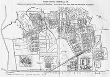
Hidden Location #20 was promptly located in Camp Taylor by Nancy Howard, and properly identified by Fr. John Schwartzlose, Johnny to those of us who watched him grow up, as the foot of Indiana Avenue, where Belmar Drive and Lee Avenue intersect. I lived one door off this corner for seventeen years. I used to tell people I lived at the very bottom of Camp Taylor, which was true. Johnny grew up a few blocks down Lee and up the hill on Orchard.

At one time Indiana Avenue didn't end here. It ran along what is now called the 1600 and 1700 blocks of Belmar Drive out to Poplar Level Road. As a side note, for many years Belmar Drive did not have a 1700 block at all, as it does now from Fincastle Road out to Poplar Level Road. A second side note is that the Fante's house in the beginning of the 1600 block used to have a 1/2 attached to its address - 1603 1/2. It was renumbered sometime in the 1970s.

The other part of Belmar Drive, that from Lee Avenue westward back to Preston Highway was originally called Kentucky Avenue, one of several scattered around what was then rural Jefferson County. Another Kentucky existed in Fern Creek, another in Middletown, and two others, all in addition to the Kentucky Street in Louisville. When the Camp Taylor post office was annexed into the Louisville post office, Camp Taylor's (and Prestonia's) Kentucky Avenue was renamed Belmar Drive. Loosely translated, Belmar means pretty lake. One may recall that the area where Standiford Field, Edgewood, and the north end of Okolona now exist was once basically a swamp called the Wet Woods. Perhaps calling the street Belmar was an attempt at a euphemism.

FISCHER TO OBAMA
I've read some criticism and cynicism about the mayor's visit and chat with the president over the Sherman Minton Bridge, which has locally been dubbed Shermageddon, a name which at least four of my friends, and I am sure countless others, are taking credit for. I have to think about the president visiting Ohio and our neighbors in northern Kentucky, where very few people cast their ballots in the president's favor in November 2008. On the other hand, the two counties which are connected by the Sherman Minton, Jefferson in Kentucky and Floyd in Indiana, gave candidate Obama a 38713 vote margin over the very senior United States Senator from Arizona. [I have to admit the margin was all on the Kentucky side of the river. Floyd cast 3694 fewer votes for Obama than McCain]. As Greg is mayor of the largest city in this area of vote-largesse for Obama, I can't imagine anyone being in a better position to address the absence of traffic on the Sherman Minton than our mayor, who hasn't already offered up an opinion. And we know Obama likes Louisville. He was here several times as a candidate and once, on a beautiful September night in 2006, even before he was officially a candidate. And our side of the river is represented by one of his earliest supporters in the Congress, which can't be a bad thing. Our congressman alerted The White House to the situation twelve days ago and has been in constant contact with the Federal Highway Administation officials on a non-stop basis, and is bringing the top two from that department to Louisville in the very near future. The next logical person to get involved, since the two Republican United States Senators do not seem too interested, is the mayor. To the naysayers who have something nay to say on all-things-Fischer, give it a rest. Quite a few people in the community who didn't vote for him last November are having second thoughts, crossing over to his side. I will admit Greg and I do not entirely agree on the Bridges issue, although we do both support building the East End Bridge first. But our agreement ends there. He is supportive of a downtown bridge which I oppose. Where he stands on a Southwest bridge, an idea I've supported for a decade, I do not know. But, he is the mayor and I am happy to have him communicating with the president on our current lack of a second bridge across the Ohio.

A MAN OF NO IMPORTANCE
Last week I attended Pandora Productions' 16th season opener, A Man of No Importance, with music by Stephen Flaherty, lyrics by Lynn Ahrens, and book by Terrence McNally. Set in 1964 Dublin, it is a story of a man's sexual identity, church identity, hidden loves, and ultimately long-lived friendships. That's quite a few hot buttons to hit in one play, but it was all well done, moving, and enjoyable. Pandora's Michael Drury played the lead (and title role) as Alfie Byrne and it was an excellent perfomance of a tragic character. Although I've never had a sister, the role of Alfie's sister Lily, played by Tiffany Taylor, is an excellent role model and played as such. Alfie's love interest, Robbie, was acted by Jason Brent Button, the adorable blue collar worker who isn't quite the lover Alfie wants but proves to be a very good friend. Alfie's other more prurient interest, Breton Beret, was played quite well by an alluring Michael Mayes, a student at U of L. I know a lot of people recognized the character, the ploy, and the ultimate but sad reward of giving in to one's temptation, as Oscar Wilde counsels Alfie to do. The entire play has as a backdrop Oscar Wilde, my favorite playwright, and the name is, of course, taken from one of the great writer's plays. In the production, the presence (or ghost) of Wilde is played understatedly and dramatically by Patrick Brophy.

The entire cast is an ensemble of fifteen players, playing both their roles and those of their assigned roles of the play-within-the-play, Wilde's Salome, which causes problems for the players' venue, Saint Imelda's Church. I've been a fan of the play-within-the-play genre since my own performance in high school of a production called Here and Now. But, I digress.

I have to say I very much enjoyed A Man of No Importance. The other actors, besides those mentioned above, are Laura Ellis, Rusty Henle, Obadiah Ewing-Roush, Josh Richard, Bob Zielinski, Kristy Calman, Betty Zielinski, Chris Cook, Meg Caudill, Daniel Cooper, Anthony Ransom, Amos Dreisbach, and Blair Boyd.

METRO COUNCIL REDISTRICTING
Back on March 17, 2011, we learned that the official 2010 population of Jefferson County was 741096 people, and it is on that number that under state law the Council is required to reapportion its people into 26 districts of legally-equal size. The ideal population for a district is 28503.69 persons and legally-equal is a measure created by previous court cases allowing a difference of 10% of that number between the most populated and least populated districts. Redistricting is a fascinating once-a-decade project which purists love, I being one of them. Unofficially, I created a map of 26 districts, with some help from Ray Manley and others, back in May, a map which met certain requirements and parameters.

Once you agree on those certain requirements and parameters - that incumbents (of both parties) will remain in their respective districts, that districts with minority representation will remain (or achieve) minority-majority status, and that you will comply with all legal requirements, and that you will split as few precincts as possible - there really aren't very many ways to divvy a county up into twenty-six districts of legally-equal size. Most districts retain 70%-80% of their original territory, one way or another. There are exceptions in far southwestern Jefferson and susburban southeast Jefferson.

Metro Council President Jim King (D-10) has, since August, done an excellent job of bringing the maps from computer-images to paper and an ordinance will soon be introduced redistricting the Council constituencies. That map will look remarkably similar to one a few of my seven faithful readers have seen. I've very happy with President King's guidance on this very delicate matter.

Monday, September 12, 2011

Hidden Location #20 - Please answer in Comments below


Here is a new Hidden Location, the 20th in our series. I'm hoping to stump you on this one, although it should not be too difficult. Good luck.

Wednesday, August 31, 2011

Hidden Location #19

The two pictures below are each of one street which intersects with the street in the other picture. Name either street.


Happy Trails.

Also, Happy End of August and Happy Birthday to Rick Lusardo. The year I was dorm president at Kirwan II, Rick was my vice president.

Thursday, May 26, 2011

Hidden Location #18 - Choice of two - WITH HINTS #1 and #2

The two streets in the three pictures below are related in an unusual way. I can't tell you how they are related because that would be too big of a clue. The first two pictures are the same street, with pictures of the left and right sides of the street. The third picture is a different street. Your task, should you choose to accept it, is three-fold. Identify either the first or second street (or both), and/or tell me how they are related.

As a bonus and a clue, the second street technically doesn't exactly qualify for the relationship, but because of its accessibility was chosen over the actual street which does. I have some hints if this one takes a while. I suspect people will identify the second street before the first one.

Good luck.

Here are the pics:


HINT #1 - First, I still think in terms of the "City" and "County" - I'm still a pre-Metro sort of guy. To that end, these are superlatives - the first street is one of three in both the old City and the county. The second one, because of the house that is out of view on the right, a yellow brick edifice, what some might call a mansion, is only a superlative in the old City.

HINT #2 - I've mentioned these streets are "superlative" in some way. Here is some help. The first street we're looking for in one of three which are superlative in both the old City and the County. The second street we are looking for is superlative only in the old City. Its counterpart in the county is Port Road. The "opposite" superlative to the first street is, in the old City Greenfield Avenue. In the county it is Kulmer Beach Road. The "opposite" of the second street - which really isn't a superlative but qualifies as it is the only access to a property which causes it to be a superlative - the yellow brick mansion I've previously mentioned - in the old City is Christian Court. In the county, it is Sycamore Ridge Drive.

Thursday, May 19, 2011

Hidden Location #17

Ok, this one might be considered "inside knowledge." And it is. Below are two pictures of a location of what was considered in an October 1869 deed and subdivision dedication to be a "common" alley. Usually the word "common" in a deed relates a legal status as "of being for the public use." For many years, this alley appeared on some maps of Louisville based on that 1869 usage. However, in doing some research in 2008 on properties adjoining this "common alley" I found that the word "common" as used in the deed referred only to the adjoining properties and not to the public as a whole. The alley has been removed from most maps as a public right-of-way since the late 1950s.

Your task is to identify either the location, which should be simple for some of you; or, a more difficult challenge, to name the alley. Yes, it has a name, spelled two different ways, but a name nonetheless. Locating it should be easy. Naming it shouldn't.


Tuesday, April 12, 2011

689. Bhatraju, Facebook, and the Civil War - and Hidden Location #16

No, they aren't all related.

It has been almost a month since I've made an entry. A lot hasn't happened in that time. The two biggest things that didn't happen - at least in many Kentuckians minds - were part of the Madness of March. Louisville didn't beat Morehead State and Kentucky didn't beat Connecticut. Also, the Federal government didn't shut down, much to the chagrin of people on both sides of the aisle, all of whom said they didn't want it to, but many of whom would like for that to happen for one reason or another. What else hasn't happened?

For one thing, people didn't stop reading the blog, despite the lack of posts. According to the people-watching counters we're still averaging 34 hits a day. Woohoo. And, while I've been away, we crossed the 80,000th visit-mark. 80,000. That apparently happened on March 15 but I can't quite determine who it was.

But, let's move on. Item #1 above is Bhatraju. That's the surname of a dear friend of mine, Kiran Bhatraju, presently residing in Washington, D.C., but a native of Pike County, Kentucky, home to Pikeville University, one of the two local colleges which did win a basketball tournament last month. The Pikeville Bears defeated Mountain State University 83-76 for the championship of the NAIA Division I. Congratulations, Pikeville. The other college which was a championship was Louisville's own Bellarmine University Knights. Bellarmine defeated Brigham Young University-Hawaii 71-68 to win the school's first NCAA Division II title. Congratulations to Coach Davenport and the Knights. But, I digress.

I was speaking of my Pikeville friend Kiran Bhatraju. Today is his birthday. I ran into Kiran while I was in DC a few weeks back. We had a wonderful night out on the town at a place called Vinoteca, a wine-and-meat-and-cheese bar at 9th and U streets NW. It was Mariachi night, so all the Spanish wine bottles were half-off and we indulged our Castillian urges with some vino y carne y queso. If you were following my trip to DC on Facebook, you would already have this knowledge, as I "Facebooked" the whole trip.

That brings us to Item #2, Facebook. Lately, I've written quite a few updates on my Facebook, causing a serious deficit over here at the Left Bank of the Ohio River near Milepost 606. I need a more balanced way of writing, but as yet, I haven't stumbled upon it. In lieu of that, I am copying below a few of the entries for you perusal.

To wit,

Bourbon, for me, is usually reserved for one of three events - 1) Horse racing, 2) UK Football, or 3) Election Night.

Remember, before the Brown Bag was the Brown Bag, it was the Zanzibar. After the Brown Bag was the Brown Bag, it became the Zanzabar.

Here is the trivial matter: Elstner, Engle, Hill, Horton, McPherson, Philpot, Saint Clair Morton, Karnasch, Clark, Saunders, and Southworth. What's their significance to Louisville? No Googling.

The island where Baxter, Main, and Story intersect. Three US highway routes meet here, one of which ends. Can you name them?


And finally, We could all probably use a FB shutdown - maybe have time to check our regular emails and vacuum the living room. Maybe.


That last one is quite telling.

One of those Facebook quotes concerned a trivia question which was correctly answered by Hau Le, a senior at Central High School. He correctly identified those names as being those of forts in the Louisville area during the Civil War, known to some as the late War Between the States, or the War of Northern Aggression. The American Civil War began 150 years ago today with the firing on Fort Sumpter (South Carolina) of shots by a Lt. Col. Henry S. Farley of the Confederate States Army. The rest, as they say, is history. I just didn't want this date passing us by with a comment. A civil war 150 years ago doesn't seem so far removed after the elections of 2010 as it, perhaps, should.


Finally, a new Hidden Location. There are two pictures, taken from the same spot. There are two ways to win with this one. First, name the spot. Second, name the significance of that spot to today's post.

Happy Trails, and Happy Birthday, Kiran.


Wednesday, March 2, 2011

677. Brief Thoughts - and Tim Meyer is correct.

A necessary prerequisite to perfoming an Act of Civil Disobedience is first fully understanding the law to be disobeyed, and second, acknowledging that, indeed, such a law is current and applicable to the situation.

*****

I know three guys named Tim Meyer, all about the same age. I do not know any of them very well, although I once did. One, the youngest of the three, is Marty Meyer's younger brother, who I've known since he was in grade school, but it would be wrong to say we are friends. Another is a Audubon-area kid that I played softball with in the 1980s. The third is an African-American from Okolona I knew when I was growing up. Back then Okolona was about 94% white, a great contrast from today where it is possible that the Latinos along McCawley Road and Egypt Lane outnumber the blacks. These latter two are my age.

One of those three, or quite possibly another Tim Meyer unknown to me, correctly answered the previous Hidden Location picture. I offered that it would be easy. After all, the previous one was a Manslick Road and I had written a great deal about where all these Manslick Roads were located. Tim correctly identified the picture as the terminus of Manslick Road - neither West nor East - at Palatka Road, where continuing south one is driving upon Saint Andrews Church Road. We'll have another more difficult Hidden Location soon.

Happy March.

Thursday, February 24, 2011

HL 14 identifed; HL 15 below

Ok, y'all are getting them too quickly. I am going to have to take more obscure pictures -starting with the one after Hidden Location #15 below. HL15 should be very easy, but I promise more difficult ones in the future.


But first some comments on Hidden Location #14. John Flood correctly identified the location, writing "This looks like corner of Penile Rd, W. Manslick Rd & Old New Cut Rd. in Fairdale." Yes, to a point - an italicised point. The street names are correct and I'll address two of them below. And, yes, I would certainly call that intersection part of Fairdale. But, according to the United States Postal Service, I was in "Valley Station" when I took the picture while standing along the southern side of W. Manslick Road. All of the Penile Road addresses going off to the right also carry the Valley Station zip code of 40272. But the territory to the left on Old New Cut Road and on the other side of the intersection is, indeed, Fairdale, whose zip code is 40118.


I have nothing to report about Penile Road, and that is probably a good thing. So, let's start with Old New Cut, an interesting name. About twenty-five years ago, coinciding with the opening of the Gene Snyder Freeway, a road was built connecting New Cut Road as it then existed with W. Manslick Road, about 3/4 mile closer to Fairdale. This 3/4 mile stretch of highway went unnamed for many years. People referred to it as New New Cut or New Manslick or "that new road connecting to the Snyder." Eventually, however, developers bought the land along the northern side of the road, erecting several warehouses and a motel. With such development came the need for addresses, and address numbers need road names to make any sense.


After some - not much - discussion, it was decided to call the new stretch of road "New Cut" continuing the name of the road which extends south from Iroquois Park to this point. Further it was decided to call the older stretch of New Cut, the one now cut-off and appearing in our picture, Old New Cut, an awkward name to be sure. But the reason had more to do with the other street involved in the new connecting road - W. Manslick. Were the county streetname deciders going to give us yet another Manslick to deal with?


Check any map of southern Jefferson County and you will find six close but unconnected streets - eight if you count "Old Manslick" sections - with the name Manslick. At one time there were a few more, like the Echo Trail sections of southeastern Jefferson County. Presently the easternmost Manslick Road runs from Beulah Church Road west to Pennsylvania Run Road. A second section, starting about two blocks south of the first one, runs from Pennsylvania Run Road west to what is officially called Shepherdsville Road, but which many still call Old Shepherdsville Road, usually shortenend to Old Shep. A third Manslick starts about a block north of this one and runs from Old Shep west to Preston Highway, which, if you are wondering, was at one time the companion New Shepherdsville Road, but that name never caught on. That's all of the southeastern Manslicks.


Coming in from the southwest, beginning at the intersection of Berry Boulevard and Seventh Street Road, is the first of three Manslicks on this side of town. This one extends south to Palatka Road. A second Manslick picks up about 3/4 mile east of this point and runs south to Saint Anthony's Church Road. Another 3/4 mile from there, a third Manslick begins at Third Street Road and extends toward Fairdale, to the point in our Hidden Location #14 picture, at Old New Cut Road.


Why all the Manslicks?


First, let us dissect the name into its original name which was Mann's Lick, the name of a salt lick owned presumably by the Mann family. Actually, that's exactly what it is. Mann's Lick was a salt lick operating in the area of present day Glengarry, or Glen Garry, a subdivision in Fairdale near the intersection of National Turnpike and the Gene Snyder Freeway. Salt licks dotted southern Jefferson and much of Bullitt counties before places like Louisville and Shepherdsville existed. Thus, we are speaking of pre-Revolutionary War times. A community existed in this area known as Newtown. Newtown, in fact, grew large enough to be incorporated as a city in 1794, but its existence was one of about thirty-five years in the late 18th and early 19th centuries.


The roads leading in from the east and west to Newtown were known as the "roads to Mann's Lick." One group came south from the Falls of the Ohio River, along the north-south buffalo trail generally today followed by the CSX (formerly L&N RR), I-65, and Preston Highway. They are generally known simply as Manslick Road. Another came from the east, perhaps a more southern path of the Midland Trail, or a more northern path of the Wilderness Trail. I really don't know. These, today, are generally known as E. Manslick Road. The roads closest to Fairdale are called W. Manslick Road. Now you know.


So, here is a new picture. Again, it should be very easy to identify.


Tuesday, February 22, 2011

Hidden Location #14


Here is a new location for our cartographic enquirers to get on their Google Earth machines and other such devices and offer up an answer. Actually, I'd rather you not do that. I would ask that you truly make an effort at identifying such places without the help of a machine, other than maybe your car or bike. If you do not know where it is, just say so. There may be other readers who do, but who aren't as savvy on the computer. Again, the whole idea is to find an unusual place then see if any of my readers actually know where it is. That's the idea, although I may not have enough faithful game players to make that happen with every picture. We'll see.


Monday, February 21, 2011

HL Thirteen Answers and a Thought

Hidden Location #13 wasn't nearly as difficult as I thought it might be. Marty Meyer and Patrick C rang in within thirty seconds of each other, with Marty's answer being posted first - Stevenson Avenue headed uphill from Mellwood to William and Arlington. Yes, that is Kaviar Forge on the left as Curtis Morrison points out.

Curtis also correctly identified the 100 block of Haldeman, adding an extraneous North, unnecessary and incorrect, but we won't take points off. The 100 block, north or south, at this point in the city, is divided by the railroad track. I appreciate the additional information Curtis provided on the location.

This latter group of new homes I found last year during the Easter Parade down Frankfort Avenue. I revisited the area late last fall in search for a particular building which was seen in a Todd Lally for Congress commercial. It was my initial belief that the building outside which he was standing was the one opposite the end of Weiss Place, another part of the infill construction of which Mr. Morrison spoke. Further research revealed that building to be the old Ehrler's Dairy operation on Belmar Drive, which had closed in the mid 1990s. We never quite figured out what Mr. Lally believed to be Congressman Yarmuth's involvement in Ehrler's decision to close the building nearly a decade before John took office. But, I digress.

We'll have another Hidden Location soon. I'm also thinking about writing an entry compiling some comments from a few Facebook friends and non-friends who seem to find fault with every step our new mayor has taken during his lengthy term in office, so far a total of forty-nine days. Given some of their rhetoric, you'd think he'd served as long as, say, President Mubarak of Egypt. Forty-nine days, though, is the current mark.

Well, at least I am thinking about it - I may not actually post it. These are folks who have every reason to be upset with the mayor as none of them supproted him. Of course, I've supported candidates who never made it through the Primary before. The following is a list of my first choices for the Democratic nomination for President of the United States of America during my thirty-three years of voting:

Kennedy, Jackson, Simon, Brown, Clinton, no clear choice, Dean, Dodd.
You may notice I got a total of one ultimate nominee correct, the 1996 re-election bid by Bill Clinton. But, as part of my loss, I did not make it my duty to trash everything the victors did, if they were successful in the November race. That sounds like something Mitch McConnell might say with regard to the current president's agenda for 2011 and 2012. Maybe I'm being overly sensitive since I've been described as part of the Fischer protectorate. Maybe.

Thursday, February 17, 2011

Hidden Location #13 - Choice of two

I was sitting in my meeting today when I received a text from Marty Meyer telling me that if I had posted a new picture, he could have been figuring it out while in attendance at his meeting.

For the record, he was seated next to me.

Below are two pictures - two different streets although, honestly, not that far apart. One picture looks uphill while the other looks down. Where are they?

What goes up . . . .


Must come down.

I'm pretty sure there were no blue Volvo wagons around this time.

Saturday, February 12, 2011

676. 676 and #12

First, the answer to Hidden Location #12 was offered to our seven faithful readers by someone known on the wires as JeffnClifton. I have somewhere in the corner cobwebs of my mind that his real name is Jeff Nowlin. Is that correct? The picture was taken in the 200 block of Idlewylde Drive looking south toward Calvin Avenue.

Appropriately the answer came from a self-identified Cliftonian as this street is somewhere along the borderlands between Clifton, Crescent Hill, and Clifton Heights. To his credit, Curtis Morrison had taken a stab at the location and was headed in the right direction when he mentioned Lower Brownsboro Road. But, as there were no Iron Facades or Downtown Bridges involved, and the fact that it is very likely most of the residents in this area were Greg Fischer supporters, he somehow lost his way.

I wish I knew more of the background of this area, as it is my custom to try to give a short historical sketch once the hidden location is revealed. I'll have to return to this one on another day as I know very little specific information.

*****


The other part of this entry returns us to an old custom - that of using the entry number as a lesson for a Kentucky highway of the same number. Today is entry #676 so we'll speak briefly about KY676, a major cross-county four-lane in southern Franklin County. KY676, I believe, was built in the mid to late 1970s. The purpose of the road was to alleviate traffic on downtown Frankfort's city streets.

Frankfort stands by hills surrounded - replacing Frankfort for Zion, so would go an altered hymn by the Irish Poet Thomas Kelly, written in 1806. Anyone who has ever driven into Frankfort knows one must go downhill to get down to the city proper. The city was originally laid out in the "S" curves of the Kentucky River, where the division in 1780 of Kentucky County, Virginia occurred, at the mouth of Benson Creek into the Kentucky River. There is presently a Riverfront Park overlooking some of this, along Wilkinson Street north of Broadway.

From the south, one enters Frankfort along either the old Lawrenceburg Pike (KY420) or more often, along US60, down Louisville Hill into Second Street, which is also the major approach from the west, the minor one being the Devils Hollow Road (eventually KY1005), which was the original entry from Louisville. From the north are the Bald Knob Pike (US421) and the Owenton Road (US127). From the east, one comes down East Main Street either from the Georgetown Pike (US460) or from Versailles Road (US60). All of these approaches at some point go down hill, and often steeply. Anyone coming into town prior to the construction of KY676 did it on one of these roads.

With the expansion of what was once called the Health Department and what many people still call the Human Resources Building on East Main Street, a need arose to create a "back" way into the project. This also allowed for expansion at Kentucky State University (KSU), opposite the Human Resources Building. KY676, which is signed as the East-West Connector allowed for this back entry. BEginning on the west side at US127 the road went down hill with its first original intersection at an extended Collins Lane, which at one time had jutted west toward US127.

Further down the hill came the intersection with KY420 which hugged the stone wall along its west side leading down into South Frankfort below the Capitol and Executive Mansion. This area has always been prone to flooding. At the bottom of the hill, the road crosses the Kentucky River in the Big Eddy area, on the Julian M. Carroll Bridge, named for the previous governor from McCracken County who after his term as governor remained in Frankfort and is now serving as a State Senator for Franklin, Anderson, Woodford, and parts of Scott and Fayette counties.

The eastern side of KY676 then works its way back up the hill with Frankfort's Capital View Park off to the north along the old Glenns Creek Road, redubbed as Kentucky coffeetree Drive, for what was for a few years Kentucky's official tree, and a variety of venues off to the south including Kentucky's Vietnam Veterans Memorial, shown below. The memorial, dedicated in 1988, takes the form of a granite sundial with the dial, or gnomon, of stainless steel. The names of Kentucky's 1100 fallen and missing veterans from that war are strategically placed such that the tip of the shadow produced on a given day by the gnomon falls upon the date that the veteran was lost to the war. It is an eerie and sensitively designed memorial which everyone should visit.

The newer Franklin County Regional Correctional Facility is also up on the ridge to the south of the highway. The major intersection on this side of town is with Martin Luther King Jr. Drive (KY1659), a major four-lane city street connecting with the back (and effectively the main) entrance of the Human Resources Building, as well as all of the KSU's facilities off to the east. Martin Luther King Jr. Drive, the former Maryland Avenue, then crosses East Main Street and directly accesses the main campus of KSU. South of the East-West Connector, this street is known as Glenns Creek Road.

KY676 progresses further east, generally following the old railroad path which eventually leads to Midway and Lexington and has recently become a topic of discussion for a light rail line connecting Frankfort with Kentucky's largest two cities, Louisville and Lexington. But, I digress.

After crossing Galbraith Drive, the road makes its approach to Versailles Road, East Frankfort's major thoroughfare. The intersection here was one of a few "prototypes" combining some elements of an interstate intersection with cross-over stoplighted street level intersection as well. The Bardstown Road/Watterson Expressway intersection in Louisville is another example of this type of intersection. KY676 ceases numerically at this point, but the roadway itself extends under US60 becoming the Leestown Pike on the east side and numbered as KY 421, eventually leading into Lexington under the name West Main Street.

For most people who use it, it is simply the easy way into and out of the Human Resources Building on the east side of the river, and the circulating Captial Parking garage for the west side. Now you know.


KY676 photo by H. B. Elkins
Kentucky Vietnam Veterans Memorial photo by Lon Whitson

Tuesday, February 8, 2011

A new Hidden Location and an answer to the last one

At some point I need to get back to writing real blog entries instead of these little games. But, I am enjoying them so that may not happen for a while. First, a new picture, Hidden Location #12, for Marty to locate. Wait, I meant for everyone to take a stab at locating before Marty figures it out. Go.


Marty's answer for Hidden Location #11 is correct. That is the 1200 block of Hull Street looking northeast. This is the Irish Hill neighborhood just off Baxter Avenue near what is now called Lexington Road. The subdivision known as Irish Hill was laid out in two parts, the earlier one closer to Lexington Road, then known as Hamilton Avenue, was the old Valentine Schneikert property and developed by Adolph Hull, who probably named Hull Street. The Schneikert mansion still exists up on a hill behind some condos which front at 1234 Lexington Road. Very few people ever see the Schneikert mansion, which now has been converted to apartments and has a Pine Street address. I cannot locate a good picture of that home. Schneikert was a Louisville brickmaker in the post-Civil War era. His home was built prior to 1884.

[WRITER/EDITOR'S NOTE: Before some more informed soul than I points it out to me, someone like Dr. Tom Owen, I must confess I've eliminated a reference in the last sentence of the above paragraph to Mr. Schneikert's home being built of wood, as opposed to brick. When I wrote that earlier - the reference is now gone - I felt I was wrong. So, as part of my evening drive I went and found the house and found (most of it) to be constructed of brick, as is befitting the home of a Louisville brick merchant. Thanks for allowing me to clear that up].


Two people mentioned the old brick mansion at 1212 Hull Street, pictured below, believed to have been built around 1868. That was the home of Nicholas Finzer, a Louisville tobacco merchant - The Five Brothers Tobacco Company - as well as a member of the old Louisville School Board. A school once stood on E. Broadway between Shelby and Clay streets on the south side named for Mr. Finzer and Finzer Street runs behind the old school proeprty over to Smoketown. I've put a picture of the school below that of his mansion. It is now a parking lot.

These two homes in Irish Hill aren't that far apart. I can't determine where the proeprty division may have been based on the current street grid. But the balance of the Schneikert property was re-subdivided by an Act of the General Assembly on March 24, 1884. This later section became the property of the Payne family and Payne Street obviously is named for them. This subdivision extended over to the now-abandoned Eastern Cemetery where my Schlenk relatives are buried, including my great-grandmother Loraine Augusta Schlenk Lee Hall, and her parents, Emil and Minnie Schlenk.

*****


Nicholas Finzer Mansion, 1212 Hull Street


Nicholas Finzer School, formerly at 740 E. Broadway

Thursday, February 3, 2011

Hidden Location #11

Here it is. I have two supplementary photos which may be added if Marty doesn't figure this one out right away. Leave comments. Unrelated, the groundhog saw his shadow yesterday in Pennsylvania, according to the official media. Spring is en route.

Friday, January 28, 2011

674. "Come on out to William H. King's . . . . , and Hidden Location #10 revealed

Out at the Fairgrounds, except we officially don't call it that anymore, there is a show going on, a show most of us in Louisville have attended at one time or another in our lives. It is being advertised as the Louisville Boat, RV, and Sport Show, and there is a little jingle that was being played earlier on 103.5 FM - WAKY - or as we would say here along the Left Bank of the Ohio River near Milepost 606, Wa-Kee Ray-Dee-Oh! The trouble is I can't tell you how the jingle goes because it hasn't been around long enough. In fact, as soon as I heard it I started singing another jingle for the same event. If you are old enough, you know the real jingle for this show goes "Come on out to William H. King's Sport, Boat, and Vacation show, 'Cause it wont be long until it that time of year" Now I know that more than a few of you were singing along by the time you got to the end of that line.

If you are old enough to remember the William H. King jingle, you're probably old enough to have recognized the location in our most recent Hidden Location entry. Marty Meyer correctly identified it as the corner of S. Second Street at W. Florence Avenue. Indeed, that is exactly where it is. The picture is looking north along Second Street's southbound lanes. Back in the day, as people like to say nowadays when they are talking about something that happened a long time ago - I'm especially unnerved when I hear one of my 23 year old friends referring to back in the day and you find out they mean sometime around 2007. But, I've digressed.

At one time, this corner was an integral part of the Watterson Expressway's intersection with KY1020. The former exit sign read "2nd St - 3rd St - Southern Parkway" heading in either direction on the Watterson. If you were in the westbound lanes and you took this triply-defined exit, you made a 90 degree turn off the Watterson and up the little hill on 2nd Street to Florence. At that point you were directed 90 degrees to the left (westwardly) along Florence over to 3rd and even further, if you wanted, over to Southern Parkway. That hill was known to oldtimers as Bluebird Hill although I do not know exactly why.

Marty identified the intersection as part of Wilder Park and this is qualifiably correct, but qualifiably incorrect as well. While the old City of Louisville neighborhood boundary for Wilder Park extended this far south, the original development, which began in the very late 1880s extended no further south than Fairmont Avenue. It is possible that Fairmont is named for the little hill to the south that came to be known at some point as Bluebird Hill, while the valley between Fairmount and the eventual Florence was known as Bluebird Valley.

The original Wilder Park subdivision, built on land once occupied by the old Greenland Race Track, an early Churchill Downs comptetior, ran from Collins Court south to Fairmount, and from Third Street east over to the old L&N Railroad. It was developed by a real estate investor by the name of Angus Allmond - hence Allmond Avenue which eventually graced (loosely used) the far eastern edge of the far southern edge of the neighborhood. The property was owned by a woman named Wilder Collins. Most of the Wilder Park homes north of Fairmont, in Mrs. Collins original plat, were built in the period between 1890 and 1930. Homes south of there came along just before and just after World War Two.

2nd Street, the divided avenue in the center of the development, was originaly known as Wilder Boulevard. The east-west cross streets followed the pattern of those streets north of Churchill Downs, adopting letters as their street names. Wilder Park's letters ranged from P to V. The only Louisville streetname remaining from the configuration is M street, just north of Churchill Downs.

(Unrelated to this story is that of the City of Oakdale, which began up near The Granville Inn at what was then called A Street, and extended south to about where the Watterson Expressway is now, between the L&N on the east and Rodman Avenue on the west. An Oakdale neighborhood remains south of Churchill Downs.)

So, congratulations once again to Marty Meyer, now 7-1-1-1 in our little game. I'll find a new location tomorrow or Sunday.

Hidden Location #10

Let's see how the panel does. I have a second picture from the same intersection which I may post later if this one proves too difficult. Leave your comments below.

Friday, January 21, 2011

673. A Full Moon and a Hidden Location Winner

There a big beautiful pizza-pie style moon hanging out about 1/3 the way up in the sky somewhere over Fisherville or maybe even Finchville. It is a cold clear night like this which makes me wish I lived somewhere off KY44 or KY248 out by Taylorsville Lake, where I'm sure that moon is as bright as the sun.

*****

We have a (new) winner in the Hidden Location game. All the previous locations have been identified by Marty Meyer, with one exception to that rule, which was identified by Curtis Morrison.

But now we have a new player and winner, my friend Joanna Erny. She correctly identifed the snowy downtown location as 8th Street looking north toward Main.

On the left is the Louisville Slugger Bat Factory and on the right an old historic building recently occupied by the Louisville-Jefferson County Revenue Commission. For one term, from 1999 to 2002, I was a Louisville-Jefferson County Revenue Commissioner. It is also sometimes called the Louisville Opera Building. It is presently undergoing extensive renovation.

Across Main Street, on the northeast corner, you can see the Alexander Building, the top floor of which is a penthouse apartment where political shindigs are held now and then. In the background is the federal government's 1960s gift to Louisville's waterfront, Interstate 64, the "64" part of 86-64, a grassroots effort to rid the waterfront of its overhead expressway and create instead a parkway setting. Hope springs eternal for that.

We'll have a new Hidden Location soon for our seven faithful readers to work on.

Congratulations Joanna on your win.

Thursday, January 20, 2011

672. Billy Joel, Alison Lundergan Grimes, and Hidden Location #10

Back on November 3, 1973, as I was beginning the 8th grade at Durrett High School, California singer Billy Joel released his ode to lounge-lizard listening, a song entitled Piano Man. It is one of several songs I learned to play a few years later under the guidance of Shera Baker, a young lady who was two years behind me in school. Her living room and its piano served as a launchpad for those of you who've since heard me play, for good or for bad.

The first line of the fourth verse of Piano Man is "It's a pretty good crowd for a Saturday, the manager gives me a smile ... " While today wasn't a Saturday, and there were no pianos involved, there was a pretty good crowd today at an event I attended after work, and the manager, so to speak, was all smiles.

If you are in Louisville, you know we've been threatened with four to six inches of snow, an accumulation which has probably fallen from the skies, but for one reason or another has not quite accumulated on Mother Earth below. Nonetheless, the city went into its usual "snow mode" letting school out early, closing businesses, and generally providing a sales boon to the local groceries. See the picture below for a snowy scene in downtown Louisville.


Despite the cold weather and heavy falling snow, a "pretty good crowd" gathered today on the second floor of Louisville's famed Glassworks facility at 9th and Market streets - technically 9th is still Roy Wilkins Avenue at that point, a name typically observed only in the breach. The event was the Louisville reception for my friend Alison Lundergan Grimes, a Lexington attorney who today filed her papers for the Democratic nomination for the office of Kentucky's Secretary of State. Earlier events were held in Lexington and Frankfort, and tomorrow there will be additional events culminating in Maysville, a small river city in northeastern Kentucky, and the hometown of Alison's father, former Kentucky Democratic Chairman Jerry Lundergan, the metaphorical smiling manager in Joel's song. I'm supporting Alison in her bid to this office in the election which will be decided this fall.

Alison addressed the "pretty good crowd" for this snowy afternoon with three important women in her life looking on from the front row of the room, her mother and her two grandmothers. Her mother, Charlotte Lundergan, and I serve together on the Kentucky Democratic Party State Central Executive Committee. She is also one of Kentucky's representatives on the National Democratic Committee. Alison was joined by other members of her family as well as a host of Democratic luminaries from across the state. The current and two former lieutenant governors were present, as well as Speaker of the Kentucky House of Representatives Greg Stumbo of Floyd County, who introduced the candidate. There were also a few members of the Jefferson County Democratic Executive Committee present, along with others of the general public. The press was represented by Joe Gerth, a writer for the Courier-Journal. Again, for a snowy late afternoon, it was a "pretty good crowd."

Below is a picture which, for lack of any others in hand, we'll use as Hidden Location #10. For those who live or work downtown, as I do, this one should be relatively easy. Leave any comments below.

Finally I'd be remiss if I didn't acknowledge today's 50th anniversary of the Inauguration and speech of President John Fitzgerald Kennedy, the first inaugural of my lifetime. It was on this date fifty years ago that the new president admonished and obliged the American people to "Ask not what your country can do for you, but what you can do for your country." I grew up with that expression never too far removed from one's mind, an era when the American populace was more concerned with the collective "we" which comprises America, as opposed to the individualistic "I" which, since the presidency of Kennedy's later successor Ronald Wilson Reagan, has destroyed the fabric of American culture, a great loss to each other, our Republic, and the world. When "The Fall of the American Republic" is written, which it will be soon, perhaps in the next fifty years, one of the turning points will be when Ronald Reagan reported in his inaugural that "the government isn't the solution, but rather is the problem." How more different could the attitudes be between Kennedy and Reagan, the former telling us to be concerned about our country to the point of "doing" for it; the latter proclaiming that the government is the problem and should be abandoned. Sad!

Again, Hidden Location #10 is below.

The Archives at Milepost 606

Personal

Louisville, Kentucky, United States
Never married, liberal Democrat, born in 1960, opinionated but generally pleasant, member of the Episcopal Church. Graduate of Prestonia Elementary, Durrett High, and Spalding University; the first two now-closed Jefferson County Public Schools, the latter a very small liberal arts college in downtown Louisville affiliated with the Roman Catholic Sisters of Charity of Nazareth. My vocation and avocation is politics. My favorite pastime is driving the backroads of Kentucky and southern Indiana, visiting small towns, political hangouts, courthouses, churches, and cemeteries. You are welcome to ride with me sometime.