HL 14 identifed; HL 15 below

Musings of a political, social, cultural, religious, and/or historical nature from near Milepost 606 on the Left Bank of the Ohio River, located at Louisville, Jefferson County, Kentucky.

Posted by
Jeff Noble
at
7:20 AM
1 comments
![]() Labels:
Hidden Location
Labels:
Hidden Location
Posted by
Jeff Noble
at
7:52 AM
1 comments
![]() Labels:
Hidden Location
Labels:
Hidden Location
Hidden Location #13 wasn't nearly as difficult as I thought it might be. Marty Meyer and Patrick C rang in within thirty seconds of each other, with Marty's answer being posted first - Stevenson Avenue headed uphill from Mellwood to William and Arlington. Yes, that is Kaviar Forge on the left as Curtis Morrison points out.
Curtis also correctly identified the 100 block of Haldeman, adding an extraneous North, unnecessary and incorrect, but we won't take points off. The 100 block, north or south, at this point in the city, is divided by the railroad track. I appreciate the additional information Curtis provided on the location.
This latter group of new homes I found last year during the Easter Parade down Frankfort Avenue. I revisited the area late last fall in search for a particular building which was seen in a Todd Lally for Congress commercial. It was my initial belief that the building outside which he was standing was the one opposite the end of Weiss Place, another part of the infill construction of which Mr. Morrison spoke. Further research revealed that building to be the old Ehrler's Dairy operation on Belmar Drive, which had closed in the mid 1990s. We never quite figured out what Mr. Lally believed to be Congressman Yarmuth's involvement in Ehrler's decision to close the building nearly a decade before John took office. But, I digress.
We'll have another Hidden Location soon. I'm also thinking about writing an entry compiling some comments from a few Facebook friends and non-friends who seem to find fault with every step our new mayor has taken during his lengthy term in office, so far a total of forty-nine days. Given some of their rhetoric, you'd think he'd served as long as, say, President Mubarak of Egypt. Forty-nine days, though, is the current mark.
Well, at least I am thinking about it - I may not actually post it. These are folks who have every reason to be upset with the mayor as none of them supproted him. Of course, I've supported candidates who never made it through the Primary before. The following is a list of my first choices for the Democratic nomination for President of the United States of America during my thirty-three years of voting:
Kennedy, Jackson, Simon, Brown, Clinton, no clear choice, Dean, Dodd.You may notice I got a total of one ultimate nominee correct, the 1996 re-election bid by Bill Clinton. But, as part of my loss, I did not make it my duty to trash everything the victors did, if they were successful in the November race. That sounds like something Mitch McConnell might say with regard to the current president's agenda for 2011 and 2012. Maybe I'm being overly sensitive since I've been described as part of the Fischer protectorate. Maybe.
Posted by
Jeff Noble
at
5:07 PM
1 comments
![]() Labels:
Brief Thoughts,
Hidden Location,
History,
Politics and Politicians
Labels:
Brief Thoughts,
Hidden Location,
History,
Politics and Politicians
I was sitting in my meeting today when I received a text from Marty Meyer telling me that if I had posted a new picture, he could have been figuring it out while in attendance at his meeting.
For the record, he was seated next to me.
Below are two pictures - two different streets although, honestly, not that far apart. One picture looks uphill while the other looks down. Where are they? What goes up . . . .
 Must come down.
I'm pretty sure there were no blue Volvo wagons around this time.
Posted by
Jeff Noble
at
8:11 PM
6
comments
![]() Labels:
Hidden Location
Labels:
Hidden Location
First, the answer to Hidden Location #12 was offered to our seven faithful readers by someone known on the wires as JeffnClifton. I have somewhere in the corner cobwebs of my mind that his real name is Jeff Nowlin. Is that correct? The picture was taken in the 200 block of Idlewylde Drive looking south toward Calvin Avenue.
Appropriately the answer came from a self-identified Cliftonian as this street is somewhere along the borderlands between Clifton, Crescent Hill, and Clifton Heights. To his credit, Curtis Morrison had taken a stab at the location and was headed in the right direction when he mentioned Lower Brownsboro Road. But, as there were no Iron Facades or Downtown Bridges involved, and the fact that it is very likely most of the residents in this area were Greg Fischer supporters, he somehow lost his way.
I wish I knew more of the background of this area, as it is my custom to try to give a short historical sketch once the hidden location is revealed. I'll have to return to this one on another day as I know very little specific information.
*****
The other part of this entry returns us to an old custom - that of using the entry number as a lesson for a Kentucky highway of the same number. Today is entry #676 so we'll speak briefly about KY676, a major cross-county four-lane in southern Franklin County. KY676, I believe, was built in the mid to late 1970s. The purpose of the road was to alleviate traffic on downtown Frankfort's city streets.
Frankfort stands by hills surrounded - replacing Frankfort for Zion, so would go an altered hymn by the Irish Poet Thomas Kelly, written in 1806. Anyone who has ever driven into Frankfort knows one must go downhill to get down to the city proper. The city was originally laid out in the "S" curves of the Kentucky River, where the division in 1780 of Kentucky County, Virginia occurred, at the mouth of Benson Creek into the Kentucky River. There is presently a Riverfront Park overlooking some of this, along Wilkinson Street north of Broadway.
From the south, one enters Frankfort along either the old Lawrenceburg Pike (KY420) or more often, along US60, down Louisville Hill into Second Street, which is also the major approach from the west, the minor one being the Devils Hollow Road (eventually KY1005), which was the original entry from Louisville. From the north are the Bald Knob Pike (US421) and the Owenton Road (US127). From the east, one comes down East Main Street either from the Georgetown Pike (US460) or from Versailles Road (US60). All of these approaches at some point go down hill, and often steeply. Anyone coming into town prior to the construction of KY676 did it on one of these roads.
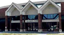
With the expansion of what was once called the Health Department and what many people still call the Human Resources Building on East Main Street, a need arose to create a "back" way into the project. This also allowed for expansion at Kentucky State University (KSU), opposite the Human Resources Building. KY676, which is signed as the East-West Connector allowed for this back entry. BEginning on the west side at US127 the road went down hill with its first original intersection at an extended Collins Lane, which at one time had jutted west toward US127.
Further down the hill came the intersection with KY420 which hugged the stone wall along its west side leading down into South Frankfort below the Capitol and Executive Mansion. This area has always been prone to flooding. At the bottom of the hill, the road crosses the Kentucky River in the Big Eddy area, on the Julian M. Carroll Bridge, named for the previous governor from McCracken County who after his term as governor remained in Frankfort and is now serving as a State Senator for Franklin, Anderson, Woodford, and parts of Scott and Fayette counties.
The eastern side of KY676 then works its way back up the hill with Frankfort's Capital View Park off to the north along the old Glenns Creek Road, redubbed as Kentucky coffeetree Drive, for what was for a few years Kentucky's official tree, and a variety of venues off to the south including Kentucky's Vietnam Veterans Memorial, shown below. The memorial, dedicated in 1988, takes the form of a granite sundial with the dial, or gnomon, of stainless steel. The names of Kentucky's 1100 fallen and missing veterans from that war are strategically placed such that the tip of the shadow produced on a given day by the gnomon falls upon the date that the veteran was lost to the war. It is an eerie and sensitively designed memorial which everyone should visit.
The newer Franklin County Regional Correctional Facility is also up on the ridge to the south of the highway. The major intersection on this side of town is with Martin Luther King Jr. Drive (KY1659), a major four-lane city street connecting with the back (and effectively the main) entrance of the Human Resources Building, as well as all of the KSU's facilities off to the east. Martin Luther King Jr. Drive, the former Maryland Avenue, then crosses East Main Street and directly accesses the main campus of KSU. South of the East-West Connector, this street is known as Glenns Creek Road.
KY676 progresses further east, generally following the old railroad path which eventually leads to Midway and Lexington and has recently become a topic of discussion for a light rail line connecting Frankfort with Kentucky's largest two cities, Louisville and Lexington. But, I digress.
After crossing Galbraith Drive, the road makes its approach to Versailles Road, East Frankfort's major thoroughfare. The intersection here was one of a few "prototypes" combining some elements of an interstate intersection with cross-over stoplighted street level intersection as well. The Bardstown Road/Watterson Expressway intersection in Louisville is another example of this type of intersection. KY676 ceases numerically at this point, but the roadway itself extends under US60 becoming the Leestown Pike on the east side and numbered as KY 421, eventually leading into Lexington under the name West Main Street.
For most people who use it, it is simply the easy way into and out of the Human Resources Building on the east side of the river, and the circulating Captial Parking garage for the west side. Now you know.
KY676 photo by H. B. Elkins
Kentucky Vietnam Veterans Memorial photo by Lon Whitson
Posted by
Jeff Noble
at
10:40 PM
1 comments
![]() Labels:
Frankfort,
Hidden Location,
History,
Land,
Travel
Labels:
Frankfort,
Hidden Location,
History,
Land,
Travel
Curtis Morrison:
If Mayor Greg Fischer continues to take cues from President Mubarak in the undemocratic disposition of Whiskey Row, all you loyal Fischer supporters will likely be activated to storm an upcoming rally of preservationists on the backs of camels, armed with those little Louisville Slugger bats they've confiscated at the airport. This all could have been prevented.
Me:
I have an opinion but it has nothing to do with the relatively recent ownership by Mr. Blue. Most of these buildings have been more or less empty since I was in my teens or 20s, which is to say for a hell of a long time. And the ones which were open back then - I can remember several - weren't in the best of shape even then. I recall a collapsing stairwell in one building in particular back in 1986. And the one on the far eastern end collapsed of its own accord a decade ago. Admittedly, those toward the west have done well.
I'm not happy about any compromise on the facade issue, of that I'll admit. But when the plans came out in 2007 for all the highrises set back away from the streets, I thought it was a great idea. My friend Michael Garton and I discussed this last night while waiting for Gil Reyes' play, Rosencrantz and Gildenstern Are Dead, to start at the Kentucky Center. We disagreed.
I wish there was to be more residential space, and particularly more affordable residential space in this project, or any project in the area. We have next to none of that. There's something worth fighting for.
But, comparing this mayor's one month and five days in office with the thirty year reign of President Mubarak is quite hyperbolic and frankly, silly. I expect better from you and your followers.
Deep in my heart, I'm a preservationist too. I remember my freshman year at college (or maybe I was a senior at Durrett) fighting the demolition of the old Will Sales Building, where the B&W Tower now stands at 4th and Liberty streets. I remembering touring with then-Alderman Allan Steinberg the old Savoy Theater on Jefferson Street and the Milner Hotel in the same block, hoping their facades could be worked into plans for the new convention center. We lost those battles and those buildings.
But using similar tactics, others succesfully incorporated the facade of the Compton or Clinton (or whatever it is - I know it starts with a C) Building into the new multi-storied Marriott at 3rd and Jefferson streets, providing construction jobs in the short run and hotel jobs for decades to follow.
Let's use a little logic here. We need to preserve the facades - the only real parts worth preserving. Work toward that end - I will join you. But we also need jobs. Here is an opportunity. Make your arguments using sensible language and reasonable ideas, not Slugger Battette wielding renegades on camelback. Don't expect anyone with any authority to help you in your crusade to take such comments with any degree of seriousness.
Posted by
Jeff Noble
at
1:55 PM
1 comments
![]() Labels:
Brief Thoughts,
History,
Louisville,
Politics and Politicians
Labels:
Brief Thoughts,
History,
Louisville,
Politics and Politicians
At some point I need to get back to writing real blog entries instead of these little games. But, I am enjoying them so that may not happen for a while. First, a new picture, Hidden Location #12, for Marty to locate. Wait, I meant for everyone to take a stab at locating before Marty figures it out. Go.
Marty's answer for Hidden Location #11 is correct. That is the 1200 block of Hull Street looking northeast. This is the Irish Hill neighborhood just off Baxter Avenue near what is now called Lexington Road. The subdivision known as Irish Hill was laid out in two parts, the earlier one closer to Lexington Road, then known as Hamilton Avenue, was the old Valentine Schneikert property and developed by Adolph Hull, who probably named Hull Street. The Schneikert mansion still exists up on a hill behind some condos which front at 1234 Lexington Road. Very few people ever see the Schneikert mansion, which now has been converted to apartments and has a Pine Street address. I cannot locate a good picture of that home. Schneikert was a Louisville brickmaker in the post-Civil War era. His home was built prior to 1884.
[WRITER/EDITOR'S NOTE: Before some more informed soul than I points it out to me, someone like Dr. Tom Owen, I must confess I've eliminated a reference in the last sentence of the above paragraph to Mr. Schneikert's home being built of wood, as opposed to brick. When I wrote that earlier - the reference is now gone - I felt I was wrong. So, as part of my evening drive I went and found the house and found (most of it) to be constructed of brick, as is befitting the home of a Louisville brick merchant. Thanks for allowing me to clear that up].


Posted by
Jeff Noble
at
6:38 AM
3
comments
![]() Labels:
Cemeteries,
Genealogy,
Hidden Location,
History,
Land
Labels:
Cemeteries,
Genealogy,
Hidden Location,
History,
Land
Here it is. I have two supplementary photos which may be added if Marty doesn't figure this one out right away. Leave comments. Unrelated, the groundhog saw his shadow yesterday in Pennsylvania, according to the official media. Spring is en route.
Posted by
Jeff Noble
at
7:34 AM
3
comments
![]() Labels:
Hidden Location
Labels:
Hidden Location

