Saturday, May 30, 2009

488. Diverse things happening

Stuart wasn't the only one. Kiran left too, as did Lillian. My friend Preston moved "back home" this weekend. My friend Keith is planning a Greyhound ride to California in two weeks to the same place where Stuart will ultimately light. All this moving about is somewhat bewildering.

But these are bewildering times. Tomorrow's readings for Mass indicate such. Outside of Christmas and Easter, the two high-holy holidays, tomorrow, which is the Feast of Pentecost, is my favorite. And it is a remembrance of a bewildering day in history, assuming you believe at least some parts of the Bible are actual, as I do. Like the reading from the Second Chapter of Luke announcing the birth of Jesus and that of Mark with the angel announcing to Mary Magdalene and Mary the mother of James at the tomb of Jesus that "He is risen; He is not here," the readings associated with tomorrow's feast are very familiar. From the Book of Acts, Chapter 2, is the arrival of the Holy Spirit, and the day every one was gathered together from all parts of the known world. It is like an enchantment. In fact, in the book The Mists of Avalon - one of my favorites - the entire scene is borrowed in a episode related to the Holy Grail. Here is the biblical passage:

When the day of Pentecost had come, the disciples were all together in one place. And suddenly from heaven there came a sound like the rush of a violent wind, and it filled the entire house where they were sitting. Divided tongues, as of fire, appeared among them, and a tongue rested on each of them. All of them were filled with the Holy Spirit and began to speak in other languages, as the Spirit gave them ability.

Now there were devout Jews from every nation under heaven living in Jerusalem. And at this sound the crowd gathered and was bewildered, because each one heard them speaking in the native language of each. Amazed and astonished, they asked, "Are not all these who are speaking Galileans? And how is it that we hear, each of us, in our own native language? Parthians, Medes, Elamites, and residents of Mesopotamia, Judea and Cappadocia, Pontus and Asia, Phrygia and Pamphylia, Egypt and the parts of Libya belonging to Cyrene, and visitors from Rome, both Jews and proselytes, Cretans and Arabs-- in our own languages we hear them speaking about God's deeds of power." All were amazed and perplexed, saying to one another, "What does this mean?" But others sneered and said, "They are filled with new wine."

But Peter, standing with the eleven, raised his voice and addressed them, "Men of Judea and all who live in Jerusalem, let this be known to you, and listen to what I say. Indeed, these are not drunk, as you suppose, for it is only nine o'clock in the morning. No, this is what was spoken through the prophet Joel:

In the last days it will be, God declares,
that I will pour out my Spirit upon all flesh,
and your sons and your daughters shall prophesy,
and your young men shall see visions,
and your old men shall dream dreams.
Even upon my slaves, both men and women,
in those days I will pour out my Spirit;
and they shall prophesy.
And I will show portents in the heaven above
and signs on the earth below, blood, and fire, and smoky mist.
The sun shall be turned to darkness
and the moon to blood,
before the coming of the Lord's great and glorious day.
Then everyone who calls on the name of the Lord shall be saved."


The repeated passage from Joel, an Old Testament prophet, adds to the whirlwind of emotion addressed in the Acts, traditionally believed to have been written by Saint Luke. What I take from the reading is simple - that we are all part of the great and mysterious family of God, no matter our race or skin color or belief or gender or occupation or economic status or political ideology or hairstyle (or lack-of-hair-to-style as is my case) or any of the other differences that make us different. Here, in this day, as in that, we all belong not only to God but to each other. That's a very comforting and comfortable thought.

Thanks Be To God.

*****

Unrelated, tomorrow, in addition to being the FEast of Pentecost, is also the 6th birthday of my youngest nephew Elijah Gene Noble. Happy Birthday, Elijah.

Wednesday, May 27, 2009

487. Mr. Perelmuter Leaves Washington

From the Old Testament, Ecclesiates Chapter 3 Verse 1, is the very familiar refrain of "There is a time for everything, and a season for every activity under heaven." This verse and the seven which follow are used for a variety of reasons, often as an explanation for some change, whether that change be small or great, temporary or permanent, life-giving or life-ending. Change is, in fact, the only real constant in life.

Such it is that I use the phrase to note the next move of a dear friend, Stuart Perelmuter. Stuart has been mentioned in the entries of this blog many times - twelve if my count is correct - and almost from the beginning, first appearing in Entry #6 on January 9, 2007, five days after the blog's commencement. And, his picture has appeared in the right-side column for most of that time as well.

I first met Stuart at a local movie premiere, one he wrote, in the Kentucky Theater in 2003, and lost track of him shortly thereafter. He reentered my scene of interest as a volunteer in the first Yarmuth for Congress campaign in 2006. He quickly moved from volunteer to staffer, and ultimately from staffer to employee of Congressman Yarmuth, for whom he has served as spokesperson and protector since John's first day in the Congress. To my knowledge, only one other original campaign staffer remains on Congressman Yarmuth's official staff.

As there is a time for every activity under the sun, so the time has come for Stuart to move on - eventually "out West" - where his passion lay as his first avocation is writing - screenwriting, playwrighting, and the like.

In today's email came his letter informing the regular readers of his dispatches from Washington (of which I am one) of his departure from service in the Congress. I wish him well.

Below is the email he sent:

Dear Release Readers,

This will be my last week as Congressman Yarmuth's Communications Director. As some of you know, I write screenplays and now, with a couple scripts in development, it's time for me to devote my full attention to them in LA.

Trey Pollard is taking over and will be excellent in the role. He will be assuming my phone numbers and can be reached at trey.pollard@mail.house.gov. Unless you tell me otherwise, you will be automatically added to his release list.

My tenure with Congressman Yarmuth has been an amazing experience. He has set the bar for a leader extraordinarily high and shown me what it means to serve a community and country effectively and with integrity.

Thank you all. It's been an incredible 1,000 days.

Stuart


*****

The familiar Scripture from Ecclesiastes has been featured before as an entry, actually two entries, on the blog, once on Kentucky Oaks Day in 2007, and a second time on the Day Before Thanksgiving in 2008. Here is the wording from the New International Version of the Bible:

1 There is a time for everything,
and a season for every activity under heaven:

2 a time to be born and a time to die,
a time to plant and a time to uproot,

3 a time to kill and a time to heal,
a time to tear down and a time to build,

4 a time to weep and a time to laugh,
a time to mourn and a time to dance,

5 a time to scatter stones and a time to gather them,
a time to embrace and a time to refrain,

6 a time to search and a time to give up,
a time to keep and a time to throw away,

7 a time to tear and a time to mend,
a time to be silent and a time to speak,

8 a time to love and a time to hate,
a time for war and a time for peace.

Tuesday, May 26, 2009

486. The Auburndale Loop is to be eliminated

Ok, I know many of you will have no idea what the title refers to. Were it not for family matters, I may not myself.

An article in today's Courier-Journal concerns changes in several TARC routes here along the Left Bank of the Ohio River near Milepost 606. One of those, along Route #6, which is commonly known as the 6th Street Route, is the elimination of a turnaround loop at Auburndale.

Where, you may ask, is that?

For some of the more senior readers of the blog, the former location of a school at the northwest corner of Palatka Road and Southside Drive (also known to some as Third Street Road at this point although that appellation doesn't actually begin until about a mile further south) marks what was once the Auburndale neighborhood. While tennis courts remain, the school is gone, replaced by a newer and larger one in the 1970s a few miles south. It is the neighborhood of Our Lady of Mount Carmel Catholic Church, the Ratterman Funeral Home, and at one time, Gordon's Corner, now home to a Speedway gas station.

Opposite Gordon's Corner, where the Rally's is now, is a very poorly paved circular drive from New Cut Road around to Third Street Road. It is where TARC busses, and before them Louisville Transit Authority busses, and before them trolley cars, would turn around and head back into town. And on the property of that turnaround sat a small white house which, for about one year, was the home of my grandparents the Hockensmith's and their teenage daughter Barbara, my mother.

They had left their Southern Parkway apartment and were building their new home off South Park Road between Okolona and Fairdale, the home in which my brother and I were raised where my mother still lives. But building that home took longer than anticipated and for a while, they rented the small white house on the Auburndale Loop which was owned by a Mrs. Probst (or maybe Probus). She lived at the top of the next hill on the other side of New Cut Road in a large farmhouse. Her farm is now the Cogan Properties' Park Place Apartment Complex, where the Burger King sits just across the railroad tracks. I can remember her big mailbox out on New Cut Road with the family name prominently printed.

Both Mrs. Probst's big white farmhouse and her rental cottage, the former home of my mother and grandparents are gone. And so too will soon be the Auburndale Loop.

*****

Below is a map of the Louisville Transit System dated May, 1954. You may not be able to see this, but at the very bottoom of the map, a little left of center, is the dot indicating the Auburndale Loop. Click on the map and it will open up to a much larger map in a new window. The old routes and street names are interesting and many of the routes have changed very little. Several of the other changes, which will take place on June 1, show up as part of the system on this map from fifty-five years ago.

Saturday, May 23, 2009

485. Jefferson to Jefferson and back

It was too nice of a day to spend working in the yard or cleaning in the house. Thus, a friend and I took to the roads for a short trip from Louisville, Kentucky to Madison, Indiana and back. Louisville is the county seat of Jefferson County, Kentucky while Madison serves the same role for Jefferson County, Indiana. Separating the two counties is Clark County, Indiana, bounded on both the north and south by a Jefferson County. About fifty miles along the Ohio River separate the two cities.

This weekend in Madison was the annual celebration known as Old Court Days, an arts and crafts show kicking off a summer full of events around the very historic river city, founded in 1809 and boasting a rather impressive collection of downtown buildings which serve as one of the largest National Historic Districts in our Republic.

One of those buildings, the Jefferson County Court House, whose grounds and surroundings serve as home to celebration mentioned above, is 154 years old and has been undergoing renovation and repainting as the city was preparing for its bicentennial celebration in two weeks. In fact the redo of the courthouse was finished this week. On Wednesday the county received an award for the renovation. Then Wednesday afternoon the courthouse caught fire destroying the dome and upper floors and ruining in the process two hundred years of official records and memorabilia. See the picture at the end of this post.

In the late 1990s and early in this decade I did title work for an attorney, David Dupps, which often took me to Recorder's Offices (known in Kentucky as County Clerk Deed Rooms) in various Indiana's county seats. On our trip today, while we didn't go past the City-County Court Building in Jeffersonville, where much of that work was done (and which is no longer the City-County Building, but rather is simply the Clark County Court House), we did go due north the thirty-one miles on US31 to the Scott County Court House at Scottsburg. The original courthouse, shown in the picture at right, was a simple structure of 2 and 1/2 stories set off the south side of the main east-west corridor, McClain Street, several blocks east of US31 and a few blocks east of the main north-south railroad line. A few years back, but not many, an addition was built with a very similar structure set to the east of the original one, and a connecting building between them greatly enlarging the courthouse operations. I must admit Indiana's process of expanding court facilities is much more historically and aesthetically pleasing than Kentucky's new cookie-cutter courthouses, properly called Judicial Centers, many of which appear to be built from one of the two sets of blueprints they seem to use. But, I digress.

We left Scottsburg and headed east on IN56 and travelled the 32 miles to Madison, entering from the north along Michigan Street, down the long and narrow winding hill on IN7 which empties you just west of the heart of town along Main Street, which is shown in the picture at left. Madison is a historically-aware and -adept town, with a little artsy-funk thrown in, along with that mixture of southern hospitality and midwestern common sense found in rivertowns throughout the area. It is how I imagine Louisville once was at some point, but it is much prettier. We had dinner in a small family-run diner - nothing special, either about the place or the food, but it was sufficient. We walked along Main Street with its art galleries, antique shops, and, surprisingly, a well-stocked cigar shop called Churchill's where we felt obliged to purchase two Cabrillos, hand-made cigars from Honduras, and chatted with the owner, a French-born man with a Polish surname, who has been in Madison since the mid 1960s.

A few feet east of the cigar shop the now burned-out superstructure that was once the Jefferson County Court House dome came into view. I have been in that building many times, doing both the title work mentioned above and searching genealogical records of the Hockensmith family, which lives and has lived for most of the life of the city in the area. Many of the earliest records of my maternal line were housed in the courthouse - they are possibly and probably lost. I was a little overwhelmed and frankly saddened by the appearance of the once-majestic building. The dome and top floor, where the courts were held, collapsed into the lower floors which house the records. Archiving and preservation experts have descended upon the building to salvage what can be, and it appears from stories I heard today that more can than can't but it is all damaged nonetheless, if not by the fire then by the water used to put the fire out. There is a process of removing the records and then freezing them, later to be freeze-dried and hopefully recovered. Several large refrigerated FedEx trucks were there being used for just that purpose.

Jefferson County's courthouse, like that here in Louisville, isn't on a town square, but rather sits in the middle of a block on a main street, in this case the street being Main Street. As this area was closed off, the festival itself moved onto Jefferson Street, which runs along the west side of the court house, and down to the Right Bank of the Ohio River at Milepost 555.

After touring the festival and visiting the riverbank, we made our way back to the car, and thence back to Kentucky and our own Jefferson County. Following the rule of never returning home along the route taken away, we crossed over the river into the little town of Milton, Kentucky, set along the riverbank on US421. We followed the left bank of the river westward along Coopers Bottom Road, home to several old-fashioned camps of twenty to thirty mobile homes perched along the river's shore. That road eventually climbs up the hill and finds its way to US421 at the Mount Byrd Baptist Church, where we turned south and headed into the Trimble County seat of Bedford, a sleepy little town where US421 and US42 intersect and not much else happens.

From there we followed US42 along its southwestward journey into Oldham County, where we took KY53 south to that county's seat, La Grange, or LaGrange, without the space. There seems to be official disagreement on how the city spells its name. While we didn't spend anytime in La Grange, I find the downtown along Main Street, which is divided by a railroad, an enchanting little place. But, just one block south of the tracks KY53, which is called 1st Street, becomes yet another commercial strip leading up to the intersection with Interstate 71, which returned us home to the Left Bank of the Ohio River near Milepost 606.


*****


The Jefferson County Court House fire, May 20, 2009, looking east along Main Street in downtown Madison, Indiana.

Friday, May 22, 2009

484. Obama and the Supreme Court Vacancy

It occurred to me, amid all the criticism already out there, as well as whatever remains to be heard or printed, that it has been a long time since we have had a Constitutional lawyer who practiced and taught Constitutional law who upon arriving in the White House was obliged to make a Supreme Court nomination. I think very few of the forty-four men who have served as Commander-In-Chief of the Republic were more qualified to make such a nomination.

We'd had a number of lawyers who became president. Other that General Washington, the first six were of that ilk, and my guess is, they having formed the Republic, any one or all of them were as or probably more qualified than Obama, especially Jefferson, Madison, and the second Adams.

The years between our country's infancy and the Civil War which threatened its adolescense, most of the presidents were lawyers, but none of them, save James Knox Polk, were of any great merit. (If you do not know a lot about Polk, his four goals and his four accomplishments which, among other things, greatly expanded the United States, you should. After all, he had to beat the venerable Henry Clay of Kentucky to be elected).

After the Civil War, we had a succession of presidents who would better be described as clerks, at best. Most were military heroes; a few were lawyers; fewer were exceptionally qualified to make Supreme Court nominations.

The fin de siecle brought about a change in the calibre of our presidents and a change in the way America saw itself both at home and abroad. This era saw some excpetionally talented and remarkably different presidents. Perhaps, of those forty-four who have served, the most qualified of all to name a Supreme Court Justice was "Big Bill" Taft, properly William Howard Taft, who later became the Chief Justice of the United States and is pictured here in that role. President Taft is, to me, one of the most underrated of the presidents and none of them were or have been more capable than he to make a nomination to the Republic's highest court.

Having said that, Taft's successor, Woodrow Wilson, would rank very close. Since Wilson, I would be hard pressed to say that any of the later 20th-century presidents demonstrated great credentials as someone who could nominate a Supreme Court Justice. Certainly FDR thought he could name not one or two but several. That isn't to say that the justices he and his successors named didn't become great justices - some did, and perhaps a better barometer would be to look at the people they appointed and they served. But this entry is simply about the raw qualifications of making such an appointment.

Richard Nixon and Bill Clinton, with whatever faults one may assign them, were students and practicioners of the Constitution. Both were among the most capable to make such a nomination. And that brings us to the current occupant of the presidency, Barack Obama.

Mr. Obama is a graduate of Columbia University and of the Harvard Law School where he served as editor of the Harvard Law Review and graduated magna cum laude. Before and during his terms in elective office in Illinois he was a Constitutional Law Professor at the University of Chicago School of Law. My belief is these roles, as student, professor, and lawyer, have prepared him to make an appropriate decision as to who the next Supreme Court Justice should be. Further, that outside of the Founding Fathers, he is one of the most qualified presidents ever to make such a decision. And that's a good thing.

Thanks Be To God.

Thursday, May 21, 2009

483. Celebration

It has been a year since Kentucky's last Democratic Primary election, one which pitted the current President against the current Secretary of State. I made some congressional district predictions in that race but the only place I was on target was here at home in Kentucky's Third, ably represented by Congressman John Yarmuth, who was unopposed on that day. In Kentucky, as a reminder, the current president did not fare well at all, losing to the current secretary of state 65 to 30, a pitiful showing. He did much better in the fall amongst the general electorate, but still lost by another pitiful showing, 58 to 41, capturing some 300,000 votes less than the Senior Senator from Arizona, who recently announced he was running for re-election in 2010.

Which brings us to Kentucky's next Democratic Primary, which is a year from now on May 18, 2010. We have a United States Senate primary and might have a Mayoral primary here along The Left Bank of the Ohio River near Milepost 606. In the former, the current Attorney General, the current Lieutenant Governor, and a former federal inspector of some sort, have all announced their intentions. It will make for an interesting race. In the latter, His Honor the Mayor of Louisville-Jefferson County Metro has not announced his intentions. But, like the Republican Primary for the United States Senate where at least two candidates, Rand Paul and Trey Grayson, have said they will wait for the incumbent to annouce his plans, on this side of the aisle are several persons indicating the same thing.

Lots of speculations begin with the words "If Jerry doesn't run." If Jerry doesn't run, it will only be the second time in twenty-five years he will have made such a decision, and the first time he had no choice as he was term-limited. That is not the present case. He can seek a third term which, if he did and was elected, would make his combined service in a larger city/bigger town like ours one of the longest in the history of the Republic. Of course, such a record would not come close to that of the late Robert Linn, a Republican who served as mayor of Beaver, Pennsylvania, a somewhat smaller burg than Louisville. Linn was first elected in 1945 and served through the middle of his fifteenth term, dying in office at the age of 95.

A lot can happen between now and 4:00 pm on January 26, 2010, the deadline to file for the May 18, 2010 Primary. Stay tuned.

*****

Oh yeah, a celebration. Today marks the birthdays of several friends of mine - Jerry S. (68), Jim W. (63), Gary P. (52), James J. (31), Keith D. (25), and Casey R. (15). Happy Birthday, one and all. Celebrate.

Sunday, May 17, 2009

482. River Road open west of 6th - and a birthday

Back on November 5, 2007, I wrote an entry entitled 7th Street North of Main Closed. I lamented in that entry that this block of 7th, a block dating from the very earliest of Louisville's history, was being closed off for the beginnings of a new and exciting waterfront building - well, properly it would have fronted on I-64 which itself fronts on the Left Bank of the Ohio River near Milepost 606. Alas, the new I-64 fronting 61-story Museum Plaza is still just a bundle of sheets of plans, the very basic beginnings of which have taken place, but nothing of any great notice. If this were a child's erector set, most of the pieces to be erected are still in the box. But, there is one change. While 7th Street north of Main remains closed - it is actually closed north of Washington Street - River Road west of Sixth has now been reopened to its old traffic pattern, which is to swerve southward at 7th, then westward on Washington (which is really just the alley north of Main), and come to a narrow intersection with N. 8th Street, all at the rear of W. Main Street's very busy and popular 600 and 700 blocks, which include the Muhammad Ali Center and the Louisville Science Center. What this means, hopefully, is a lessening of the logjam of cars which since November 5, 2007 have been forced to turn south on 6th when they really wanted to turn south on 8th.

Maybe the City could erect some proper streetname signage at the intersections of 6th and 7th with River Road. Currently the only sign in the area is wrong, identifying N. 6th as S. 6th, which starts a block further south. Someday I will write more than one line on the state of our City's streetname sign system but not today as this is a happy entry. I'm happy that River Road has been extended to 8th. Ideally it will someday be extended to 15th as part of the new Riverside Parkway to replace I-64 as part of the 8664 project. Someday.


*****

Unrelated: Today is the 13th birthday of my #2 niece, Kavesha. Happy Birthday Kavesha!

Thursday, May 14, 2009

481. Bike to Work - Remember to Stop at the Stoplights

Tomorrow has been declared Bike To Work Day, an environmentally friendly sounding idea given the amount of pollutants each car, truck, TARC bus, and other motor vehicle emit as they drive up and down the streets and highways. I am one of those people who love to drive - seeing the USA in my Chevrolet like Dinah Shore said we should do. My car is a small Chevrolet getting gas mileage in the 30s, but it does run on gas and I've polluted counties all across the Commonwealth. Perhaps I shouldn't be too critical of a Bike to Work Day. But, I do have a concern.

My trek into work, on those days which I drive - I also walk or ride the TARC, is a short one - about 16 blocks. There aren't a lot of bikers along the path I take down to Witherspoon Street, over to Bingham Way which becomes E. River Road as you go around the curve, then west to 6th Street and south to Congress Alley. Not much of a trip. It would be an easy bike ride, even for an out-of-shape 48 year old. I should probably take up the idea of peddling my way to work. My health could certainly use the boost.

There was a time I rode my bike a lot. I rode my stingray with regularity all over Okolona growing up, cutting through woods and paths that have since been developed into the drives and lanes of many new subdivisions. I remember getting my first 10-speed from my Dad when he lived in the Camelot apartments in the Highlands, sometime in the early 1970s. It was a warm and sunny day-after-Christmas and me and my brother, whose got the identical bike, took off from Everett Avenue down past the then-unfinished superstructure that later became the 1400 Willow, and from there into and through Cherokee Park and the adjoining Seneca Park. Before we knew it we were in the Bowman Field parking lot, quite a distance from our starting point to which we had to return.

When I was in my early 20s, I used to get up early on a Saturday - early meaning halfway through the night about 3:30 am, and take off from my Camp Taylor home to head into town. I'd ride down Preston to Hill, then walk my bike across the railroad crossing - my friend Dan Borsch would like to see that crossing reopened to traffic by the way - and from there I'd cut over to Old Louisville and head north on 4th Street to the fairy abandoned Fourth Street Mall. The anchoring hotels along the Mall, now known once again as simply Fourth Street, had just reopened. Both the Brown and the Seelbach long stood empty and most of the rest of the mall hadn't yet been revitalized, and some would argue it still hasn't. For the record, they would be wrong and can be proven wrong most any night by driving down Muhammad Ali Boulevard through the 4th Street intersection anytime from 9pm to 1am. The place is packed. But, I digress.

Much of my bicycle riding was done in the middle of the night or early in the morning, with very little traffic. A few times in the late 1970s and early 1980s I rode all the way to Frankfort along US60, staying overnight at a cousin's, and then returning the next day. I do not ever remember riding to work in the 1980s and I quit riding a bike before the 1990s arrived. So, I may not be the best spokesperson on this matter.

I will plainly admit that Louisville's avid bike riders annoy me, especially those who ride to work on a weekday, weaving in and out of traffic, regularly running stoplights, crossing up onto and off of sidewalks, and generally disregarding both the vehicular traffic and the vehicular traffic laws. I am not upset by their presence; I'm upset by their intentional violation of the city's traffic code. And it is upsetting to me that nothing is ever done about it.

Downtown there are two or three bicycle courier services who regularly peddle their business on the city's sidewalks. This is illegal and I've told more than one of them they are violating the law, but to no avail. When people are exitting one of our city's office buildings, dodging a bicycle courier should not be one of their problems. Sadly that is not the case, especially along the 5th Street business district between Liberty and Main. Bikes regularly weave in and out of pedestrians and occasionally tag them with a mirror or handlebar.

If your were tagged with the mirror or bumper of a car, and you took a notion to raise hell about it, your first line of response would be to get the license number. That isn't possible with bicyclists. They are unlicensed, perhaps as drivers, but certainly as vehicles. With a car, you look over and jot down a number. Now, think for a minute, why does that car have a license number anyway? There are two answers. One is to let people know - people meaning the law - who owns a car which may be violating the law. The other far more important reason a car carries a tag is to indicate the car represents the payment of taxes in the form of a license plate. Paying for car tags is one way of paying for streetlights, stopsigns, and asphalt. The other way of doing that is filling your car up with gas. Gasoline taxes in Kentucky account for nearly 37 cents for each gallon of gas you pump - a little higher for diesel. (Federal taxes add another 18 to 25 cents per gallon). Bikes pay nothing into the system which provide payment for roads. Bikes do not provide any revenues, except when they are first sold by the payment of sales tax.

Admittedly there are other things besides roads which are provided by the government for which no payment is made for general use. Parks are one example. I had a great albeit overly libertarian business professor in college, Dr. Bernard Theimann, who suggested that fences be erected around every park facility and an entrance fee be charged each time a person enters. He said that was one way of paying for their use. But most people using a park aren't simultaneously violating traffic laws as many bicyclists do - except of course a handful of bicyclists who ride through stopsigns, cross over lanes, and generally operate their bikes in the parks just as they do on other city streets - recklessly and often illegally.

But, a question. Have you ever seen any of our city police officers cite a bicyclist for anything? For weaving in and out of traffic? For riding on the sidewalks? For running a stopsign, or more dangerously, a stoplight? Or even speeding? The speed limit on most of downtown Louisville's streets is 25 miles per hour, a speed often violated, especially on long stretches of road, such as Main Street between Baxter Avenue and Slugger Field.

All this is not to say I am against bike riding - I'm not. And I wish I had the initiative to go bike riding more regularly. Part of it is fear of drivers, part of it being overweight, and part is just plain old damned laziness. But when (or if) I do, my goal will be to acknowledge, observe, and obey traffic regulations like any other vehicle on the street. That's a goal. I've admittedly fail to attain other goals and this one might meet with a similar end. But, it is a goal nonetheless.

The right to use the road comes with the responsibility to obey the law, doesn't it?

Monday, May 11, 2009

More from the corners of the Big Tent of the Kentucky Democratic Party

This Wednesday afternoon is the regular monthly meeting of the Metro Democratic Club, presently presided over by James "Jimmy" Moore. This month's meeting is to be a presentation by State Senator Perry Clark and State Representative Jim Wayne. These are two men from different parts of the big-tent of the Kentucky Democratic Party. Yesterday I referenced that tent held both me - from the left, and J. R. Gray, who other than his strong labor record as a legislator - habitates the right side of the tent.

Some would argue the same could be said of Jim Wayne and Perry Clark, one from the left; the other from the right. But that is not exactly accurate. Both are from unusual (and sometimes lonely) corners of the Party but neither could be simply listed as left or right.

Representative Wayne hails from the social justice side of the Party, a remnant from what I consider the glory days personified by presidents Franklin Delano Roosevelt and Lyndon Baines Johnson, and their respective New Deal and Great Society, neither of which were great successes but both of which were initiated with the noblest of intentions. Unfortunately, like the Roman Catholic Church, our country and our Commonwealth have lost the focus of those days as Representative Wayne reminds us from time-to-time with his speeches from the lower house of Kentucky's General Assembly. Jim represents territory running north and south from the corner of Breckinridge Street and Barret Avenue in the Original Highlands neighborhood of the (old) City out to Blue Lick Road and Susan Lane, a few blocks south of T. T. Knight Middle School, almost to the Bullitt/Jefferson County line. Representative Wayne is pictured here with Ivor Chodkowski and John Brumley of the Community Farm Alliance.

Senator Clark, who was Representative Clark for many years before he became a senator following his father Paul Clark in the same office, is a well-known libertarian on many issues. He is a constitutional scholar well versed in the history and purpose of the making of our republican experiment of government. He brings to the table a clear independence from the liberal versus conservative punditry most politicians follow. In 2006, he was an integral part of the campaign of John Yarmuth in the latter's defeat of Congresswoman Anne Northup, offering a strong and effective counter to her attack on Yarmuth for his alleged unfamiliarity with Louisville's South End. And he has helped keep Yarmuth in office by his continued support in this sometimes overlooked or even forgotten sector of our community. In 2008, Clark turned back a challenge from Southwest Jefferson's Doug Hawkins, a Republican on the Metro Council. Clark represents a district which crosses over southern Jefferson County, starting in the east in Highview and generally following a mile or two north and south of the Outer Loop, through Okolona, Edgewood, South Louisville, Auburndale, the Seven Hills, and crossing Dixie Highway to include portions of Pleasure Ridge Park and Valley Station. Senator Clark is shown here with our orange-sweatered Congressman John Yarmuth of Kentucky's Third Congressional District.

Wayne and Clark's districts overlap in the Edgewood/Preston Park areas, south of Standiford Field, an area which is basically unpopulated due to the UPS operations clearing out of residences, guised as part of the Louisville International Airport Expansion, Louisville's largest economic undertaking during the last twenty-five years, a project which incidentally displaced approximately one-eighth of the local population, but, alas, that is an entry for another day.

The Metro Democratic Club meeting on Wednesday starts at 6:30 at the American Legion Hall on Bardstown Road, three blocks north of the Watterson and across from the home of some of Louisville's best donuts, Krispy Kreme.

Sunday, May 10, 2009

Big Tents, Pup Tents, Heaven, and Republicans

First, Happy Mother's Day to all the wonderful women in everyone's lives, whether they be moms or grandmothers or sisters or aunts or nieces or just friends. I went to visit my mother earlier than usual this morning, something I do most Sundays but usually later in the afternoon. I took her flowers and gift certificates to her favorite place to regularly shop. She also got flowers from my niece and a two-seater rocker from my father. She now spends most of her time looking after my father, a man from whom she was granted a divorce in 1964. Not that she needs any, but I'm sure she is getting some bonus points in that big book where God is keeping score.

As for God's big book, who gets in and who doesn't, and all that, I am a Universalist. I sincerely believe in the grace of God and the idea that it extends to everyone and, since all have sinned, it isn't like only the perfect can make it. If so there would have been no reason to have built all those rooms mentioned in the line "in my father's house are many rooms (or mansions)." What need would he or we have of all those rooms if he didn't intend to invite us in. For most of us, the idea of God's grace is a very good thing because most of us have at one time or another given a judgmental person a reason to exclude us. But, excluding people over and over and over leads to a very small tent, one that eventually collapses upon itself.

Such is what has seemed to happen to the Republican Party. During the Bush administration, Republican purists (or self-described purists till they get caught doing something Democrats are often accused of but rarely caught) have made the big-tent Ronald Reagan created and the late Jack Kemp personified into a pup-tent suitable for a boy scout outing for a night or two. The Republican Party keeps imposing upon its members tighter and tighter restrictions. If you don't meet all the requirements, they sometimes wish you would just leave. That's what Arlen Specter famously did last week. He just up and left. Now, to be honest, he stuck his finger up and found the wind blowing strongly in a leftward-leaning direction. By his own admission, he wasn't the first of the 200,000 Pennsylvanians who switched from one side of the aisle to the other - he was the 200,001st. Political self-preservation played a large role in Arlen's short hop across. But, he did cross over into the big-tent of the Democratic Party, one which here in Kentucky I've often said is big enough for both me and J. R. Gray from down in Benton.

I tend to think of God and Heaven in a similar vein. A big-tent place where everyone can get in thanks to God's grace. I'm sure some are allotted nicer rooms than others; some get filet mignon, others get White Castles; some have cable, others rely on rabbit ears, and so on. But it is my sincere belief that everyone gets in - even Republicans.

Thanks Be To God.

Monday, May 4, 2009

Clay Overbury and James Burden Day come to Kentucky

One of my favorite writers is Gore Vidal. I am, frankly, enamored with his series of political/historical novels, blending real political figures and events with fictional characters and story-lines. I've mentioned them before. A lot of history, and particularly political history, can be learned from reading Vidal's novels, if one can keep the fiction out of the way.

According to the critics, the least historic and most fictional of the group of seven of his many books which fit this category is Washington DC, written in 1967. One of the characters is Clay Overbury. Another is James Burden Day. Overbury is a protege and staff member of Day, who is a longtime member of the United States Senate. And while the novel is novel-length, one of the shorter and recurring internal plots is Overbury's desire to supplant Day in the Senate. And at one point in the novel, Overbury, who is young and handsome and ambitious, and a pseudo-military hero, announces that he is going to run for Senator Day's seat, while also saying he wouldn't run if Day did. But he was running. And eventually Day didn't.

If this sounds like some of the political theater going on up and down I-75 between northern Kentucky and Frankfort, there are similarities, indeed. But I've mentioned most of them. There are also very stark differences between the two characters in the novel and the would-be screenplay unfolding in the Kentucky Republican Party. Clay Overbury is a genuine fraud. James Burden Day is a well-liked, deeply thoughtful, and rather effective United States Senator. Their counterparts in Kentucky are, respectively, neither.

Sitting, as I do, way over on the other side of the aisle, gives me a pretty good seat to see the current drama unfold. When I go to the theater, I like to sit in the center-aisle front row seat up in the balcony, if possible, so as to see everything on stage and off. And right now what is happening off-stage seems to be more entertaining.

Saturday, May 2, 2009

On Any Given First Saturday In May . . . . .


. . . . a Fifty-To-One shot might win The Kentucky Derby. Today, that happened. Mine That Bird, with Calvin Borel aboard, won the 135th Running of the Kentucky Derby, by riding the rails on a muddy track, before 154,000 or so fans, winning the race in a little under 2:03, a slow race. A $2 winning ticket paid $103.20. (The above picture is a copyright of the Assocaited Press).

For most of the year, most Louisvillians know or care little about horseracing. Every year though, about this time on this Saturday, a new memory is etched into our collective memories, and this year the memory's name is Mine That Bird.

Yesterday, the same jockey won what was one the best horse races ever ran, winning the 135th Running of the Kentucky Oaks on the filly Rachel Alexandra. Around 105,000 fans saw Borel lead the favorite on a 20-length victory a few thousandths of a second off the record time. (The picture below is by Michael Clevenger of the Courier-Journal).

This is a good ending to this year's Kentucky Derby Festival.

Congratulations Mine That Bird, Rachel Alexandra, and Calvin Borel.

Wednesday, April 29, 2009

476. Highways, One Hundred Days, Derby Days

Whenever I have nothing in particular to write about, and today is one of those days, I can usually rely on using the entry number as it relates to one of Kentucky's highway numbers.

Today, for entry number 476, I could mention KY476, a run of a highway of which part used to be part of KY80, Kentucky's state-crossing southern corridor, which probably more than any other state highway, has been rerouted here, rebuiilt there, and renumbered all over more than any other road.

KY476 gets its start in Perry and later ends Breathitt County, Kentucky. North Main Street in Hazard, headed north, leads KY476 out of Hazard, following along the side of the North Fork of the Kentucky River toward the intersection known as Darfork, shown in the picture at right which is copied from H. B. Elkins' website, www.millenniumhwy.net which is one of my favorites websites. All I can tell you about Darfork, is that I've driven across the bridge in the picture, and turned right onto 476, which would be south on North Main Street. But, turning the other way, 476 follows the creekbed and the railroad, as is the case in most eastern Kentucky towns, from one village to the next, the next one being at the Mouth of Lotts Creek. The next town in Bulan and a few miles later 476 comes to where the Engel Fork Road breaks off at Dwarf.

Past Dwarf the road meanders along side the river passing through severla small places in the road - Ary, Stacy, Hardshale, Clayhole, and Flintville, ending in the Breathitt County commnuity of Lost Creek, which is home to the Breathitt County Third District Magistate Jeff Noble, of no relation to my knowledge, although I did meet his mother on my way back from Hillbilly Days in 2007.

That's the long and short of KY476.

Another waymarker for today is the One Hundred Days mark of the administration of America's 44th President, Barack Hussein Obama, Jr. Every media outlet (including those in the blogosphere) seems to marking it with their own grade. As a supporter and admirer of the president, I give him very high marks. I needn't go into why - I'll just say that I have been very pleased with the outcome of my vote and that is not the usual situation. I'm still in awe that he was elected and I think things will improve once we get past the Republican-created economic quagmire which won't be easy but will be done.

Finally, here along the Left Bank of the Ohio River near Milepost 606, it is Kentucky Derby Week, marking the 135th running of America's oldest continuously ran sporting event, the Kentucky Derby, at Churchill Downs in South Louisville. As a note, the Kentucky Oaks could also hold that title. Not much gets accomplished this week, and that will likely include any more entries from me until Sunday.


This picture shows Churchill Downs, at center-right on the picture, on January 27, 1937, during the Great Flood of '37.

Happy Great Steamboat Race Day.
Happy Pegasus Parade Day.
Happy Kentucky Oaks Day.
Happy Kentucky Derby Day.

Monday, April 27, 2009

475. Utica? Where is Utica?

At 6:58 am today, someone logged on here along the Left Bank of the Ohio near Milepost 606. The information listed tells me they did so from the tiny village of Utica, Kentucky.

And that reminds me of a story, the butt of which is me.

Back in the fall of 1978, I was a freshman at the University of Kentucky. I lived in Kirwan II, one of the low-rise dorms on South Campus in the Blanding-Kirwan Commons. Kirwan II was assigned to freshmen men only. During those first few days or weeks, much time was spent meeting new friends. This often occurred at the supper table over at the South Commons Cafeteria, the place I regularly ate. There I met Steve Davis and Mark Whitaker, both of Colerain, Ohio which is a suburb northwest of Cincinnati, as well as my two neighbors in my dorm, in the room to my room's left, Steve Marelli and Gary Loyd, both of Daviess County. Rounding out the group was my roommate, Peter Matthews Wright, of Pittsburgh, Pennsylvania.

Our conversations often centered on our hometowns. In the UK Freshman Register I was listed as being from Okolona, Kentucky, which I explained was a suburb of Louisville. Peter would talk about Pittsburgh, Steve Davis and Mark would talk about Cincinnati, I'd chime in for Louisville, and Steve Marelli trumped up Owensboro, his hometown. Finally, Gary Loyd would go on about the virtues of Utica, Kentucky. Utica this and Utica that, on and on. It was somewhat maddening and we derided him more than once over his Utica-centered pronouncements.

A month or two into the fall semester, one would think that every thing which could be said about Utica, Kentucky had been said. Not so with Gary, who could always find one more way for Utica to one-up Owensboro, Louisville, Cincinnati, or Pittsburgh - or New York, Paris, or London for that matter. I was among the deriders about what good could come out of Utica.

Sometime in October, Marelli and I decided we needed a break from class and declared ourselves a holiday - that is to say we cut class. And we decided to go visit some of my relatives over in Frankfort, who during this time of year, would be cutting and bundling tobacco. We caught a ride over to Frankfort from my late Uncle Noble Hedger, who lived in Lexington and was an employee at the Health Department on East Main. Once in Frankfort we somehow made it out to my aunt's house and garden on Pea Ridge Road. Aunt Frances Moore raised a huge garden on the back of Taylor Collins' farm, land which is now part of the Capital City Airport, next to what used to be the Whippoorwill Springs Golf Course. (Aunt Frances is still with us, now 89 and no longer raising a garden).

From there we borrowed somebody's car and went to visit my great-grandfather, Robert Lewis, Sr., who lived along the Old Louisville Road between the communities of Bridgeport in Franklin County and Graefensburg in Shelby County. I had just about this time begun an interest in genealogy, but I knew very little about Papaw Lewis's family other than he was originally from Owenton. I knew he had two brothers, Revel and Roy, and I thought I knew about a sister, Theresa. In October, 1978, my great-grandfather would have been 85 years old. He died three months after this visit.

So it was that Marelli and I were sitting in his kitchen while he had lunch, which consisted of the exact same thing he had had for breakfast and would have later for supper - a hamburger, some milk-toast, peas, and half-and-half to drink. We asked all kinds of questions and he responded with answers and a few questions of his own. One was directed to Marelli about his family and his hometown. When Marelli responded that he was from Owensboro, my great-grandfather took an interest. He explained that he too was from Owensboro, but not really. I interjected that I thought he was from Owenton. Rather than being from Owenton or Owensboro, he told us he was in fact from a little village about 12 miles south of Owensboro and named for his family, and still called Lewis. When Marelli asked where that was, he described it as just west of Utica and that, in fact, while Lewis did not have post office, Utica did. So, for all intents and purposes, he was from Utica. The villages of Lewis and Utica are, to this day, less than a mile apart in southern Daviess County, just west of US431 on KY140.

Upon learning that I was descended from a Utica resident Marelli looked at me and let out a big laugh. He couldn't wait to get back to Lexington that night and spread the news. Not only was Utica everything that Gary said it was, it was also Jeff Noble's ancestral hometown.

Thursday, April 23, 2009

474. Trivial Answers


Here are the answers to the Trivial Driving Quiz from last week. I really appreciate everyone who submitted an answer or comment.

1. East Manslick Road - PRESTON HIGHWAY - South Park Road.

2. Robbs Lane - SHEPHERDSVILLE ROAD (formerly known as OLD SHEPHERDSVILLE ROAD) - Applegate Lane.

3. Seventh Street Road - BERRY BOULEVARD or SEVENTH STREET ROAD - Manslick Road. (Two possible answers). This is not the original configuration of the intersection, although it has been this way since the late 1930s. Originally, before Berry Boulevard was built, the road forked at this point, with 7th Street Road hugging the railroad R-O-W to the point of crossing. The city limits line between Shively and Louisville follows this old line, behind the Thorobred Dance Club building.

4. New Cut Road - SOUTHERN PARKWAY - Taylor Boulevard.

5. Baxter Avenue - SHADY LANE (ENTRANCE TO CALVARY CEMETERY also accepted - Newburg Road. This is an old Louisville City Limits line from the 1920s. As evidence, you will notice the sidewalks end at this point on Newburg Road.

6. Browns Lane - BOWLING BOULEVARD - Hubbards Lane. This original answer would have been Browns Lane, and was until not long ago. With the construction of Kresge Way in the 1970s and Bowling Boulevard in the 1980s, the road names have changed disconnecting the two sections of Browns Lane in this area.

7. Southside Drive - NEW CUT ROAD - Third Street Road.

8. Algonquin Parkway - WINKLER AVENUE - Rodman Avenue. Again, this is not the original configuration, which originally had Algonquin forking off of Winkler Avenue, with Rodman crossing over both streets. The former path can be reckoned by following the driveway out of the Dairy Queen to Rodman.

9. Breckenridge Lane - FRANKFORT AVENUE (SHELBYVILLE ROAD also accepted reluntantly) - Chenoweth Lane. Of course, up until the 1980s, Breckenridge Lane was spelled Breckinridge Lane.

10. Brownsboro Road - BROWNSBORO ROAD - Ballardsville Road.

11. Manslick Road - PALATKA ROAD - Saint Andrews Church Road.

12. Beulah Church Road - BEULAH CHURCH ROAD - Fegenbush Lane

13. S. Third Street - NO ANSWER, THE STREET CHANGES NAME IN THE MIDDLE OF THE BLOCK. FOR THAT MATTER, THE BLOCK NUMBER SKIPS FROM 3100 TO 3700 AT THE SAME POINT - Southern Parkway. (This is a trick
question). Where 3rd Street originally ended was where Mayor Jacob decided to build his "Grand Avenue" out to Jacob's Park, now called Iroquois Park. The park was also called Jacob's Folly at the time, as it was in the middle of nowhere with no access. All that has changed.

14. Winkler Avenue - WINKLER AVENUE - Taylor Boulevard.

15. Goss Avenue - EASTERN PARKWAY - Poplar Level Road.

16. Fern Valley Road - FEGENBUSH LANE - S. Hurstbourne Parkway. This is a recently finished roadway, rebuilding Fern Valley at Poplar Level and extending S. Hurstbourne over to meet them. Briefly last year, there was a movement to change the name of Fern Valley to W. Hurstbourne, as businesses would rather have a Hurstbourne address than a Fern Valley address.

17. W. Manslick Road - FAIRDALE ROAD - Mount Holly Avenue.

18. Pindell Avenue - HESS LANE - Oriole Drive.

19. Oakdale Avenue - SOUTHERN PARKWAY - S. Third Street.

20. E. Main Street - NO ANSWER, THE STREET CHANGES NAMES IN THE MIDDLE OF THE 1400 BLOCK - Mellwood Avenue. (This is a trick
question).

21. S. 15th Street - W. HILL STREET - S. 16th Street. Before the construction of the old Brown-Williamson plant at this intersection, S. 16th followed it former patter and would not intersected with S. 15th at this point.

22. E. Oak Street - BARRET AVENUE - Winter Avenue.

23. S. Shelby Street - CLARK'S LANE - Preston Highway.

24. Newburg Road - SHEPHERDSVILLE ROAD (formerly known as OLD SHEPHERDSVILLE ROAD) - Buechel Bank Road.

26. Klondike Lane - KLONDIKE LANE -Bradford Avenue.

27. Hikes Lane - NEWBURG ROAD (PETERSBURG or OLD NEWBURG ROAD also accepted) - Produce Road. For years, in the 1960s and 1970s, the intersection of Produce Road, then known as Produce Lane, did not connect with Hikes Lane or anything else. It was built but didn't go anywhere. In the 1970s, the ends of Produce Lane and Hikes Lane were constructed to connect to the previously built intersection.

28. S. 7th Street - ALGONQUIN PARKWAY - Seventh Street Road. (There is
disagreement on this answer. I am looking for the Post Office definition). Others assert the name changes at the old Railroad R-O-W just south of McFerran Elementary. Still others say it is where the City Limits line is on the west side, which is a few blocks south of Algonquin Parkway, just past the Mobile Home Park entrance. Of course the City erroneously marks it as 7th Street in places all the way out to Berry Boulevard.

29. New Cut Road - BROWN AUSTIN ROAD or W. MANSLICK ROAD - W. Manslick Road. This was not the original configuration. In the 1980s, a road was built through between W. Manslick Road at Brown Austin Road and New Cut Road about 3/4 mile to the north. People mostly called it Manslick Road (since that is a pretty common street name in Louisville and Jefferson County) but it really wasn't. It was never officially named and was only known on some maps as KY1865. Finally, in the 1990s, and after a few building permits were taken, it became necessary to name it. Since W. Manslick went off in another direction at one end, it was decided to name it New Cut Road. But then at the other end was the road originally called New Cut. That section was changed to Old New Cut.

30. Saint Andrews Church Road - DIXIE HIGHWAY - Greenwood Road.

31. W. Manslick Road - W. MANSLICK ROAD - Keys Ferry Road.

32. Old New Cut Road - W. MANSLICK ROAD - Penile Road.

Extra Credit:

Where is the street Louisville Metro officially calls Old Shepherdsville Road? Hint: It is not the street most of us mean when we say Old Shepherdsville Road (or "Old Shep") but it used to be. ANSWER: IT IS THE REMNANT OF THE OLDER PART OF SHEOHERDSVILLE ROAD AT SAINT FRANCIS AVENUE IN THE CITY OF WEST BUECHEL.

Also, Louisville has three streets named Indian Trail which aren't connected. Where are they? ANSWER: ONE IS EAST OF PRESTON HIGHWAY, STARTING AT MONTGOMERY CHEVROLET. THE SECOND IS WEST OF PRESTON HIGHWAY, STARTING AT H&S HARDWARE. THE THIRD IS OFF NEW CUT ROAD, NORTH OF THE OUTER LOOP.

Happy Trails!

Sunday, April 19, 2009

473. In Lieu of Thunder

Knowing the streets and alleys would be packed with people in various states of clear-mindedness for Thunder over Louisville, I took to the streets - or really the highways and backroads - yesterday to get away from it all. I had promised a dear friend of mine who is, unfortunately but deservedly, incarcerated in a State Prison in West Liberty that I would visit. I hadn't been to see him for two years - actually two years ago on Thunder Day. Is that an acceptable set of words, Thunder Day, like we say Oaks Day and Derby Day? Along the way I was hoping to see my friend Tony, who lives in Mount Sterling. I thought I might also look up the new Vice Chair of the Kentucky Democratic Party since I had planned my route through her town.

Thus it was I headed out to the east along I-64, crossing over the Floyds Fork of Salt River in Jefferson County and Guist and Benson creeks in Shelby County. Benson Creek was at one time one of the southern borders of Jefferson County, Virginia. Crossing into Franklin County I made the great descent and ascent over the Kentucky River, another original border of Jefferson County, Virginia, separating it from Fayette County, Virginia. (See the map above for the original division of Kentucky County, Virginia into the three original counties of Jefferson, Fayette, and Lincoln. The far west of the state came in 1811 by a purchase from Native Americans of what has come to be known as the Jackson Purcahse, after Andrew Jackson). Next came Woodford, Scott, and Fayette, with their crossings of South Elkhorn Creek and Cane Run. I continued on I-64 into Clark County, exitting onto the By-Pass (KY1958) to get over to the McDonald's on the west side of town on US60 for a refill of coffee.

From this point until my return, I stayed off the Interstate system and on a number of less travelled backroads. I coursed through downtown Winchester, a old western looking town, where US 60 makes a right angle off of Lexington Avenue and onto Main Street and then to the northeast toward Mount Sterling in Montgomery County. My first stop was in Mount Sterling to meet a friend, one I haven't seen since one night in Lexington several years ago. Mount Sterling's big festival is the Court Days which is in October, something everyone should make at least once. I always like to drive once around the Courthouse, which is on an offset square completely done in cobblestones. Little has changed around the Montgomery County Court House.

Truthfully I also tend to get confused in Mount Sterling because of US60 and US460. In Frankfort, US460 heads due east out of town while US60 runs to the south out past the KDP HQ and into Woodford County. The opposite is true in Mount Sterling, where again the two routes intersect, with US460 heading due south along Bank Street while US60, the route I wanted, goes off to the east, generally running alongside the CSX RR, at least the first few miles. This road is called Owingsville Road, after the county seat of the next county, which is Bath. My second stop was in Bath County, but I did not find the person I was seeking. Other than driving through Bath County along I-64, it has been a while since I've been in the county seat, which is a very pretty little town, with the Courthouse set off on the south side of the downtown square. Like Winchester, but on a much smaller scale, US 60 wraps around the town to the north then east before heading out into the countryside. The view just beyond town, especially to the south, is breathtaking. It looks like the Green Hills of Ireland, with babbling brooks here and there and roads gently cutting through dells and ridges. It is the Ore Mines area of the Daniel Boone National Forest.

At Salt Lick, named for the creek which flows through town, I turned off US60 and onto KY211, which zigzags through this once thriving railroad community, complete with a set of old building straight out of a Hollywood set. The pic on the left is the left side of the street. The old buildings, unfortunately, are on the right. The land is very level except for the railroad crossing, and like other places in Bath County, the water seems to rise up out of the ground at a number of different places forming quick-flowing brooks, which just as mysteriously disappear a few hundred yards later. Off to the east side of this road are the foothills of Kentucky's mountains, set atop of which is Cave Run Lake, someplace I've not been fishing since 1983. KY211 winds down past the turnoff road to the Pioneer Weapons Wildlife Management Area, where hunting with modern day firearms is prohibited. Instead, hunters are required to use old flintlock or percussion cap rifles, or cross bows of some configuration. The area extends all the way over to the lake along what is known as the Zilpo Scenic Byway. Like Bernheim Forest, there is a Fire Tower which draws tourists - the Tater Knob Fire Tower which is very nearly in the center of the area. But, I didn't go there.

Instead, I continued south of KY211 following along side Salt Lick Creek to the highway's intersection with KY36 and turned south toward Frenchburg and Menifee County. Frenchburg is a tiny little place set at the fork of Beaver Creek with Blythe's Branch. As I continued south, now on US460, and the town, all four square blocks of it, is off to the west, I missed most of it. Arguably by driving through the intersection, I crossed over 1/4 of the town.

US460 from here carries you into Morgan County, home to a branch of Morehead State University as well as the Eastern Kentucky Correctional Institute. Passing through the communities of Denniston, Wellington, and Ezel, the bottomland widens into a broader plain and the highway responds by getting considerably wider. Still there are hills bwtween Ezel and West Liberty including one named Index on top of which is the collection of pink buildings which comprise the prison.

My friend and I visited for about an hour and a half. He has had only two other visitors during his time there. Visiting prisoners is one of those things Jesus Christ tells us to do from time-to-time although a lot of modern-day Christians tend to avoid this directive. Many of them seem to have their own version of Christianity. I'm reminded of a bumper sticker I saw the other day on a car. It read, "Telephone! It's Jesus calling. He wants His religion back." I like the message of the sticker. But, I digress.

Leaving the prison site I headed into downtown West Liberty, home to a former boss of mine, Evan Perkins, an attorney, as well as Jacob Payne, the writer of the PageOneKentucky blog. Both left years ago. US460 goes north then east to get out of town and eventually follows the course of the Licking River for a few miles. I followed as far south as KY1000, turning right where the Licking River divides to a Left and Right Fork. KY1000 is a meandering and narrow country lane following the Right Fork to its own fork between Caney and Brushy creeks. At KY191, I turned left, meaning south, at the town of Caney. Between Caney and Cannel City, both small villages about 1.5 miles apart, the territory seemed a little rough, although that may just be my urbanity speaking more loudly than necessary. I did check to see if my cell phone had service. Thoughts of the movie Deliverance came to mind. KY191 follows back around various forks of the Red River, arriving at the little town of Helechewa, where there is a makeshift intersection with the Bert T. Combs Mountain Parkway. I jumped on the parkway, headed generally west for a few miles, exitting back down on KY191 to follow that road into Campton, the county seat of Wolfe County.

Campton is another tiny little town, altough not nearly as small as Frenchburg. And Campton has too many roads called KY15 or Old KY15. Kind of like the Manslick Roads in Jefferson County, Campton has three streets which seem to go by KY15, the main road, the old road, and the Hazard Spur. The one they call Old KY15 on the mailboxes is marked by the state as KY15. I'm presume the state has the correct road marked. Between Campton and the next county seat is the turnoff to make the drive through the Red River Gorge, a geological gem, owned by the federal government.

If you've never been to the Red River Gorge, and I hadn't in years, you need to do go. But there aren't any lodges or restaurants, only trails and paths and rivers and views, along with deep gorges, humongous rocks in the river bed, and hundreds of hikers, most of whom appeared to be in the 20s and 30s. I was frankly envious. If you do not know the story of the Red River Gorge, the plan to build a dam therein, and the political powers which kept that from happening, it is an interesting (and surprising progressive) part of Kentucky history. Louisville's own United States Senator, former Jefferson County Judge Marlow Cook, a Republican, was a key leader against the damming of the river and protection of the gorge. Along with help from the Bingham's at the Courier and in opposition to the Lexington Herld-Leader, the dam/gorge controversy in the end was won by the environmentalists and perhaps its cost. When the country was spending millions of dollars on an unwinnable war on the other side of the globe, doing this project was too much. President Richard Nixon eventually helped put an end to the proposal over the objections of many in his Party.

I spoke with two of the hikers, then took a break at the Gladie Center, a sort of headquarters for the park. Following the 15 mile long KY715/KY77 loop through the Gorge, I exitted through the Nada Tunnel, at right, a 900 foot long unlighted one-lane passage through solid rock - somewhat scary but very cool. At the end, I turned right, back on KY15, or maybe Old KY15, or whatever, and ventured into Stanton, the county seat of Powell County.

As I stayed on College Avenue through town, I missed the courthouse altogether, located a few blocks north of College. I followed up to Clay City, a pretty flat burg and several square blocks, along with a dragway of some sort which could be heard for a few miles both before and after leaving the town. Just past Clay City, I turned left on KY82, crossing the Red River out of Powell County and into Estill County.

Several years ago at a political fundraiser held at Nick Wilkerson's house on S. 3rd Street, a neighbor of his told me of property she owned along KY89 just south of the bridge over the Red River in Estill County. I've always wanted to go by and check on that property - don't ask me why as I don't really have a good answer. Unfortunately, from that day until yesterday, none of my travels took me in such a direction. KY82, the road on which I entered Estill County ends at the Hargett community where it intersects KY89, the main road from Winchester to Irvine. I tunred right on KY 89 and made the general incline up a hill leading to the bridge over the river. I spied her property off to the east just as she described. Crossing over the bridge, I was back in Clark County, completing something of a large circle. I followed KY89 into Winchester, and made my way back through town on US60 (although I'm not sure if 60 follows Main or Maple), and then back out to the By-Pass and over to I-64, this time westbound.

Passing successively back through Fayette, Scott, and Woodford, I was back in Frankfort where I departed the interstate to return to US60, this time heading south into the bucolic city of Versailles. Versailles has always been one of my favorite cities in Kentucky, although Woodford County is a little too rich for my blood. I have Collins and McGohon relatives there. I followed into town on Frankfort Street and out of town on KY33 down to the Martha Layne Collins Bluegrass Parkway. My final destination was to see a friend in Vine Grove.

The BG Parkway is a quiet ride of rolling hills and valleys, crossing from Woodford into Anderson, Mercer, Anderson again, Washington, Nelson, and Hardin counties. Along the way, one crosses over the Kentucky, Salt, Chaplin, Beech Fork, and Rolling Fork rivers headed toward Elizabethtown. I followed US62 (Mulberry Street) into E'town and W. Dixie Avenue, known as Dixie Highway later north, out of town. My friend lives off the main road going over to Vine Grove. We visited for about an hour when the time came to head back to Louisville. As it was now early in the hours of this (Sunday) morning, the traffic of both people and cars left over from Thunder would make the return to the house in Butchertown a little easier.

Friday, April 17, 2009

472. Trivial Driving in Louisville


An orgy of festivities begins here along the Left Bank of the Ohio River near Milepost 606 tomorrow with North America's largest fireworks show, known here as Thunder over Louisville, which come about 9:35 tomorrow night will be an understated description of the noise along the riverbank. Given the weather is (presently) forecast to be nice, upwards of 1,000,000 people will shove, push, and work their way as close to the shores of the Ohio, both here in Louisville and over in Clarksville and Jeffersonville, for our pyrotechnic extravanganza. From tomorrow through the First Saturday in May (and extending through the Day after Derby) folks from all over the United States will find their way to the 26th or 43rd (but not 16th or 17th) Biggest Little Country Town in the Republic.

This calls for a lesson on street names. As any native Louisvillian knows, some of our street's names can be confusing. A number of streets change names, some more than once. So, just for fun, I am offering a trivia game. There are, as usual, no prises shoud you win, just the pride you might have for knowing your way around Louisville. Listed below are several fill-in-the-blank phrases. Here is the deal - the first street name listed turns into the second street name listed at the intersection with the blank. Your job is to fill in the blank. No cheating. Do it from memory (unless you are from out-of-town, which gives you license to cheat). Each of these first-named streets turn into the second-named streets without having to make a turn, whether a slight turn or a full turn. Leave your answers in the comments section. Some of the answers are in the question - kind of like Jeopardy.


For Example:
Hikes Lane _______________ Browns Lane. The answer is Taylorsville Road.


1. East Manslick Road ___________________ South Park Road.

2. Robbs Lane ___________________ Applegate Lane.

3. Seventh Street Road ___________________ Manslick Road. (Two possible answers).

4. New Cut Road ___________________ Taylor Boulevard.

5. Baxter Avenue ___________________ Newburg Road.

6. Browns Lane ___________________ Hubbards Lane.

7. Southside Drive ___________________ Third Street Road.

8. Algonquin Parkway ___________________ Rodman Avenue.

9. Breckenridge Lane ___________________ Chenoweth Lane.

10. Brownsboro Road ___________________ Ballardsville Road.

11. Manslick Road ___________________ Saint Andrews Church Road.

12. Beulah Church Road ___________________ Fegenbush Lane

13. S. Third Street ___________________ Southern Parkway. (This is a trick
question).

14. Winkler Avenue ___________________ Taylor Boulevard.

15. Goss Avenue ___________________ Poplar Level Road.

16. Fern Valley Road ___________________ S. Hurstbourne Parkway.

17. W. Manslick Road ___________________ Mount Holly Avenue.

18. Pindell Avenue ___________________ Oriole Drive.

19. Oakdale Avenue ___________________ S. Third Street.

20. E. Main Street ___________________ Mellwood Avenue. (This is a trick
question).

21. S. 15th Street ___________________ S. 16th Street.

22. E. Oak Street ___________________ Winter Avenue.

23. S. Shelby Street ___________________ Preston Highway.

24. Newburg Road ___________________ Buechel Bank Road.

26. Klondike Lane ___________________ Bradford Avenue.

27. Hikes Lane ___________________ Produce Road.

28. S. 7th Street ___________________ Seventh Street Road. (There is
disagreement on this answer. I am looking for the Post Office definition).

29. New Cut Road ___________________ W. Manslick Road.

30. Saint Andrews Church Road ___________________ Greenwood Road.

31. W. Manslick Road ___________________ Keys Ferry Road.

32. Old New Cut Road ___________________ Penile Road.

Extra Credit:

Where is the street Louisville Metro officially calls Old Shepherdsville Road? Hint: It is not the street most of us mean when we say Old Shepherdsville Road (or "Old Shep") but it used to be.

Also, Louisville has three streets named Indian Trail which aren't connected. Where are they?

Happy Trails.

Enjoy the Thunder.

Sunday, April 12, 2009

471. Happy Easter, among other things

Happy Easter.

Along with my dear friend Migael Dickerson, who called me fresh out of bed at 9:55 a.m. to say he would be joining me at 10:30 a.m. for Easter Mass, I attended church at the Episcopal Church of the Advent, at the top of Broadway on Baxter Avenue. (Migael arrived during the Second Reading). After the lighting of the Easter Candle by the deacon, the Reverend Dr. Eva Markham, the homily was delivered by the Reverend Dr. Tim Mitchell, centering on Jesus being the light of the world, a light which despite much of what happens as life goes on and on, and much does happen, the light can not be extinguished. It was a very good sermon.

Afterwards, the congregation celebrated with champagne and chocolates, set upon a table on what the parishioners call "the point" which is the sliver of land north of the church where Cherokee Road and Baxter Avenue come together opposite Broadway on the west and Cave Hill Cemetery on the east. Last week we used the perimeter of "the point" to make our Passion Sunday Procession into the church. I'm big on processionals and recessionals, in and out of the church, although I joined the Roman Catholic Church too late in life to fully understand "the old days" of Mary feasts, Corpus Christi, and others. Still, I like the ritual.

That point where we celebrated with champagne and chocolates was created when Louisville's "first subdivision" was built in the late 19th century, the beginnings of what is now called the Cherokee Triangle. It began by piercing Broadway across Baxter Avenue, and angled to the southeast, a new road which we now call Cherokee Road, but what originally known as New Broadway. The piercing of the street crossed over property which had been a part of Cave Hill Cemetery and the small amount of cemetery land south of this new road and north of Baxter, now detached from the main tract and unsuitable for burials, became home to the Episcopal Churh of the Advent, first in the form of a lease, and later by passage of title.

They also had organge juice available, which helped me with the champagne, something I truly do not like the taste of. But, a little organge juice makes for a mimosa, something I can handle, especially on a beautiful morning as we had today. From church, I visited the grave of my late uncle, among others, who is buried in Calvary Cemetery, a mile and a half south of the church. Calvary is one of Louisville's Catholic Cemeteries, of which there are officially four, the others being Saint Louis, Saint Michael's, and Saint John's (which is also known as Saint Mary's). There are at least two other Catholic Cemeteries, although they are privately controlled. Saint Andrews is a bucolic spot on top of one of the Seven Hills of southwestern Jefferson County, located off Saint Andrews Church Road on Saint Anthony's Church Road - see the picture above. The other is Saint Stephen, which is a small cemetery along the west side of S. Preston Street, a few blocks north of Eastern Parkway. There is some story having to do with the establishment of Saint Stephen's being centered on a rise of the fees associated with the opening and closing of a grave. I'm not clear on the story so I'll leave it at that.

I eventually made it to my mother's where I was fed, as is usally the case. She had chicken and potatoes and three-bean salad - and root beer to drink. There may have been other items available, but that's what I had. Thus ended my Easter celebration.

*****

Yesterday I was in Frankfort for a meeting of the Kentucky Democratic Party State Central Executive Committee. Other than confirming the governor's choice for a Vice Chair, nothing of note happened although it was relatively interesting and exciting meeting, as our meetings go. Our new vice chair is Bath Coumnty Judge Executive Caroyn Belcher, a CPA from Owingsville. Bath County, whose courthouse is pictured at left, is a few counties east of Fayette along I-64. It is one of five counties in Kentucky which is represented in two different congressional districts, the 4th and the 5th; the other four being Lincoln (1st and 6th), Ohio (1st and 2nd), Scott (4th and 6th), and Jefferson, where twelve precincts mostly in Okolona are in the 2nd rather than the 3rd. After the meeting, I had a lenghthy conversation with George Mills who is the SCEC By-Laws Committee Chair. We talked about divided districts, whether they be these congressional divisions, or the 46 legislative districts in more than one county, such as the 39th in Fayette and Jessamine or the 59th in Jefferson and Oldham, or senate districts such as the 7th, which is in several counties in central Kentucky.

In my last term on the SCEC, I had proposed several by-law amendments which addressed shortcomings (in my opinion) of our by-laws, but my efforts were defeated in February 2008, the day the lawyers stuck together and eventually tabled those efforts. I am hopeful the conversation I had with Mr. Mills will afford an opportunity to reopen those discussions, with a friendlier reception.

Leaving the meeting, I made stops at several cemeteries on my way home. First was Sunset Memorial Gardens, where several generations of my Lewis and Collins and Hockensmith relations are buried, including my grandparents who raised me. From there I went through downtown Frankfort, emerging on the west side of the county along Benson Creek and made my way to Beech Ridge Cemetery in Shelby County. Here are even older generations from my Hockensmith, Perkins, and Peters branches. I also found a cemetery on Bob Rogers Road in that same area with some Perkins and Smith burials. I'm confident the Perkinses there are kin, although I'm not sure as to how. I arrived in Shelbyville along Benson Pike and from there made my way back home.

Finally, trivia.

Since this is entry #471, can anyone tell me where the highway known (but not marked) as KY471 is located?

Sunday, April 5, 2009

Holy Week

I'm taking the week off from posting. We'll return after Easter Sunday.

Happy Easter.

Thursday, April 2, 2009

469. Long Weekend Ahead; Events Calendar

This entry has been edited since its original posting.


I'm gearing up for a long weekend, one away from the computer, and thus away from the blog. My last entry on The Underground Rooster blog did increase readership a bit, but only one commenter, and that one a bot of some sort, but I'll leave it there.

So, next week is Holy Week in most of Christendom, with a variety of special services all week long. On top of that, I've got two political dates on my calendar, one on Wednesday night, the other on the Day Before Easter.

Wednesday night is the monthly Metro Democratic Club meeting, starting at 6:30 pm at the American Legion Highland Post on Bardstown Road across from the Krispy Kreme Donut Shop. The speakers are two young activisits, Ashley Cecil and JK McKnight. Ashley Cecil is a local artist whose works focusses on social concerns. Her work can be viewed on her webiste, listed at the end of this column. JK McKnight runs the Forecastle Festival each summer here along the Left Bank of the Ohio River near Milepost 606. His website is also listed below. It should be an interesting meeting as these two explain the roles of a couple of generations below me and how their activism can shape our community's future.
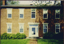
Saturday morning, Charlie Moore, who is the Chair of the Kentucky Democratic Party has called for a meeting of the Kentucky Democratic Party State Central Executive Committee, the only known purpose of which is to confirm as Vice Chair the County Judge/Executive of Bath County, former State Representative Carolyn Belcher. I wholeheartedly support Judge Belcher's appointment as Vice Chair.

As to our new Chair, who has been in office for just over a month, he is working on a plan to involve young folks from throughout the state, bringing them to Frankfort for a weekend of education and entertainment. It is a great program that looks ahead to our Party's vitality. I am very hopeful for its success, and I am very thankful for his leadership and initiative on this matter.
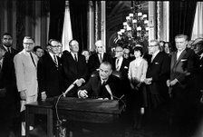
So those are the two events on the horizon. The Metro Club's meeting on Wednesday night is open to everyone. Any registered Democrat in Kentucky is considered a member of the Kentucky Democratic Party and by their registration is inferred an invitation to Saturday's KDP SCEC meeting.

Have a good week.

Happy Easter.

*****

www.ashleycecil.com/
www.forecastlefest.com/

The Archives at Milepost 606

Personal

Louisville, Kentucky, United States
Never married, liberal Democrat, born in 1960, opinionated but generally pleasant, member of the Episcopal Church. Graduate of Prestonia Elementary, Durrett High, and Spalding University; the first two now-closed Jefferson County Public Schools, the latter a very small liberal arts college in downtown Louisville affiliated with the Roman Catholic Sisters of Charity of Nazareth. My vocation and avocation is politics. My favorite pastime is driving the backroads of Kentucky and southern Indiana, visiting small towns, political hangouts, courthouses, churches, and cemeteries. You are welcome to ride with me sometime.