452 - 9617
452-9617 was my uncle's phone number when I was a kid. Back then, you could look at the first two digits of a phone number and be able to generalize as to where in Louisville that person (or business) was located. The numbers beginning with 45- were generally somewhere between Preston Highway and Taylorsville Road, from Broadway out to about the Watterson, except over in Buechel those numbers went all the way out to where Fern Creek (the creek named Fern, not the town named for the creek) crosses under Bardstown Road. I grew up with a 96- number. That area was out Preston Highway, Poplar Level Road, and what was then called Old Shepherdsville Road, but now is known as simply Shepherdsville Road. To the east of this area, starting around Vaughn Mill Road and extending east to Seatonville Road, and south of the aforementioned creek named Fern were the 23- numbers. To the west of the 96- area was a large swath covered by the 36- numbers. It started just south of Eastern Parkway and ran from Preston Highway over to 7th Street Road, and out to Fairdale and the county line. West of that area, all the way out Dixie, from south of Rockford Lane were the 93- numbers. North from there from 7th Street Road, south of Berry, and west over to the Ohio River, were 44- numbers. The west side of downtown Louisville had 77- numbers, while downtown was restricted to 58- numbers. Starting south of Oak Street, from 9th over to Preston and out to Churchill Downs were 63- numbers. The upper east side, from the other side (meaning the east side) of Cave Hill and out Lexington Road, Frankfort Avenue, Brownsboro Road, and Shelbyville Road to the Watterson were 89- numbers. On the northeast side of the county were 22- numbers, fitting in with the 22- numbers in Oldham County. Generally those in Jefferson were 228, while those in Oldham were 222. From Brownsboro Road around to about I-64 and out to the Snyder Freeway were 42- numbers. Beyond that, along the eastern edge of the county were 24- numbers. And finishing up the county, on the southeast side, south of Middletown and east of Fern Creek (the community, not the creek), were 26- numbers. Here and there were a few anomalies, but not many. For instance, way out Dixie were the 922 and 942 numbers, serving West Point (in Hardin County) which was a local call and Fort Knox (in Hardin, Meade, and Bullitt) which wasn't. All along the Bullitt County line, the 95- numbers creeped across the line here and there as did the 47- numbers from Spencer County. On the east and northern sides, the system worked the other way with the 24- and 22- numbers lapping, respectively, over into Shelby and Oldham counties. At that time, calling across the river involved adding the prefix 50- to the number. To call my aunt in Clarksville, one would dial 50- then the number. This was true for all the numbers over there in New Albany, Georgetown, Galena, Clarksville, Sellersburg, Jeffersonville, and Charlestown. However, parts of Clark County, north of Sellersburg (such as Borden and New Washington) were then and still are long distance. Even so, we had an extensive local calling area, with all of Jefferson and Oldham being able to call all of those two counties, plus much of Floyd and Clark across the river, and quite a bit of northern Bullitt County, which had three or four different phone systems. The folks in the northern part of the county were on the Echo Telephone Company, later Pioneer, and finally BellSouth, which is known this year as AT&T. That part of the county, now known as Hillview, was previously defined by two communities, the more rural Zoneton and the subdivisions off Preston originally called Maryville. If nothing else, they had a great local calling area, encompassing all of Jefferson and Oldham in Kentucky, part of Floyd and Clark in Indiana, but interestingly, not all of Bullitt, their home county. For many years, and it may still be the case, Shepherdsville, Zoneton, Mount Washington, Lebanon Junction, and the western environs of the county within the Fort Knox reservation, had differing phone services. East and west, the divide was along Floyds Fork on the east of Shepherdsville, and Blue Lick Creek on the west. North and south, the line was less defined, but somewhere south of KY245 on the south side of Shepherdsville, and along Bells Mill Road on the north side. Fort Knox had its own system. I do not know if all this is still the case.
Now, we have caller ID. It tells us the number and usually the name. But it doesn't tell us from where they are calling. No longer can we automatically judge a caller by their phone number. That's might be a good thing. Maybe.
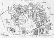
The next time you are downtown at the Main Library, pull out an old telephone directory from the 1960s or 1970s. The are on the second floor, to the right when you exit the elevators. In the center was the map telling you where it was people were calling from - a kind of old-fashioned precursor to Caller ID.









1 comment:
WOW. What a ride down memory lane. I grew up in Fern Creek and graduated from FCHS in 1974. I vaguely remember not only the 239 prefix, which did identify you as being from Fern Creek, but hearing about the CE9 prefix from my parents. Those were good times. Bardstown Road was a multi-lane road up to just past the Fern Creek Meat Market,from there it was two lanes all the way to Mt. Washington. You could go to the Apple House that was run by the Fegenbush family across from Resthaven Cemetery and get fresh produce; sometimes Mr. Fegenbush would reach into the baskets and hand you an apple for free. There was only one Fern Creek firehouse (right across from the school) and depending on who your parents where just about everyone knew who you or at least knew of your parents. Fern Creek's main rival in sports was Seneca High School. We attended church in Buechel, and if you didn't take the ByPass but went down Old Bardstown Road was a thriving area what with all the stores. These days, home is in an area close to Brighton Michigan.
Boy, times have sure changed. The last time I visited family in Fern Creek I almost felt like I needed a map to find home and family.
Post a Comment