762. A little road trip - and an excuse to post
Thanks to my friend Keenan Wilson, I made a short road trip out into the heartland of the Commonwealth today. Keenan, from Radcliff in Hardin County, today joins the ranks of college graduates turned over from their in loco parentis overseers to face the world.
For Keenan, the overseeing college was Saint Catherine College, a Dominican based school just outside of Springfield, Kentucky at the dead end of the old US 150, a couple of miles west of downtown and about 58 miles southeast of Louisville.
For his persistence in getting an education, Keenan was today awarded a Bachelor of Arts degree during the 81st Commencement Ceremonies at the school, which was initially founded in 1823. Congrats to Keenan.
I had made him the promise of attending the ceremonies thus giving me an excuse to pursue a favorite hobby, driving the old roads and highways of Kentucky. This trip covered very little in the way of a new route, although one of the main routes along the way has been rerouted on some new land, this being US150 beginning right at the college's property west of town.
The new US150 winds around the north side of Springfield and a new roundabout was built at the college's formal entrance, connecting the new road with the old road and the college. The ceremony began with College President William D. Huston explaining the delay in beginning the commencement was due to an accident involving a semi-trailer in the roundabout, something he said was getting to be all to common.
I can only think of a few roundabouts in Louisville. The most famous one encircles Enid Yandell's statue of Daniel Boone at the entrance to Cherokee Park, at Eastern Parkway and Cherokee Road. As an historical note, I would add that location is neither the original entrance to the park nor the original location of the statue. There is another roundabout in my friend Preston's subdivision in far northeastern Jefferson County, where Hunting Creek Drive begins on one side of the circle and splits into Westover Drive going east and Deep Creek Drive going south. There is a "sort-of" extended roundabout in front of the Louisville Zoo along Trevilian Way, a signature project of the current councilman representing that area, Jim King. Another roundabout has been planned for many years in "downtown" Fairdale, connecting Fairdale Road, Mitchell Hill Road, West Manslick Road, and Mount Holly Road. I am sure there are others here and there.
So, my purpose today was to get from here along the Left Bank of the Ohio River near Milepost 606 to there, at the new roundabout on the old US150, just west of Springfield. The road travelled today is one often travelled; the most direct route from here to there - essentially out I-65 to the Clermont exit (also known as the Bernheim Forest exit, and gaining popularity as the Jim Beam exit) which is KY245. KY245 runs along a northwest-southeast corridor from KY61 (Preston Highway) on the west to and through the northside of Bardstown where it serves as a by-pass of sorts, ending at US150, the Springfield Road, on the southeast side of Bardstown. At one time this road ended at N. Third Street in Bardstown, the road to Louisville, but it was pushed through about twenty years ago.
From the southeast side of Bardstown, the road to St. Catherine used to be a straight shot since the college is located on what was the main road into Springfield. Recently, however, US150 has been routed around the north and east sides of Springfield along a new mostly two-lane concrete highway with wide emergency lanes and even wide shoulders. I followed the new road as far as KY55, or Bloomfield Road, which I took into town and angled back to the west to the college, making my first encounter with the new roundabout from the east, and entering the college proper.
Although this entry is about the roadtrip, it would be disrespectful at this point not to acknowledge (again) the graduation of my friend Keenan. For the school, this was a day of firsts. In addition to their Baccalaureate program, this past year they introduced a "Commander College" program for Washington County high school students and the first of this class also participated in today's program. Another new group of students included those receiving Master's Degrees, the first year of completion for this program as well. But, I digress.
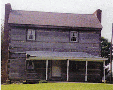
Upon leaving the ceremony, as is my wont, I travelled a different path getting back to the Derby City. Returning (almost) to town, I took a right onto KY55 and proceeded south on a road officially known as the Western By-Pass, but usually just called the By-Pass. Further south the old road joins from town and it is known as Lebanon Hill Road - the road into Lebanon. Once in Lebanon, KY55 is known as N. Spalding Avenue for a distance and along this distance is the historic antebellum home Myrtledene, built in 1833, at the southwest corner of Saint Rose Road and N. Spalding Avenue. The home is operated as a Bed and Breakfast by the innkeeper, James Spragens, and is somehow, I'm not clear how, affiliated with the family of a young Republican banker friend of mine, Sean Holleran, formerly of this town but now residing in Evansville.
I followed KY55 into town on N. Spalding and out of town on W. Main Street, where it joins US68 and heads southwest towards Campbellsville. Not too far along the way, I turned right on KY426 and headed west. This was the southernmost point of today's journey so far. I followed KY426 west to its intersection with KY84, which would be my main road west to begin the northward trip home.
KY84 is a long sometimes meandering and sometimes straightway road, running through Raywick and Howardstown and around the hills of Cecil Ridge, then crossing the Rolling Fork (of Salt River), which was running high itself due to the recent rains. KY84 eventually joins US31E between Bardstown and Hodgenville at a wide place in the road known as White City. US31E/KY84 follows Main Street into town and around Lincoln Square - another roundabout - and follow south out of town along Lincoln Boulevard. At Tanner Road, KY84 breaks off to the west and shortly thereafter becomes Sonora Road, the road which will take us to I-65 and the return trip northward. There's about nine miles between this turn-off and Sonora but our travels only takes us about 8 1/2 miles to the intersection with I-65 North, about equally south as the corner of KY55 and KY426, and the return trip through or around Elizabethtown, Colesburg, Lebanon Junction, Shepherdsville, Brooks, and Okolona, to Louisville.
A very pleasant ride in the heartland of the Commonwealth.

