83. The Short Square Route
Spring seems to have finally sprung today. The temperature has climbed into the low 50s after some cold winds, heavy rains, and more than a few hailstones in the last week. They say it is snowing bigtime in New England, a late and rare 'noreaster that has made its way across the country, leaving a lot of snow and considerable damage in its path.
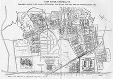
Today also marks the birthday of my friend Anthony Chandler, a Roman Catholic priest of the Archdiocese of Louisville. I haven't seen Fr. Chandler in the last few years. He was pastor of my church in the 1990s when we undertook to build our new building, a monstrous cathedral of a place set along Poplar Level Road in the Camp Taylor neighborhood. Starting today, and for the next five months and a week, Father and I are the same age. Alas, come September, I will age another year. I suppose it is always good to have a birthday. Those who don't have birthdays - well they don't have birthdays. That isn't good. I always remember a line spoken to me at the visitation of Jim Reddington's father. Jim, who has since died himself, was a big burly guy, a rough and tumble politician. People were remarking that his father "was better off where he is now." Jim's response was, "Well, everytime he went on a vacation, I got a postcard saying, 'Having a wonderful time, wish you were here.' " Jim said he hadn't yet received one of those, so he wasn't sure if the old man was better off or not. Not the most respectful comment said over the body of your deceased father, but also not out of character for Jim Reddington. Jim himself is buried in Calvary Cemetery, where my uncle Don is also interred, and where someday my father will be laid to rest.
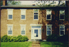
On a brighter note, as the weather improves, I will once again be taking to the roadways to visit old haunts and find some new ones. I had planned to do some politically related travelling this weekend (to Elizabethtown and Madisonville) but didn't. As a consolation, I made one of my "short" tours last night, a square-like route I've made many times mostly as a form of relaxation. The trips heads out of Louisville west on I-64 to Corydon, a quaint little burg about 20 miles away in that direction. Corydon was home to the late Governor of Indiana, Frank O' Bannon, who operated the town newspaper before his entry into politics. After his death, a nearby state park, Wyandotte Woods, was renamed in his memory. It is home to the first capital of Indiana, a structure still standing along the main north-south street in the town, appropriately called Capital Avenue, and numbered in Indiana's highway system as State Road 337. For one block, between Walnut and Chestnut streets, Capital Avenue also carries the designation of State Road 62, a meandering highway which runs along the southern border of Indiana, from Dillsboro in the east to the Wabash River west of Evansville, where it crosses over into Illinois. SR 62 in the Louisville area now runs along I-265 between E. Tenth Street in Jeffersonville west to I-64 in Floyds Knobs. At one time the eastbound route proceded down the hill along I-64 from Edwardsville into New Albany, where the sign for Exit #123 still reads "East _____" with the blank representing where the old "62" sign used to be. But, I digress.
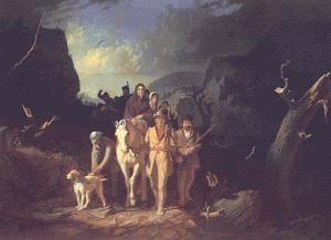
After reaching Corydon on my short square-shaped drive, I head south along IN 135, a very well built and wide highway connecting Corydon toward the south with KY 79, a highway previously discussed several entries back which ends in the southern (in more ways than one) Kentucky town of Russellville. Along IN 135, one passes the Squire Boone Caverns, which are about three miles east off of the highway. Boone is the brother of Daniel Boone. Upon his death in 1815, Squire Boone was buried in the cave, on land where he made his final home. Rumors persist that Boone's remains were at a later date removed from the cave and reburied on the farm of his youngest son, Enoch Boone, which was located on property that is now a part of the Fort Knox Military Reservation in Kentucky.
South of here, the road rides down toward Mauckport, a very small hamlet along the northern bank of the Ohio River. You have to depart IN 135 and go down the hill along IN 11 to get to Mauckport, which at one time was a thriving riverport, but today is probably home to no more than 75 people at the most. The bridge crossing from Mauckport, Indiana in Harrison County into Brandenburg, Kentucky in Meade County, where IN 135 becomes KY 79, is named for Matthew E. Welch, a governor of Indiana who served in the 1960s. Entering Kentucky, one is already at a considerable altitude above the river below. At the top of the hill, the highway intersects KY 228, although the intersection is not lit at all and is very poorly marked. To the left, 228 leads into Brandenburg. To the right, 228 follows the bends of the Ohio River to the community of Battletown and further to an area known as Big Bend. I have relations on my father's mother's mother's side (the Antle and Prince families) who have kinfolk buried in the Mount Hope Cemetery along Big Bend Road. A little known piece of trivia concerns this extended shoreline of the Ohio River, which serves as the northern border of the entire county. At fifty-six miles, Meade County has more river shoreline than any other county in the Commonwealth.
As I said above, the city of Brandenburg is located to the east of KY 79 along KY 228. One of the most breathtaking views of the Ohio river is along this route, called Lawrence Street at this point. The town itself once had its business district along Main Street, which ends at the river, literally going several feet out into the water. It is the only "Main Street" in the state which ends in the river. Main Street itself, along with the Court House and most of the business district, was wiped out in the April 3, 1974 tornadoes, which hit many cities in the south including Louisville. But tiny Brandenburg was hardest hit, losing 31 lives in the storm. May their souls Rest In Peace.
Leaving Brandenburg, one heads east along KY 1638, the road to Muldraugh. Along the way, the Doe Run Inn, an old historic roadhouse and restaurant is a few miles to the south. A few miles to the north is the 2000 plus acre Otter Creek Park, a property owned by the Louisville-Jefferson County Metro Parks Department. Muldraugh itself is a long narrow town just outside of Fort Knox on Dixie Highway, numbered as US 31W-US 60. Going north down the hill from Muldraugh to West Point, one enters into Hardin County. West Point is an old river town. Up on the hill to the east of West Point is the earthworks of the old Fort Duffield, a lookout point during the Civil War, constructed by Union forces to protect Louisville, about 25 miles north of here. Hardin County and Jefferson County are divided by the Salt River, which empties into the Ohio at this point. There is a sign as one crosses the river proclaiming "Welcome to Louisville-Jefferson County Metro, 16th largest city on America." The next sign one sees in a mileage sign, saying "Louisville, 27." There is something wrong with this picture.
The trip back home is mostly non-descript. Dixie Highway, of course, will take you all the way to Broadway, should you choose that route. I usually depart it and travel the Snyder Freeway back to I-65, and I-65 back to the real Louisville, not the imaginary Louisville-Jefferson County Metro one enters upon crossing the Salt River at West Point.








No comments:
Post a Comment