32. A short few lines on Jefferson County's old roads
We had a luncheon today in our office for one of the attorneys who is leaving to go practice elsewhere. Out of the window from the restaurant, one has a view of the Belvedere Plaza, where the faux-waterfall will cascade with water once the seasons change and where, at one time, during the winter you could rent a set of skates and iceskate on the artificial lake which now serves as a faux-picnic ground. Louisville's Riverfront/Belvedere Plaza has undergone several changes since first proposed and built in the late 1960s. Hotel developer Al Schneider built the first hotel there in 1970 and later added another one to the east. Dinwiddie Lampton established his insurance building next door in the "Rust" building, a popular concept in the 1970s. There is also a bridge across I-64 in Seneca Park of the same material - rusted steel. Schneider later built four different office buildings achoring the corners of Fourth and Main streets, but tearing down the old Columbia Building on the northwest corner to do so, a building former Mayor Frank Burke described to me as one of the prettiest buildings in downtown Louisville.
As a little kid, I can very vaguely remember the old Kingfish Restaurant, when it was actually located on the Wharf at Fourth Street and River Road, where the cobblestones made their way down into the waters of the Ohio River, on the Left Bank, right at Milepost 606. There was another Kingfish Restaurant way out River Road, I think near where the Caperton Swamp is located. Both are now gone, each replaced by a newer restaurant, the 4th Street one moved two blocks west to 6th Street, and the River Road site closer in and on the other side of the street. The 6th Street site itself was vacated a few years back, and that location is the current home of the new Muhammad Ali Museum.
I can remember the old Harshfield Produce company under the Second Street bridge on the east side, as well as the row of old taverns and nightclubs that used to line Washington Street as part of Louisville's seedier side when I was a teenager and not yet old enough to drive. There were times I would ride my bike all the way downtown on the then-closed Fourth Street, rechristened the Fourth Street Mall. The blocks from Ali Boulevard south to Broadway were especially wicked, housing wig shops and porn shops among the mostly boarded-up buildings. At the time, both the Seelbach and the Brown were closed, although the Brown served for a period as offices for the old Louisville Board of Education, and after the city-county school merger in 1975, the Jefferson County Board of Education. My junior class prom was held in the Crystal Ball Room of the "Brown Education Center," the then-name of the Brown Hotel. In 1984, both hotels were restored and re-opened. Of the old stores from the 1970s, the wig shops are still there. Louisville's porn industry, formerly there and in the so-called porno-district at 3rd and Jefferson streets were all cleaned up and moved out in the 1980s. The Metro government still spends a great deal of time in court over the First Amendment Right issues of businesses of the that ilk.
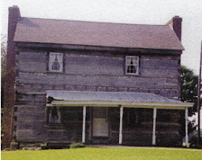
Over time the Fourth Street Mall was renamed the River City Mall, then back to the Fourth Street Mall, then Fourth Avenue, and finally, back to its roots as Fourth Street, a name found on one of Louisville's earliest maps, when the city extended from the river south to Liberty (which was really the alley south of Jefferson, and later called Green Street, before becoming Liberty), and from Preston's landing (around Wenzel Street) west to 9th Street. There was a road which led to Portland to the west. Fifth Street led out of town, bending ever so slightly, just south of Kentucky Street, a bend which remains in the road grid to this day. River Road led upriver toward Prospect, the Brownsboro Road toward Brownsboro and Ballardsville (US42 outside of the Watterson came much later), the Midland Trail led to points east and is still called that in both Shelbyville and Lexington, Baxter Avenue led out towards Bardstown (the road called Baxter south of Highland Avenue was called Von Borries Avenue and ended just north of what is now Tyler Park), 5th went out to around Crittenden Drive, where it was called Flat Lick Road and joined the Wilderness Road leading out of Portland along 26th Street, joining the path to Shepherdsville near what is now Preston Highway and Locust Lane. For many years a brick toll house, recently painted white, stood on this corner, torn down only a few years ago to make way for a US Bank branch. The Louisville and Nashville Railroad eventually became the main north-south route out of town and the old National Turnpike ran along beside it from Louisville out to Gap-in-Knob, just north of Shepherdsville. All other roads headed southwest and joined the Salt River Turnpike, also known as the old L & N Turnpike, and now known as Dixie Highway.
Those are the early roads of Jefferson County. They all still run more-or-less along the same routes first establish many years ago. Chances are they will for many years to come.








No comments:
Post a Comment