87. Crossing (the) Kentucky in 551.3 miles
Although none of it was really planned, several of the last few entries have been seemingly tied together, the string connecting them being US 460. Maybe it is because my internet friend Nick Stump has prompted my attention toward the Appalachians, or it may be another friend, Barry Norris, who several years ago picked up roots from his Highlands home and relocated to Lee County - for whatever reason, I had been pining to do an eastern Kentucky loop and this weekend was the weekend to do it.
As promised, my destination was Pikeville, home of the Hillbilly Days festival where I would see some friends and walk the parade route, and for that reason, almost as an afterthought, I took along one of my "Jeff Noble, Democrat for Council" tee-shirts, left over from the unsuccesful run in 2002. As it turned out, taking the tee along was a moment of serendipity [serendipity is a word I learned from Ken Herndon - it kinda means unplanned but useful timing]. The only reason I have the shirts was that Ken was running someone else's campaign in 2002 and due to a mistake, he had a credit coming to him from a screenprinter, and chose the tee-shirts as his contribution to my campaign. But, I digress.
I did go to Pikeville to the festival, but it turned out only to be a stop along the way. My trek began very early Saturday morning, as I had to be in West Liberty by 9:00 am, and that is a three hour drive. As I entered the on-bound ramp to eastbound I-64, I punched the trip odometer down to zero. I went to visit a friend, who is also a cousin to my youngest four nieces and nephews, who is, well, living (so to speak) in West Liberty. I had not seen him in two years, and given the circumstances, he was in good spirits and looked well for the wear. Euphemistically, his present residence is a State-operated Bed and Three Squares operation and he is scheduled to be there for the foreseeable future. We talked about books and writers - Machiavelli and Shakespeare among them. To say the least, I was pleasantly intrigued and impressed by the conversation. My friend is a 22 year old middle school dropout. His reading list rivals that of many much-better educated friends, and his knowledge of what he has read is well retained. While I left feeling sorry for his state, it is one of his own doing. And, as I said, he seemed well, both physically and mentally, and that is a good thing.
I left West Liberty where the main street, called Main Street, is numbered as US 460. US 460 takes you from there to Salyersville in Magoffin County. In Magoffin, it is called Maple Street for a few blocks and Church Street for a few more. Beyond Salyersville, I joined KY 114, known as either the Mountain Parkway or the Mountain Parkway Extension. By the way, Magoffin County was named for Kentucky's governor at the outbreak of the Civil War. Beriah Magoffin is said in some histories to have tried to keep Kentucky neutral while in others he was said to have Southern sympathies. When the General Assembly chose to remain in the Union, but officially remain neutral in the war (how does one do that?), Magoffin made off to Russellville, mentioned a few entries ago as "southern" in more ways than one. It was in Russellville that Magoffin presided over the Confederate Convention for Kentucky, which in fact set up an extra-constitutional government for Kentucky as part of the Confederate States of America. But Kentucky never seceded. And I'm off topic.
KY 114 takes you around the southwest bottom of Prestonsburg, home of one of the current candidates for Lieutenant Governor, Greg Stumbo, who is also the current Attorney General of the Commonwealth. At this point, a right turn returns me to US 460 (again) along with US 23, better known as Kentucky's Country Music Highway, which proceeds as a divided four-lane highway towards our destination, Pikeville.
Along the way KY 80 joins the road from the west side, and further yet, US 119 joins from the east side. As one enters Pikeville, all four numbers are "multiplexed" on the road. The main street, a former railroad bed, is called Hambley Boulevard, a new circular road which circumnavigates parallel to the old Big Sandy riverbed, before it was re-routed in a geo-engineering extavanganza several years back, the second largest earth moving project in this hemisphere; the Panama Canal ranks first. The so-called "Cut-Through" project was the brain-child of the late Dr. William Hambley, former mayor of Pikeville, for whom the new main street along the old railroad bed was named. The project was first conceived in the 1960s and started in earnest in 1973. Finally costing about $60,000,000.00, it was dedicated on October 2, 1987. There are lots of things in Pikeville named for Mayor Hambley who served in that capacity for 29 years. He died in 1996.
The purpose of the trip was to politic, see friends, and walk in the parade. I did all that, donning my "Noble for Council" tee-shirt for everyone to see. I chatted with Bruce Lunsford, running for governor with the aforementioned Greg Stumbo, as well as their campaign manager Dale Emmons. I also saw Todd Hollenbach, who is a candidate for State Treasurer. I introduced myself to David Neville of Pleasureville, who is a candidate for Agriculture Commissioner. We are probably kin of some sort, as he knows a number of my family members, most prominently my cousin Rick Sharp, and others who live along the sideroads in eastern Shelby and western Franklin counties.
The parade began near the City Park, where there has been erected an historical marker denoting the place where James Garfield, later to be president, was made a brigadier general for his services. A few entries back, we discussed his monument in front of the United States Capital. And then here he was in Pikeville.
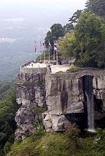
After the parade, I left town and travelled south along the same four-numbered highway. Eventually US 460 and KY 80 left off to the east, going over to the Breaks Interstate Park, and eventually to Blacksburg, Virginia. Thus, leaving only US 23/119 to make the climb toward the ridge that separates Kentucky from Virginia I dorve on. One mile before the crossing, at Pound Gap, US 119 goes off to the southwest and this is the route I needed to take, but I had not ever been to Pound Gap although I have known about it all my life. Pound Gap, where US 23 crosses from Letcher County, Kentucky into Wise County, Virigina, has played a role in Kentucky's history from long before Daniel Boone made his way into the state. It is known that Christopher Gist came through here around 1751. Gist served as a guide for George Washington and later for Daniel Boone. His name is associated with the early exploration of most of Kentucky, including here along the Left Bank of the Ohio River at Milepost 606. In 1861 and 1862, there were civil war battles here (and in other places in Letcher and Pike counties) with James Garfield leading the Union forces and Humphrey Marshall leading the Confederacy. Marshall was the grandson of a Kentucky Secretary of State and United States Senator by the same name. This Marshall served as a Congressman from Kentucky in both the Union and Confederate governments, although not at the same times. A memorial on the Virginia side marks the site, and both states have erected historical markers telling the stories of Garfield and Marshall at Pound Gap, which sits some 2500 feet above sea level. It is an impressive drive and an impressive dirve. To celebrate, I stopped at the gas station at the top, where there is a broad view toward the southeast where you can literally, like Pete Townshend wrote for The Who, "see for miles and miles and miles and miles."
After the view, I turned around and headed back down US 23 to the turn of of US 119 and headed southwest to Whitesburg, the county seat of Letcher County. Many years ago, I was known to have said that the Letcher County Court House was the ugliest in the Commonwealth, with its alternating blue and white panels. That is no longer the case, as the building has been updated and the blue/white panel combination is no more, replaced with a nice brick veneer. In Whitesburg, our path left US 119, which follows along the southeastern border of Kentucky on down to the Cumberland Gap. Instead, I went north on KY 15, which is an excellent four-lane highway, one of the best in the state, and headed for Hazard, the county seat of Perry County, where the Fiscal Court is presided over by Denny Ray Noble, who is not known to be a relative of mine. The family name Noble is one of the more prominent ones in this part of the state, even moreso over in Breathitt County. I'd like to say that I took a look at the new Perry County Judicial Center, which I know from having read it is next door to the old Court House, but, alas, I got sort of lost and never did see the Court House, although I did venture around the city quite a bit, trying to find my way to either KY 80 or KY 15 or the Hal Rogers Parkway, all of which are prominent streets in Hazard and none of which were making themselves present.
I did eventually find KY 15 and headed northwest to Breathitt County and its county seat of Jackson. Again, Noble is one of the more prominent names here, and as I entered the county, coming down the hill in the first mile, I spied a semi-trailer with the name "Noble" emblazoned across it. As I got closer, not only did it say "Noble" - it said "Jeff Noble, Democrat for Magistrate." Pulling off the four lane KY 15 at the house, I saw it was attached to a garage called "Jeff's Body Shop." An older woman came out and we introduced ourselves, she as Mrs. Glenn Noble and mother of Jeff Noble (who had won his race), and me as Jeff Noble (who did not win mine). The other Jeff Noble was down in Tennessee at a fishing tournament so I missed him. She and I spoke for a few minutes and before departing, I changed shirts and gave her my "Jeff Noble, Democrat for Council" shirt as a memento - a serendipitous moment.
I followed KY 15 into Jackson and then out of there I turned briefly on KY 30 which goes to Booneville but then very shortly thereafter I saw the KY 52 sign, and after a half-second of thought, took it. Here's why. A search. I knew that KY 52 was the road into Ravenna and Irvine, at this point still two counties away. Many years ago, I was on one of these trips and I saw two churches, small white frame buildings, side-by-side and identical, alongside a railroad and a creek. For whatever reason that day, I did not investigate to see why two identical churches would be built as next door neighbors and I've always regreeted that. It was a curious sight. In my mind, these churches were in Ravenna, but I've never been sure of that and until this trip had never been back in that area to see. So, for that reason alone, off of KY 30 and onto KY 52 I turned. This road runs along a railroad track and crosses over different forks of the Kentucky River as it proceeds westward into Lee County (where Barry Norris moved) and Beattyville. Along this route I passed through what is marked on maps as Airedale but which the locals call Saint Helen's from the church (or formerly, churches as the Presbyterian one recently burned leaving only the Christian Church) nearby. Several entries ago, talking about post offices and how some get their names, we blogged about this Saint Helen's, the not-so-wide place in the road along side the Middle Fork of the Kentucky River, which caused Shively in Jefferson County to be called Shively and not Saint Helen's, the name everyone originally knew it by.
I continued on the winding and narrow KY 52 leaving Beattyville and Lee County, crossing over a ridge, where the bright afternoon sun made for a beautiful picture against the valley, as the road straightens out and settles down along side the old L & N Railroad yard and the Kentucky River. I searched and searched for the two little churches but to no avail. Ravenna turns into Irvine without much notice, and Irvine itself, the county seat of Estill County, is a town with wide streets set into the right side of the road, while the railroad yard and the river constitute the left side. At the main intersection, I turned left (across the Kentucky River) as KY 52 heads to Richmond in Madison County.
At this point, KY 52 becomes a four lane highway and eventually joins the US 25/421 By-Pass around Richmond to the east and north, along the way passing through the town of Waco, which is off to the right. I looked over at Waco to see if there were two identical churches side-by-side, still unsuccessfully pursuing the missing location. It occurred to me at that point that the KY 52 I was driving on was not the one I drove on the last time I was in the area. Sooner or later, I need to go back through there and find those churches. Not knowing their circumstances has bothered me for years.
Finally, this current road takes you to I-75, where going north gets you to Lexington and I-64, and thus west to the point of beginning. Upon my departure from I-64 at the Mellwood Avenue exit, the trip odometer read 551.3. It was a good trip.


2 comments:
Nice piece. I've lived in Leeco, Beattyville, Jackson, Hindman, Whitesburg, West Liberty and Booneville., This piece was a nice trip back home.
No news since Sunday? What is going on?
Post a Comment