473. In Lieu of Thunder
Knowing the streets and alleys would be packed with people in various states of clear-mindedness for Thunder over Louisville, I took to the streets - or really the highways and backroads - yesterday to get away from it all. I had promised a dear friend of mine who is, unfortunately but deservedly, incarcerated in a State Prison in West Liberty that I would visit. I hadn't been to see him for two years - actually two years ago on Thunder Day. Is that an acceptable set of words, Thunder Day, like we say Oaks Day and Derby Day? Along the way I was hoping to see my friend Tony, who lives in Mount Sterling. I thought I might also look up the new Vice Chair of the Kentucky Democratic Party since I had planned my route through her town.  Thus it was I headed out to the east along I-64, crossing over the Floyds Fork of Salt River in Jefferson County and Guist and Benson creeks in Shelby County. Benson Creek was at one time one of the southern borders of Jefferson County, Virginia. Crossing into Franklin County I made the great descent and ascent over the Kentucky River, another original border of Jefferson County, Virginia, separating it from Fayette County, Virginia. (See the map above for the original division of Kentucky County, Virginia into the three original counties of Jefferson, Fayette, and Lincoln. The far west of the state came in 1811 by a purchase from Native Americans of what has come to be known as the Jackson Purcahse, after Andrew Jackson). Next came Woodford, Scott, and Fayette, with their crossings of South Elkhorn Creek and Cane Run. I continued on I-64 into Clark County, exitting onto the By-Pass (KY1958) to get over to the McDonald's on the west side of town on US60 for a refill of coffee.
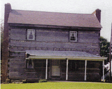
From this point until my return, I stayed off the Interstate system and on a number of less travelled backroads. I coursed through downtown Winchester, a old western looking town, where US 60 makes a right angle off of Lexington Avenue and onto Main Street and then to the northeast toward Mount Sterling in Montgomery County. My first stop was in Mount Sterling to meet a friend, one I haven't seen since one night in Lexington several years ago. Mount Sterling's big festival is the Court Days which is in October, something everyone should make at least once. I always like to drive once around the Courthouse, which is on an offset square completely done in cobblestones. Little has changed around the Montgomery County Court House.
Truthfully I also tend to get confused in Mount Sterling because of US60 and US460. In Frankfort, US460 heads due east out of town while US60 runs to the south out past the KDP HQ and into Woodford County. The opposite is true in Mount Sterling, where again the two routes intersect, with US460 heading due south along Bank Street while US60, the route I wanted, goes off to the east, generally running alongside the CSX RR, at least the first few miles. This road is called Owingsville Road, after the county seat of the next county, which is Bath. My second stop was in Bath County, but I did not find the person I was seeking. Other than driving through Bath County along I-64, it has been a while since I've been in the county seat, which is a very pretty little town, with the Courthouse set off on the south side of the downtown square. Like Winchester, but on a much smaller scale, US 60 wraps around the town to the north then east before heading out into the countryside. The view just beyond town, especially to the south, is breathtaking. It looks like the Green Hills of Ireland, with babbling brooks here and there and roads gently cutting through dells and ridges. It is the Ore Mines area of the Daniel Boone National Forest.  At Salt Lick, named for the creek which flows through town, I turned off US60 and onto KY211, which zigzags through this once thriving railroad community, complete with a set of old building straight out of a Hollywood set. The pic on the left is the left side of the street. The old buildings, unfortunately, are on the right. The land is very level except for the railroad crossing, and like other places in Bath County, the water seems to rise up out of the ground at a number of different places forming quick-flowing brooks, which just as mysteriously disappear a few hundred yards later. Off to the east side of this road are the foothills of Kentucky's mountains, set atop of which is Cave Run Lake, someplace I've not been fishing since 1983. KY211 winds down past the turnoff road to the Pioneer Weapons Wildlife Management Area, where hunting with modern day firearms is prohibited. Instead, hunters are required to use old flintlock or percussion cap rifles, or cross bows of some configuration. The area extends all the way over to the lake along what is known as the Zilpo Scenic Byway. Like Bernheim Forest, there is a Fire Tower which draws tourists - the Tater Knob Fire Tower which is very nearly in the center of the area. But, I didn't go there.
Instead, I continued south of KY211 following along side Salt Lick Creek to the highway's intersection with KY36 and turned south toward Frenchburg and Menifee County. Frenchburg is a tiny little place set at the fork of Beaver Creek with Blythe's Branch. As I continued south, now on US460, and the town, all four square blocks of it, is off to the west, I missed most of it. Arguably by driving through the intersection, I crossed over 1/4 of the town.
US460 from here carries you into Morgan County, home to a branch of Morehead State University as well as the Eastern Kentucky Correctional Institute. Passing through the communities of Denniston, Wellington, and Ezel, the bottomland widens into a broader plain and the highway responds by getting considerably wider. Still there are hills bwtween Ezel and West Liberty including one named Index on top of which is the collection of pink buildings which comprise the prison.
My friend and I visited for about an hour and a half. He has had only two other visitors during his time there. Visiting prisoners is one of those things Jesus Christ tells us to do from time-to-time although a lot of modern-day Christians tend to avoid this directive. Many of them seem to have their own version of Christianity. I'm reminded of a bumper sticker I saw the other day on a car. It read, "Telephone! It's Jesus calling. He wants His religion back." I like the message of the sticker. But, I digress.
Leaving the prison site I headed into downtown West Liberty, home to a former boss of mine, Evan Perkins, an attorney, as well as Jacob Payne, the writer of the PageOneKentucky blog. Both left years ago. US460 goes north then east to get out of town and eventually follows the course of the Licking River for a few miles. I followed as far south as KY1000, turning right where the Licking River divides to a Left and Right Fork. KY1000 is a meandering and narrow country lane following the Right Fork to its own fork between Caney and Brushy creeks. At KY191, I turned left, meaning south, at the town of Caney. Between Caney and Cannel City, both small villages about 1.5 miles apart, the territory seemed a little rough, although that may just be my urbanity speaking more loudly than necessary. I did check to see if my cell phone had service. Thoughts of the movie Deliverance came to mind. KY191 follows back around various forks of the Red River, arriving at the little town of Helechewa, where there is a makeshift intersection with the Bert T. Combs Mountain Parkway. I jumped on the parkway, headed generally west for a few miles, exitting back down on KY191 to follow that road into Campton, the county seat of Wolfe County.
Campton is another tiny little town, altough not nearly as small as Frenchburg. And Campton has too many roads called KY15 or Old KY15. Kind of like the Manslick Roads in Jefferson County, Campton has three streets which seem to go by KY15, the main road, the old road, and the Hazard Spur. The one they call Old KY15 on the mailboxes is marked by the state as KY15. I'm presume the state has the correct road marked. Between Campton and the next county seat is the turnoff to make the drive through the Red River Gorge, a geological gem, owned by the federal government.
If you've never been to the Red River Gorge, and I hadn't in years, you need to do go. But there aren't any lodges or restaurants, only trails and paths and rivers and views, along with deep gorges, humongous rocks in the river bed, and hundreds of hikers, most of whom appeared to be in the 20s and 30s. I was frankly envious. If you do not know the story of the Red River Gorge, the plan to build a dam therein, and the political powers which kept that from happening, it is an interesting (and surprising progressive) part of Kentucky history. Louisville's own United States Senator, former Jefferson County Judge Marlow Cook, a Republican, was a key leader against the damming of the river and protection of the gorge. Along with help from the Bingham's at the Courier and in opposition to the Lexington Herld-Leader, the dam/gorge controversy in the end was won by the environmentalists and perhaps its cost. When the country was spending millions of dollars on an unwinnable war on the other side of the globe, doing this project was too much. President Richard Nixon eventually helped put an end to the proposal over the objections of many in his Party. I spoke with two of the hikers, then took a break at the Gladie Center, a sort of headquarters for the park. Following the 15 mile long KY715/KY77 loop through the Gorge, I exitted through the Nada Tunnel, at right, a 900 foot long unlighted one-lane passage through solid rock - somewhat scary but very cool. At the end, I turned right, back on KY15, or maybe Old KY15, or whatever, and ventured into Stanton, the county seat of Powell County.
As I stayed on College Avenue through town, I missed the courthouse altogether, located a few blocks north of College. I followed up to Clay City, a pretty flat burg and several square blocks, along with a dragway of some sort which could be heard for a few miles both before and after leaving the town. Just past Clay City, I turned left on KY82, crossing the Red River out of Powell County and into Estill County.
Several years ago at a political fundraiser held at Nick Wilkerson's house on S. 3rd Street, a neighbor of his told me of property she owned along KY89 just south of the bridge over the Red River in Estill County. I've always wanted to go by and check on that property - don't ask me why as I don't really have a good answer. Unfortunately, from that day until yesterday, none of my travels took me in such a direction. KY82, the road on which I entered Estill County ends at the Hargett community where it intersects KY89, the main road from Winchester to Irvine. I tunred right on KY 89 and made the general incline up a hill leading to the bridge over the river. I spied her property off to the east just as she described. Crossing over the bridge, I was back in Clark County, completing something of a large circle. I followed KY89 into Winchester, and made my way back through town on US60 (although I'm not sure if 60 follows Main or Maple), and then back out to the By-Pass and over to I-64, this time westbound.
Passing successively back through Fayette, Scott, and Woodford, I was back in Frankfort where I departed the interstate to return to US60, this time heading south into the bucolic city of Versailles. Versailles has always been one of my favorite cities in Kentucky, although Woodford County is a little too rich for my blood. I have Collins and McGohon relatives there. I followed into town on Frankfort Street and out of town on KY33 down to the Martha Layne Collins Bluegrass Parkway. My final destination was to see a friend in Vine Grove.
The BG Parkway is a quiet ride of rolling hills and valleys, crossing from Woodford into Anderson, Mercer, Anderson again, Washington, Nelson, and Hardin counties. Along the way, one crosses over the Kentucky, Salt, Chaplin, Beech Fork, and Rolling Fork rivers headed toward Elizabethtown. I followed US62 (Mulberry Street) into E'town and W. Dixie Avenue, known as Dixie Highway later north, out of town. My friend lives off the main road going over to Vine Grove. We visited for about an hour when the time came to head back to Louisville. As it was now early in the hours of this (Sunday) morning, the traffic of both people and cars left over from Thunder would make the return to the house in Butchertown a little easier.


2 comments:
HI JEFF!!!
I was looking up some stuff on Louisville and came across this blog and saw your name. Had to say hello. We have thought often about you - still together - still in Los Angeles. Give us a holler. I'm at oleeta@yahoo.com. Norman is at normanigar@yahoo.com. You helped make a difficult time bearable. Thanks.
Oleeta Igar
viagra and cannabis viagra mexico viagra blood pressure buy viagra in england free sample pack of viagra viagra and hearing loss buying viagra online viagra in the water bought viagra fuerteventura viagra and cocaine viagra free sites computer find generic viagra india buying viagra in uk guaranteed cheapest viagra
Post a Comment