384. Weekend Travel to Kenlake
As many of you know, I took a trip over the past weekend down to the southwestern part of the state to Kenlake State Park, which is advertised as being in Hardin, Kentucky, but is in fact only in the Hardin zip code, actually being located in the small village of Aurora, which doesn't have a zip code of its own. Aurora is made up a several mobile home courts and other "camps" along the western shores of Kentucky Lake in far southeastern Marshall County. It is about ten miles due east of downtown Hardin on KY402, which up until a few years ago was known as KY80. The last time I visited Kenlake (other than a few weeks ago when I drove around that part of the state during the annual jaunt to Fancy Farm) the park was located on KY94. That road has been replaced by the new KY80, a wide four-lane currently finished from the Eggners Ferry Bridge west to US 641. Someday the KY80s will all be connected again, but not yet.
Although I was supposed to have made the trip with at least one and possibly two others, neither came with me which left me to my own devices along the highway. Following my old rule of not going and returning by the same route, and given that I had just been to the west a few ago, I changed course early on, exiting the long and boring Wendell H. Ford Western Kentucky Parkway at Leitchfield, on KY 259 south in Grayson County. I had not been down this road since the summer of 1991, when I was taking my friend Rob to his girlfriend's grandfather's camp on Nolin Lake at Conoloway. But instead of turning left to go over to Peonia and out KY88 to the camp, I turned right, staying on KY 259, through the little towns of Annetta, Moutardier, and Broadway, bringing me into Edmonson County. Moutardier is one of those words that the locals use to know "you ain't from here." My aunt and late uncle have a place on Moutardier Shores, which my uncle would jokingly pronounce "moo-tar-dee-ay" as if it were French. But, like Versailles, which isn't pronounced as if it were French, neither is Moutardier, which is pronounced something like "moody-deer." I played little league at Okolona with a Moutardier and he taught me many years ago the Kentucky way of saying his name.
Towns along the way to Brownsville, the county seat of Edmonson, included Bee Spring, Woodside, Sweeden, and Lindseyville. Kyrock is in there somewhere although not directly on KY259. In Brownsville, there was a farmers market getting started on the Courthouse square, which is offset from the main road - this was about 6:55 am their time. I chatted with the two farmers who were setting up, getting into a political discussion, which wasn't the smartest thing, me being from Louisville and they each being God-fearing Republicans from Edmonson County. The conversation ended admirably.
Although I meant to head west out of Brownsville, I realized that being south of the Green River meant I would be continuing generally south rather than west for a few miles. KY259 is joined by KY70 south of Brownsville and the road is currently being widened once you get passed the Dairy Queen, one of the must-stop places in a small town if one wants to gauge the political climate, which I usually like to do.
At a town named Rhoda, KY259 bears to the east back toward Mammoth Cave. I went south on KY101, leading out of Edmonson and into Warren County, shortly after passing through the town of Chalybeate. I've never known if that word is pronounced "kal-ee-be-ett" or "chal-eh-beat." I've heard both. Once in Warren County, I turned south on US31W, known in Bowling Green as Louisville Road. I stayed on 31W into the outskirts of Bowling Green, alongside Barren River and the CSX RR (formerly the Louisville and Nashville) and further meaning I didn't go up the hill, at the top of which is Western Kentucky University, instead turning on the US68 By-Pass called Veterans Memorial Lane winding around the north and western edges of the city adding about five miles to the route which would have otherwise skirted me along the western edge of Western's campus. Eventually I made my way to the Russellville Road, heading southwest on Kentucky's Southern Corridor, US68/KY80, which I've written about before back in August 2007. Leaving Warren takes you into Logan, named for Benjamin Logan, the brother of an ancestor of mine - if the research is correct - through my paternal grandmother's family.
Logan's communities are South Union (which sits on the Memphis Junction line of the L&N and is now owned by the R J Corman RR, which also serves as the boundary between Logan and Simpson counties), Auburn, and Russellville. Beyond Russellville, at least along US68, there are no discernible smaller towns. The next county is Todd. Up on the southern side of the highway, along the old road, is the village of Daysville or sometimes just Days. You must turn off the four-lane US 68 onto the old road to head into the county seat of Elkton, population about 2000. Todd County's population is about 12,000. Last year when going through Elkton, I became ware their old court house in the center square is now a museum. But I couldn't find the new one, if there is one. Because I was on a schedule, I didn't take the time to look. But, given the whole town is only two miles square, it must be there somewhere. West of Elkton, the old road jumps to the the northside of the four-lane where one will find the town of Tress Shop. I do not know the origin of this name. Still further west, on the Todd-Christian County line is the village of Fairview, birthplace of Jefferson Davis, the one and only president of the Confederate States of America, which site is marked by an obelisk, also previously mentioned in a previous entry. A few weeks ago a friend of mine, Preston Bates, called me from this site informing me of his presence there. I returned the favor but only got his voicemail.
Like the western side of Logan County, the eastern side of Christian has no small towns that I noticed. It isn't long before you pass the southside By-Pass (variously called Eagle Way and Dr. Martin Luther King, Jr. Way) and begin the descent down McLean Avenue and into Hopkinsville, the county seat, a town which appears much larger than it is recorded to be. I have a confession. I always lose my bearings in Hopkinsville, heading north which I take to be west. I've done it at least three times. The key is to stay on the numbered streets, particularly 7th and 9th, and avoid the named streets such as Virginia and Main, both of which I always think will take me where I intend to go, although neither of them do. 7th Street eventually makes a right turn and dead-ends into 9th, where one should make a left if it their intention to "Go West Young Man" as John Soule and later Horace Greeley both famously suggested people do. As thus I did.
West of Hopkinsville, and just before the Trigg County line is Gracey, Kentucky, again off on the old road to the south of the highway. Crossing into Trigg means crossing under Interstate 24 and through what was once called Montgomery but now seems to be just a commercial area at the highway intersection, a few miles east of Cadiz, the Trigg County seat. I did not exit the four-lane and venture into Cadiz as I normally do, as it was closing in upon the time of the meeting I was attending still twenty minutes away. The new US68 runs well south of Cadiz heading directly into the Land Between the Lakes (LBL) at Canton, an old river town which is mostly gone.
Within the LBL, the highway is being rebuilt as a wider road. But, the bridges on either end, the one leading in from Canton, and the other leading out to Aurora, are both old and narrow. I do not know if there are eventual plans to replace the bridges.
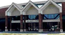
Crossing the Eggners Ferry Bridge out of the LBL and up the hill into Marshall County, US68 forks off to the right. Kenlake State Park is just ahead on the left, on the new KY80. My meeting started at 10:00 am Central Time. I arrived at 9:55, greeting State Party Chair Jennifer Moore in the lobby of the Lodge, as she was just arriving from the Lone Oak Ham Breakfast, held over in Lone Oak in McCracken County, at her high school Alma Mater.
The next entry will describe the journey back to Louisville.









No comments:
Post a Comment